Mborokua
This article does not cite any sources. (February 2018) |
Nickname: Mary Island | |
|---|---|
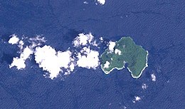 Landsat image of Mborokua Island, Solomon islands | |
| Geography | |
| Coordinates | 9°01′S 158°44′E / 9.02°S 158.74°ECoordinates: 9°01′S 158°44′E / 9.02°S 158.74°E |
| Area | 4 km2 (1.5 sq mi) |
| Administration | |
| Province | |
| Demographics | |
| Population | uninhabited |

Mborokua (also known as Mary Island) is an uninhabited, jungle-covered volcanic island 30 km west of the Russell Islands. It is occasionally visited by local fishermen, as well as by dive tours.
See also[]
- Desert island
- List of islands
External links[]
- Satellite view of Mborokua from Google Maps
This Solomon Islands location article is a stub. You can help Wikipedia by . |
Categories:
- Uninhabited islands of the Solomon Islands
- Western Province (Solomon Islands)
- Solomon Islands geography stubs