Simbo
| Simbo | |
|---|---|
| Highest point | |
| Elevation | 335 m (1,099 ft) |
| Coordinates | 8°17′30″S 156°31′0″E / 8.29167°S 156.51667°ECoordinates: 8°17′30″S 156°31′0″E / 8.29167°S 156.51667°E |
| Geography | |
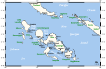
| Location | Solomon Islands |
| Geology | |
| Mountain type | Stratovolcanoes |
| Volcanic arc/belt | Bougainville & Solomon Is. |
| Last eruption | 1910 ± 10 years[1] |

Simbo is an island in Solomon Islands; it is located in the Western Province. It was known to early Europeans as Eddystone Island.[2]
Geography[]
Simbo is actually two main islands, one small island called Nusa Simbo separated by a saltwater lagoon from a larger one. Collectively the islands are known to the local people as Mandegugusu, while in the rest of the Solomons the islands are referred to as Simbo.[3] Simbo has an active volcano called Ove as well several saltwater lagoons and a freshwater lake.
Earthquake[]
On April 2, 2007 Simbo was hit by a massive earthquake and tsunami which is now known as the 2007 Solomon Islands earthquake. A 12 m tsunami destroyed two villages on the northern side of the island and killed 10 people.
In popular culture[]
Some of the historic cultural practices on Simbo are referenced in The Ghost Road, a novel by Pat Barker about World War I. The author used the research of Arthur Maurice Hocart and the psychoanalyst William Rivers.
References[]
- ^ "Simbo". Global Volcanism Program. Smithsonian Institution. Retrieved 2010-02-26.
- ^ Hocart, A. M. (1922). "The cult of the dead in Eddystone of the Solomons." The Journal of the Royal Anthropological Institute of Great Britain and Ireland 52: 71-112.
- ^ Scheffler, H. W. (1962). "Kindred and kin groups in Simbo Island social structure." Ethnology 1(2): 135-157.
This Solomon Islands location article is a stub. You can help Wikipedia by . |
- Islands of the Solomon Islands
- Western Province (Solomon Islands)
- Solomon Islands geography stubs