McClave, Colorado
McClave, Colorado | |
|---|---|
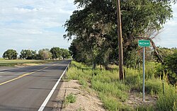 Entering McClave from the south. | |
 McClave Location of the McClave CDP in the State of Colorado. | |
| Coordinates: 38°07′54″N 102°51′02″W / 38.1315470°N 102.8504444°WCoordinates: 38°07′54″N 102°51′02″W / 38.1315470°N 102.8504444°W[1] | |
| Country | |
| State | |
| County | Bent County |
| Government | |
| • Type | unincorporated town |
| Elevation | 3,865 ft (1,178 m) |
| Time zone | UTC-7 (MST) |
| • Summer (DST) | UTC-6 (MDT) |
| ZIP Code[3] | 81057 |
| Area code(s) | 719 |
| GNIS feature[2] | McClave CDP |

McClave is an unincorporated town, a census-designated place (CDP), and a post office located in and governed by Bent County, Colorado, United States. The McClave post office has the ZIP code 81057.[3] At the United States Census 2010, the population of the McClave CDP was 328, while the population of the 81057 ZIP Code Tabulation Area was 418 including adjacent areas.[4]
McClave's services include a store, gas station, post office, and a full K-12 school with large athletic field.
History[]
The McClave post office has been in operation since 1908.[5] The town was named after B. I. McClave, a pioneer settler.[6]
Geography[]
The McClave CDP has an area of 1,225 acres (4.956 km2), all land.[1]
Climate[]
The Köppen Climate system classifies the weather as semi-arid, abbreviated as BSk.[7]
| hideClimate data for McClave, Colorado | |||||||||||||
|---|---|---|---|---|---|---|---|---|---|---|---|---|---|
| Month | Jan | Feb | Mar | Apr | May | Jun | Jul | Aug | Sep | Oct | Nov | Dec | Year |
| Average high °C (°F) | 45 (7) |
51 (11) |
59 (15) |
70 (21) |
78 (26) |
89 (32) |
94 (34) |
92 (33) |
84 (29) |
72 (22) |
57 (14) |
46 (8) |
70 (21) |
| Average low °C (°F) | 14 (−10) |
19 (−7) |
26 (−3) |
37 (3) |
47 (8) |
57 (14) |
63 (17) |
61 (16) |
51 (11) |
37 (3) |
24 (−4) |
16 (−9) |
38 (3) |
| Average precipitation mm (inches) | 0.4 (10) |
0.4 (10) |
0.8 (20) |
1.4 (36) |
2.3 (58) |
2.2 (56) |
2.4 (61) |
2.1 (53) |
1.2 (30) |
0.9 (23) |
0.5 (13) |
0.5 (13) |
15.3 (390) |
| Source: Weatherbase [8] | |||||||||||||
Demographics[]
The United States Census Bureau defined the McClave CDP for the United States Census 2020.
| Year | Pop. | ±% |
|---|---|---|
| 2020 | — | |
| Source: United States Census Bureau | ||
See also[]
- Outline of Colorado
- State of Colorado
- Colorado cities and towns
- Colorado census designated places
- Colorado counties
- Colorado cities and towns
References[]
- ^ Jump up to: a b c "State of Colorado Census Designated Places - BAS20 - Data as of January 1, 2020". United States Census Bureau. Retrieved December 8, 2020.
- ^ Jump up to: a b c "U.S. Board on Geographic Names: Domestic Names". United States Geological Survey. Retrieved December 8, 2020.
- ^ Jump up to: a b "Look Up a ZIP Code". United States Postal Service. Retrieved December 8, 2020.
- ^ "2010: DEC Summary File 1". United States Census Bureau. Retrieved December 20, 2020.
- ^ "Post offices". Jim Forte Postal History. Retrieved 1 July 2016.
- ^ Dawson, John Frank. Place names in Colorado: why 700 communities were so named, 150 of Spanish or Indian origin. Denver, CO: The J. Frank Dawson Publishing Co. p. 34.
- ^ Climate Summary for McClave, Colorado
- ^ "Weatherbase.com". Weatherbase. 2013. Retrieved on September 5, 2013.
External links[]
 Definitions from Wiktionary
 Media from Wikimedia Commons
 News from Wikinews
 Quotations from Wikiquote
 Texts from Wikisource
 Textbooks from Wikibooks
 Resources from Wikiversity
| hide Municipalities and communities of Bent County, Colorado, United States | ||
|---|---|---|
| City |  | |
| CDPs | ||
| Unincorporated communities | ||
| Ghost town | ||
| ||
- Census-designated places in Bent County, Colorado
- Census-designated places in Colorado