McDermitt, Nevada and Oregon
McDermitt, Nevada–Oregon | |
|---|---|
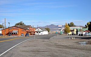 Central McDermitt | |
 Location of McDermitt in Nevada | |
| Coordinates: 41°59′51″N 117°43′06″W / 41.99750°N 117.71833°WCoordinates: 41°59′51″N 117°43′06″W / 41.99750°N 117.71833°W | |
| Country | United States |
| State | Nevada and Oregon |
| County | Humboldt County, Nevada, and Malheur County, Oregon |
| Named for | Lt. Col. Charles McDermit, 2nd Cavalry, California Volunteers |
| Elevation | 4,432 ft (1,351 m) |
| Population (2010) | |
| • Total | 513 |
| Time zone | UTC-8 (PST) |
| • Summer (DST) | UTC-7 (PDT) |
| ZIP codes | 89421 (NV) and 89425 (OR) |
| Area code(s) | Area code 775 (NV), 458 and 541 (OR) |
| Coordinates and elevation from United States Geological Survey[1] | |

McDermitt is an unincorporated community straddling the Nevada–Oregon border, in Humboldt County, Nevada, and Malheur County, Oregon, United States. McDermitt's economy has historically been based on mining, ranching, and farming. The last mining operation closed in 1990, resulting in a steady decline in population.[2]
As of the 2010 census, the combined population was 513. Seventy-five percent of the residents were American Indian, predominantly Northern Paiute of the Fort McDermitt Indian Reservation, whose members include Shoshone people.[3][4]
History[]
The community, originally called Dugout, was named after Fort McDermit. It was named after Lt. Col. Charles McDermit,[5][6] commander of the Military District of Nevada, who was killed by Indians in a skirmish in the area in 1865.[7] It is not known why there is a discrepancy in the spelling.[5] Fort McDermit, which was five miles (8.0 km) outside the current township, was originally established to protect the stagecoach route from Virginia City through Winnemucca to Silver City, Idaho Territory. The stage road was the military's most important transportation route in southeast Oregon.[8] The township of Dugout was established as support for Fort McDermit.[2]
Geography and climate[]
The community is on U.S. Highway 95, 73 miles (117 km) north of Winnemucca. The elevation of McDermitt is 4,432 feet (1,351 m) above sea level.[1]
McDermitt is in the Oregon High Desert with a desert climate (Köppen climate classification BSk), averaging 9.2 inches (230 mm) of rain annually with hot, dry summers and cold winters. Most precipitation (47%) occurs from March through June. About 23% occurs from September through November, and 25% from December through February, much as snow.[9][10]
| hideClimate data for McDermitt | |||||||||||||
|---|---|---|---|---|---|---|---|---|---|---|---|---|---|
| Month | Jan | Feb | Mar | Apr | May | Jun | Jul | Aug | Sep | Oct | Nov | Dec | Year |
| Record high °F (°C) | 66 (19) |
70 (21) |
79 (26) |
87 (31) |
98 (37) |
105 (41) |
111 (44) |
105 (41) |
100 (38) |
92 (33) |
75 (24) |
65 (18) |
111 (44) |
| Average high °F (°C) | 41.1 (5.1) |
46.7 (8.2) |
53.4 (11.9) |
61.1 (16.2) |
70.6 (21.4) |
80.8 (27.1) |
91.3 (32.9) |
89.3 (31.8) |
80 (27) |
67.3 (19.6) |
50.7 (10.4) |
41.8 (5.4) |
64.5 (18.1) |
| Average low °F (°C) | 19.2 (−7.1) |
22.7 (−5.2) |
25.7 (−3.5) |
29.6 (−1.3) |
36.7 (2.6) |
43.5 (6.4) |
49.2 (9.6) |
47.5 (8.6) |
40 (4) |
31.9 (−0.1) |
25.1 (−3.8) |
19.3 (−7.1) |
32.5 (0.3) |
| Record low °F (°C) | −29 (−34) |
−24 (−31) |
−3 (−19) |
8 (−13) |
15 (−9) |
22 (−6) |
28 (−2) |
20 (−7) |
10 (−12) |
−2 (−19) |
−8 (−22) |
−29 (−34) |
−29 (−34) |
| Average precipitation inches (mm) | 0.74 (19) |
0.58 (15) |
0.87 (22) |
0.99 (25) |
1.38 (35) |
1.02 (26) |
0.35 (8.9) |
0.41 (10) |
0.48 (12) |
0.7 (18) |
0.83 (21) |
0.8 (20) |
9.15 (232) |
| Average snowfall inches (cm) | 3.3 (8.4) |
1.9 (4.8) |
2.4 (6.1) |
0.9 (2.3) |
0.3 (0.76) |
0 (0) |
0 (0) |
0 (0) |
0 (0) |
0.1 (0.25) |
1 (2.5) |
2.7 (6.9) |
12.6 (32) |
| Average precipitation days | 6 | 5 | 6 | 7 | 8 | 6 | 2 | 3 | 3 | 4 | 7 | 6 | 63 |
| Source: [11] | |||||||||||||
The McDermitt area boasts the longest climatic record in Nevada, with data beginning in 1866. The earliest Nevada climate stations were at Army posts. The U.S. Army Signal Corps was responsible for weather duty in the late 19th century and established the National Weather Service in 1870.[12]
Demographics[]

For statistical purposes, the census bureau has allocated McDermitt two census-designated places (CDPs), McDermitt, Nevada and Fort McDermitt, Nevada. The Oregon portion of McDermitt is not part of the McDermitt CDP, but is included in the Ontario, OR–ID Micropolitan Statistical Area.[3] Essentially the Fort McDermitt CDP entails the Fort McDermitt Indian Reservation and the McDermitt CDP entails the adjoining McDermitt township.
Fort McDermitt CDP[]
As of the US census of 2010, there were 341 people, of which 30% were under the age of 18 years and 11% (39 people) over the age of 65 years. 92% (313 people) were American Indian, with 3.5% (12 people) described as being of two or more races, and 0.6% (two people) were White. There were 125 housing units with 86% (108) described as occupied. There were 108 males for every 100 females.[3]
McDermitt CDP[]
As of the US census of 2010, there were 172 people, of which 18% were under the age of 18 years and 22% (38 people) over the age of 65 years. 24% (42 people) were American Indian, with 0% described as being of two or more races, and 68% (117 people) were White. There were 101 housing units with 77% (78) described as occupied. There were 110 males for every 100 females.[3]
Economy[]

McDermitt's economy has historically been based on mining, ranching and farming. In the period 1917 to 1989 it was home to four nationally significant mercury mines in the McDermitt Caldera – Bretz, Opalite, Cordero and McDermitt – which from 1933 to 1989 were the largest producers in North America.[13][14] In 1985 of the 16,530 flasks of mercury (each containing 76 pounds (34 kg) produced in the US, 16,337 came from the McDermitt Mine.[15] The closure of mercury mining in 1990 resulted in a significant decline in population.[3]
Significant gold mines in the nearby Santa Rosa Mountains were the National that produced in excess of 200,000 troy ounces (6,200 kg), and the Buckskin National that produced 24,000 troy ounces (750 kg) of gold and 300,000 troy ounces (9,300 kg) of silver over the period 1906–1941.[16]
Current development activities that may result in renewed mining are at Cordero (gold and silver),[13] Cordero (gallium),[17] Buckskin-National (gold-silver),[18] Aurora (uranium)[19] and Disaster Peak (gold).[20] The largest employers in McDermitt are the Say When Bar, Restaurant & Casino and the McDermitt Combined School.
Points of interest[]
The state line goes through the White Horse Inn, a historical landmark now being restored, which was a saloon, hotel, and (reportedly) brothel.[21] When it was open, food could be ordered and paid for in Oregon, avoiding the Nevada state sales tax.[22]
Education[]
Humboldt County School District operates the , a kindergarten–twelfth grade (K–12) school, in the community.
McDermitt has a public library, a branch of the Humboldt County Library.[23]
Transportation[]
See also[]
References[]
- ^ Jump up to: a b "McDermitt". Geographic Names Information System. United States Geological Survey. December 12, 1980. Retrieved November 12, 2010.
- ^ Jump up to: a b Salter, Chuck (March 21, 2001). "The Town That the Internet (Almost) Forgot". Fast Company. Retrieved 2012-02-23.
- ^ Jump up to: a b c d e "2010 Census Data". U.S. Census Bureau. Archived from the original on October 13, 2013. Retrieved 2011-08-24.
- ^ Bengston, Ginny; SWCA Environmental Consultants (Dec 16, 2002). Northern Paiute and Western Shoshone Land Use in Northern Nevada: A Class 1 Ethnographic/Ethnohistoric Overview (PDF). Cultural Resources Series No 12, 2003. Reno, Nevada: US Department of the Interior Bureau of Land Management Nevada. p. 32. Archived from the original (PDF) on 2012-06-30. Retrieved 2012-02-23.
- ^ Jump up to: a b McArthur, Lewis A.; McArthur, Lewis L. (2003) [1928]. Oregon Geographic Names (7th ed.). Portland, Oregon: Oregon Historical Society Press. p. 624. ISBN 978-0875952772.
- ^ "McDermit, Charles". Carson City Consolidated Municipality. Archived from the original (pdf) on 2011-09-27. Retrieved 2011-08-25.
- ^ Federal Writers' Project (1941). Origin of Place Names: Nevada (PDF). W.P.A. p. 38.
- ^ "Winnemucca to Silver City Wagon Road". Bureau of Land Management. Retrieved 2011-08-26.
- ^ Taylor, Jerry L. (2002). "Louse Canyon Geographic Management Area Standards Of Rangeland Health Evaluation" (pdf). Bureau of Land Management. Retrieved 2011-11-06.
- ^ "Historic Average: McDermitt, Nevada". Intellicast.com. 24 Sep 2012. Retrieved 2012-09-24.
- ^ "McDermitt 26 N, OR (355335)". Western Regional Climate Center. Retrieved November 26, 2015.
- ^ "Nevada's oldest Climate Records". Weather Observations. Mic Mac Media. Retrieved 2012-09-24.
- ^ Jump up to: a b "Cordero Property". Nevgold Resource Corp. Archived from the original on 2011-02-05. Retrieved 2011-08-24.
- ^ Fisk, Elwin (1968). Ridge, John (ed.). Cordero Mine, Opalite Mining District, in Ore deposits of the United States, 1933-1967. New York: The American Institute of Mining, Metallurgical, and Petroleum engineers, Inc. pp. 1573–1591.
- ^ Schlottmann Jr, J.D. (April 1987). "Last Mercury Mine Closes" (PDF). California Mining Journal. p. 17. Retrieved 23 Oct 2013.
- ^ "Buckskin National and McCormick Group Mine/Millsites: Humboldt Toiyabe National Forest" (pdf). US Forest Service. Retrieved 2011-08-26.
- ^ "Cordero Gallium Project". Gold Canyon Resources Inc. Retrieved 2011-08-24.
- ^ "National District" (PDF). Nevada Bureau of Mines and Geology. Archived from the original (pdf) on 2011-09-29. Retrieved 2011-08-24.
- ^ "Oregon Energy". Energy Ventures Limited. Archived from the original on 2011-08-31. Retrieved 2011-08-24.
- ^ "Albisu – USA". Concordia Resource Corporation. Archived from the original on 2012-07-07. Retrieved 2011-08-24.
- ^ http://www.baberfamilytree.org/Notes/4.htm#138
- ^ "Archived copy". Archived from the original on 2003-12-16. Retrieved 2004-01-19.CS1 maint: archived copy as title (link)
- ^ "Nevada Public Libraries". PublicLibraries.com. Retrieved 14 June 2019.
External links[]
| Wikimedia Commons has media related to McDermitt, Nevada. |
- Historic images of McDermitt from Salem Public Library
| show Municipalities and communities of Humboldt County, Nevada, United States |
|---|
| show Municipalities and communities of Malheur County, Oregon, United States |
|---|

| show Authority control |
|---|
- Census-designated places in Humboldt County, Nevada
- Census-designated places in Nevada
- Divided cities
- Ontario, Oregon micropolitan area
- Unincorporated communities in Malheur County, Oregon
- Unincorporated communities in Oregon
- Unincorporated communities in Nevada