Orovada, Nevada
Orovada, Nevada | |
|---|---|
 | |
 Orovada Location within the state of Nevada | |
| Coordinates: 41°34′12″N 117°47′2″W / 41.57000°N 117.78389°WCoordinates: 41°34′12″N 117°47′2″W / 41.57000°N 117.78389°W | |
| Country | United States |
| State | Nevada |
| County | Humboldt |
| Area | |
| • Total | 45.3 sq mi (117.3 km2) |
| • Land | 45.3 sq mi (117.3 km2) |
| • Water | 0 sq mi (0 km2) |
| Population (2010) | |
| • Total | 155 |
| • Density | 3.4/sq mi (1.3/km2) |
| Time zone | UTC-8 (Pacific (PST)) |
| • Summer (DST) | UTC-7 (PDT) |
| ZIP codes | 89425 |
| FIPS code | 32-53000 |

Orovada is a census-designated place in Humboldt County, Nevada. The population was 155 at the 2010 census.[1]
History[]
The first permanent settlement at Orovada was made in 1918.[2] The name is a combination of oro (Spanish "gold") and Nevada.[3] A post office has been in operation at Orovada since 1920.[4]
Geography[]
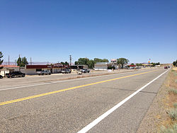
According to the United States Census Bureau, the Orovada CDP has an area of 45.3 square miles (117.3 km2), all land.[1] U.S. Route 95 runs through the CDP, leading south 43 miles (69 km) to Winnemucca and north 30 miles (48 km) to the Oregon state line at McDermitt.
Education[]
The Humboldt County School District operates schools serving areas with Orovada addresses. Some areas are zoned to Orovada School, a K-8 school. Other areas are zoned to Kings River School, a K-8 school.
Notable residents[]
Rodeo announcer Bob Tallman lived on Willow Creek Ranch, eight miles north of Orovada, during his early childhood.[5]
References[]
- ^ Jump up to: a b "Geographic Identifiers: 2010 Demographic Profile Data (G001): Orovada CDP, Nevada". U.S. Census Bureau, American Factfinder. Archived from the original on February 12, 2020. Retrieved January 24, 2013.
- ^ Federal Writers' Project (1941). Origin of Place Names: Nevada (PDF). W.P.A. p. 38.
- ^ Carlson, Helen S. (1985). Nevada Place Names: A Geographical Dictionary. University of Nevada Press. ISBN 9780874174038. Retrieved December 2, 2020.
- ^ U.S. Geological Survey Geographic Names Information System: Orovada Post Office
- ^ Tribe, Kristen (27 February 2005). "The Voice of Rodeo". American Profile. Franklin, TN. Archived from the original on December 5, 2010. Retrieved April 4, 2010.
| Wikimedia Commons has media related to Orovada, Nevada. |
| show Municipalities and communities of Humboldt County, Nevada, United States |
|---|
| show Authority control |
|---|
This Humboldt County, Nevada state location article is a stub. You can help Wikipedia by . |
- Census-designated places in Humboldt County, Nevada
- Census-designated places in Nevada
- Nevada geography stubs