Medgyesegyháza
Medgyesegyháza | |
|---|---|
 Flag  Coat of arms | |
 Medgyesegyháza | |
| Coordinates: 46°30′N 21°02′E / 46.50°N 21.03°E | |
| Country | |
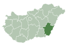
| County | Békés |
| District | Mezőkovácsháza |
| Area | |
| • Total | 64.32 km2 (24.83 sq mi) |
| Population (2015)[1] | |
| • Total | 3,558 |
| • Density | 55/km2 (140/sq mi) |
| Time zone | UTC+1 (CET) |
| • Summer (DST) | UTC+2 (CEST) |
| Postal code | 5666 |
| Area code | (+36) 68 |
| Website | www |

Medgyesegyháza (Slovak: Medeš) is a town in Békés County, in the Southern Great Plain region of south-east Hungary.
Geography[]
It covers an area of 64.32 km2 and has a population of 3558 people (2015).
Politics[]
The current mayor of Medgyesegyháza is (Independent).
The local Municipal Assembly has 6+1 members divided into this political parties and alliances:[2]
| Party | Seats | 2014 Council | |||
|---|---|---|---|---|---|
| Fidesz-KDNP | 3 | ||||
| Independent | 2 | ||||
| Unity (MSZP-DK-Együtt-Liberálisok) | 1 | ||||
| City Mayors from 1990 | |
|---|---|
| Dr. Béla Nagy (SZDSZ) | 1990–2010 |
| Márton Ruck (Fidesz) | 2010–2014 |
| Dr. Béla Nagy (Independent); - II. | 2014– |
Twin towns – sister cities[]
Medgyesegyháza is twinned with:
 Kolárovo, Slovakia
Coordinates: 46°30′N 21°02′E / 46.50°N 21.03°E
References[]
- ^ Gazetteer of Hungary, 1st January 2015. Hungarian Central Statistical Office.
- ^ [1]
External links[]
| Wikimedia Commons has media related to Medgyesegyháza. |
- Official website in Hungarian
| Authority control |
|
|---|
This Békés County location article is a stub. You can help Wikipedia by . |
This Slovakia-related article is a stub. You can help Wikipedia by . |
This article related to Jewish history is a stub. You can help Wikipedia by . |
Categories:
- Populated places in Békés County
- Slovak communities in Hungary
- Shtetls
- Békés County geography stubs
- Slovakia stubs
- Jewish history stubs