Battonya
This article needs additional citations for verification. (May 2013) |
Battonya | |
|---|---|
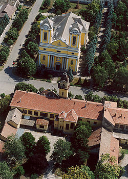 Aerial photography: Battonya - Temple | |
 Flag  Coat of arms | |
 Battonya | |
| Coordinates: 46°17′N 21°1′E / 46.283°N 21.017°E | |
| Country | |
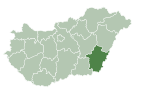
| County | Békés |
| District | Mezőkovácsháza |
| Area | |
| • Total | 145.77 km2 (56.28 sq mi) |
| Population (2015) | |
| • Total | 5,960[1] |
| • Density | 46.34/km2 (120.0/sq mi) |
| Time zone | UTC+1 (CET) |
| • Summer (DST) | UTC+2 (CEST) |
| Postal code | 5830 |
| Area code | (+36) 68 |
| Website | www |

Battonya (Romanian: Bătania, Serbian: Батања, romanized: Batanja) is a town in Békés County, in the Southern Great Plain region of south-east Hungary. Residents are Magyars, with minority of Serbs and Romanians.
Geography[]
It covers an area of 145.77 km² and has a population of 5960 people (2015).
History[]

Kingdom of Hungary stamp, issue 1874, cancelled at BATTONYA.
This section needs expansion. You can help by . (April 2013) |
After the Ottoman occupation until 1918, BATTONYA was part of the Austrian monarchy, province of Hungary;[2] in Transleithania after the compromise of 1867 in the Kingdom of Hungary.
Twin towns – sister cities[]
Battonya is twinned with:
References[]
- ^ Gazetteer of Hungary, 1st January 2015. Hungarian Central Statistical Office. 03/09/2015
- ^ Handbook of Austria and Lombardy-Venetia Cancellations on the Postage Stamp Issues 1850-1864, by Edwin MUELLER, 1961.
External links[]
| Wikimedia Commons has media related to Battonya. |
- Official website in Hungarian
Coordinates: 46°17′N 21°01′E / 46.283°N 21.017°E
| show Authority control |
|---|
This Békés County location article is a stub. You can help Wikipedia by . |
Categories:
- Populated places in Békés County
- Hungary–Romania border crossings
- Romanian communities in Hungary
- Serb communities in Hungary
- Békés County geography stubs