Melrose Park, South Australia
| Melrose Park Adelaide, South Australia | |||||||||||||||
|---|---|---|---|---|---|---|---|---|---|---|---|---|---|---|---|
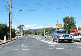 Looking east along Daws Road. Melrose Park is to the left (north) | |||||||||||||||
 Melrose Park | |||||||||||||||
| Coordinates | 34°59′24″S 138°34′34″E / 34.990°S 138.576°ECoordinates: 34°59′24″S 138°34′34″E / 34.990°S 138.576°E | ||||||||||||||
| Population | 2,211 (2016 census)[1] | ||||||||||||||
| Established | 1989 | ||||||||||||||
| Postcode(s) | 5039 | ||||||||||||||
| LGA(s) | City of Mitcham | ||||||||||||||
| State electorate(s) | Elder | ||||||||||||||
| Federal division(s) | Boothby | ||||||||||||||
| |||||||||||||||

Melrose Park is a suburb of Adelaide, South Australia in the City of Mitcham. It is bordered by South Road, Daws Road, Winston Avenue and Edward Street. Until 1989,[2] Melrose Park was part of the suburb of Edwardstown. The name change occurred as the suburb was quite large, located on either side of South Road and was in the jurisdiction of two local government councils, with the larger western side belonging to the City of Marion. The suburb was named after early South Australian aviator, Charles James Melrose.
References[]
- ^ Australian Bureau of Statistics (27 June 2017). "Melrose Park (State Suburb)". 2016 Census QuickStats. Retrieved 5 April 2020.

- ^ Place Names of South Australia - M, The Manning Index of South Australian History, State Library of South Australia
This article about a place in Adelaide is a stub. You can help Wikipedia by . |
Categories:
- Suburbs of Adelaide
- Adelaide geography stubs