Daws Road, Adelaide
This article has multiple issues. Please help or discuss these issues on the talk page. (Learn how and when to remove these template messages)
|
Daws Road | |
|---|---|
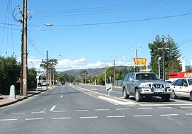 | |
| Daws Road, looking east from the South Road intersection | |
| General information | |
| Type | Road |
| Length | 3 km (1.9 mi) |
| Major junctions | |
| West end | Oaklands Road Park Holme, Adelaide |
| East end | Goodwood Road Daw Park, Adelaide |
Daws Road is a major double-lane arterial road in the central southern suburbs of Adelaide, running east–west between Goodwood Road in the east and Marion Road in the west.[1] Daws Road crosses South Road and the Tonsley railway line. It passes under one of the two diagonal railway bridges of the Seaford railway line, before ending at Marion Road, Ascot Park. Beyond this point, the road continues under the name , heading towards Brighton Road in the west.
The section of Daws Road west of South Road was previously known as Sweetmans Road, with the road ending at Railway Terrace, Ascot Park.
Daws Road travels through and borders the following suburbs:
The road is serviced by the 241 bus between Marion Road and West Street (Ascot Park), while the 213 bus runs between Beaumont Street (Clovelly Park) and Goodwood Road. The 297 bus travels from Beaumont Street to Winston Avenue (Melrose Park). Pasadena High School and the Repatriation Hospital are located here.
In 2019, the government proposed to realign the intersection of Daws and Goodwood Roads to create a new four-way intersection so that Daws Road will continue east into Springbank Road.[2] Construction is scheduled to be completed in 2022[3]
References[]
- ^ 2003 Adelaide Street Directory, 41st Edition. UBD (A Division of Universal Press Pty Ltd). 2003. ISBN 0-7319-1441-4.
- ^ Wills, Daniel (6 May 2019). "Minister accused of 'embarrassing backflip' as new plans are released to eliminate Springbank Rd dog-leg". The Advertiser. Retrieved 10 December 2019.
- ^ "Goodwood, Springbank and Daws Road Intersection Upgrade". Department of Planning, Transport and Infrastructure. Retrieved 10 December 2019.
This article needs additional citations for verification. (July 2007) |
- Roads in Adelaide