Main North Road
It has been suggested that this article be split into a new article titled Horrocks Highway. (Discuss) (December 2019) |
Main North Road South Australia | |
|---|---|
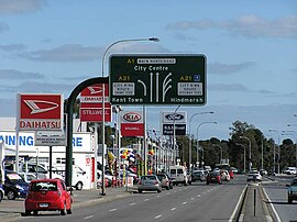 | |
Looking south at Main North Road's southern (city) end. According to signage, this section is not a part of the National Highway. | |
 | |
 North end South end | |
| Coordinates |
|
| General information | |
| Type | Road |
| Length | 307 km (191 mi)[1] |
| Route number(s) |
|
| Former route number |
|
| Major junctions | |
| North end | Winninowie, South Australia |
| |
| South end | Barton Terrace West O'Connell Street North Adelaide |
| Location(s) | |
| Major suburbs | Wilmington, Gladstone, Clare, Giles Corner, Gawler, Elizabeth, Gepps Cross, Medindie |

Main North Road is the major north-south arterial route through the suburbs north of the Adelaide City Centre in the city of Adelaide, South Australia.[2] It continues north through the settled areas of South Australia and is a total of 307 kilometres (191 mi) long, from North Adelaide to 21 kilometres (13 mi) out of Port Augusta.[1] It follows the route established in the early years of the colony by explorer John Horrocks and was a major route for farmers and graziers to reach the capital, passing through rich farmland and the Clare Valley wine region. In 2011, the section of road between Gawler to Wilmington was renamed Horrocks Highway.[3]
Horrocks Highway[]
Main North Road from Gawler to Wilmington was renamed to Horrocks Highway in 2011 to honour John Horrocks, an early explorer and pioneer in the region.[3] However while Main North Road turns west in Wilmington through Horrocks Pass to join the Augusta Highway as route B56, route B82 carries the name Horrocks Highway north to Quorn.[4]
Route description[]
Main North Road branches from the northern end of O'Connell Street (North Adelaide) and passes through the Adelaide Parklands and the suburbs of Thorngate, Medindie, Medindie Gardens, Nailsworth, Prospect, Sefton Park, Blair Athol and Enfield before reaching the major intersection at Gepps Cross. Here the road forks, with the Port Wakefield Road (A1 - National Highway 1) continuing to the north, and the Main North Road turning northeast and continuing as route A20.
It continues through the outer northern suburbs, passing Mawson Lakes and Salisbury, crossing the Little Para River and passing Elizabeth and Smithfield before entering Gawler. In Gawler, it crosses the South Para and North Para Rivers, and the Barossa Valley Way branches to the east between them. Just north of Gawler, it passes under the Sturt Highway which heads east to the Barossa Valley, Riverland, northern Victoria and New South Wales.
This is where the name Horrocks Highway takes over from the historic name of Main North Road. The environment changes from the urban environment to undulating land, mostly cleared for grain cropping. Several of the towns have grain storage bunkers or silos. It crosses the Light River then crosses and follows the Gilbert River to where the Barrier Highway branches northeast towards Riverton and Burra.
Over the next ridge, it crosses the Wakefield River and enters the southern end of the Clare Valley. The dominant scenery changes from grain crops to grapevines from Auburn to Clare, then returns to grain fields again north of the Hutt River as it passes through the Southern Flinders Ranges. It crosses the Broughton River near Yacka and on to Wilmington at the eastern side of Horrocks Pass. As the Horrocks Highway is in the valley between the southern Flinders Ranges and northern Mount Lofty Ranges, it is in the relatively wetter climate south of Goyder's Line.
At Wilmington, Main North Road diverges from the Horrocks Highway. Main North Road turns northwest from Wilmington to pass through Horrocks Pass to Winninowie where it meets the Augusta Highway 21 kilometres (13 mi) south of Port Augusta. The Horrocks Highway continues northwards from Wilmington to Quorn.[5]
Commuter route[]
In the metropolitan area, the road is a major commuter route to the central business district in the Adelaide city centre.
The portion of Main North Road between the city centre and Mawson Lakes is a 15-minute public transport 'Go Zone', with the maximum wait for a bus being 15 minutes during peak times (7:30 am – 6:30 pm weekdays) and 30 minutes on weekends and evenings.[6] Bus routes via Main North Road generally begin with the prefix "22x". The bus service is provided by SouthLink for Adelaide Metro.
Route numbers[]
From North Adelaide, the route numbers used along the road are:
 A1 to Gepps Cross, where A1 (part of the national Highway 1) continues as Port Wakefield Road and Augusta Highway to Port Augusta
 A20 to just outside of Gawler, where A20 follows Sturt Highway towards Sydney.
 B19 through Gawler, where B19 follows Barossa Valley Way through the Barossa Valley wine region.
 B82 through the Clare Valley and beyond to Wilmington.
 B56 to Stirling North, 6 kilometres (3.7 mi) south-east of Port Augusta.
In late 2010 when the Northern Expressway was completed, National Highway A20 was diverted to the new road as National Highway M20. Main North Road and the southern section of the Gawler Bypass Road were then designated as State Route A52. In late 2016, the Northern Expressway was designated M2, and route 20 returned to Main North Road as state route A20 to Gepps Cross.[7]
| LGA | Location | km[1] | mi | Destinations[5] | Notes |
|---|---|---|---|---|---|
| Port Augusta | Winninowie | 0 | 0.0 | Northern terminus of Main North Road and route B56 | |
| Mount Remarkable | Wilmington | 20.7 | 12.9 | Concurrency of routes B56 and B82 | |
| 23.3 | 14.5 | ||||
| Melrose | 50.0 | 31.1 | White Wells Road – Booleroo Centre | ||
| Murray Town | 59.4 | 36.9 | Nukunu Yarta Way – Booleroo Centre | ||
| 62.4 | 38.8 | Germein Gorge Road – Port Germein | |||
| Northern Areas | Laura | 90.0 | 55.9 | Possum Park Road – Crystal Brook | |
| Gladstone | 100.0 | 62.1 | |||
| Gulnare | 121.9 | 75.7 | Concurrency of routes B64 and B82 | ||
| 124.0 | 77.1 | ||||
| Wakefield | Brinkworth | 150.0 | 93.2 | Condowie Plain Road – Snowtown | |
| Clare and Gilbert Valleys | Bungaree | 159.8 | 99.3 | Bungaree Road (north) – Bungaree | |
| 162.6 | 101.0 | ||||
| 168.3 | 104.6 | Bungaree Road (south) – Bungaree | |||
| Clare | 174.8 | 108.6 | Blyth Road – Blyth, Lochiel | ||
| 175.7 | 109.2 | Farrell Flat Road – Hanson, Burra | |||
| Auburn | 200.0 | 124.3 | Concurrency of routes B82 and B84 | ||
| 200.2 | 124.4 | ||||
| Giles Corner | 224.5 | 139.5 | Northbound entrance to and southbound exit from Barrier Highway only | ||
| Tarlee | 230.0 | 142.9 | Tarlee Road – Kapunda | ||
| Light | Templers | 253.1 | 157.3 | Owen Road (northwest) – Hamley Bridge, Owen, Balaklava Templers Road (east) – Freeling | |
| Gawler Belt | 264.1 | 164.1 | |||
| 264.7 | 164.5 | Southern terminus of route B82, unallocated south | |||
| Gawler | Gawler | 267.9 | 166.5 | Route B19 south (as Adelaide Road), unallocated north | |
| Evanston South | 268.8 | 167.0 | |||
| 272.4 | 169.3 | Route A20 southwest, route B19 northeast (as Adelaide Road) | |||
| Playford | Elizabeth Vale | 286.6 | 178.1 | ||
| Salisbury | Salisbury Heights | 289.1 | 179.6 | Saints Road (northwest) – Salisbury Plain | |
| Salisbury South, Salisbury East, Parafield, Para Hills West | 292.6 | 181.8 | |||
| Port Adelaide Enfield | Gepps Cross | 300.0 | 186.4 | Route A20 north-east, route A1 south; southern terminus of route A20 | |
| Prospect | Prospect, Enfield, Sefton Park | 302.9 | 188.2 | Regency Road – Kilkenny, Greenacres | |
| City of Prospect, Town of Walkerville, City of Adelaide | Thorngate, Medindie, North Adelaide | 305.9 | 190.1 | Route A1 north from here, unallocated south | |
| Adelaide | North Adelaide | 306.3 | 190.3 | O'Connell Street (south) – North Adelaide, Adelaide CBD Prospect Road (north) – Prospect Barton Terrace West (west) – North Adelaide | Southern terminus of Main North Road |
1.000 mi = 1.609 km; 1.000 km = 0.621 mi
| |||||
See also[]
- Highways in Australia
- List of highways in South Australia
- Highway 1 (Australia)
- Highway 1 (South Australia)
References[]
- ^ a b c Google (31 January 2016). "Main North Road" (Map). Google Maps. Google. Retrieved 31 January 2016.
- ^ 2003 Adelaide Street Directory, 41st Edition. UBD (A Division of Universal Press Pty Ltd). 2003. ISBN 0-7319-1441-4.
- ^ a b "Highways renamed" (PDF). The Flinders News. Rural Press. 31 August 2011. Archived from the original (PDF) on 4 September 2014. Retrieved 4 September 2014.
- ^ "Highway One gets a change of name". Plains Producer. 19 August 2011. Retrieved 4 September 2014.
- ^ a b "Mid North" (PDF) (Map). Rural road maps (PDF). Naming of State Rural Roads. Government of South Australia. 16 December 2013. Rack Plan 869. Retrieved 31 January 2016.
- ^ "FAQs: What is a Go Zone?". AdelaideMetro.com.au. Retrieved 24 March 2015.
- ^ "Road Route Numbers (Trail Blazer)". Data SA. Government of South Australia. 8 November 2016. Retrieved 16 October 2017.
- Highways in Australia
- Roads in Adelaide
- Freeways and highways in Adelaide
- Highway 1 (Australia)