Northern Expressway
Northern Expressway Fatchen Northern Expressway | |
|---|---|
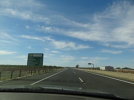 | |
The Northern Expressway looking north, halfway along the expressway | |
 | |
| Coordinates | |
| General information | |
| Type | Freeway |
| Length | 23 km (14 mi) |
| Opened | 13 September 2010 |
| Route number(s) | |
| Former route number | |
| Major junctions | |
| NE end | Gawler, Adelaide |
| |
| SW end | Waterloo Corner, Adelaide |
| Location(s) | |
| Major suburbs / towns | Angle Vale, Andrews Farm, Macdonald Park, Penfield |
| Highway system | |

The Northern Expressway (route M2; formerly route M20), also known as the Fatchen Northern Expressway,[1][2] is a 23 kilometre long controlled-access highway in Adelaide, South Australia. It travels from Gawler (on A20, the Sturt Highway) to Port Wakefield Road (on A1). The road has been built to four-lane standard and provides a faster route between Adelaide and Gawler, whilst reducing the amount of traffic on Main North Road, which passes through the heart of the northern suburbs and is interspersed with frequent traffic lights. It also allows freight vehicles to avoid residential areas and go straight to Port Wakefield Road. Since March 2020, the North–South Motorway continues west of Port Wakefield Road and intersects the Port River Expressway (A9) to reach the harbour at Port Adelaide. These are the northernmost two parts of the North–South Corridor.
Cycling is not permitted on the Expressway. The Stuart O'Grady Bikeway is a sealed shared cycling and walking path adjacent to the eastern side of the expressway. The northern end connects to the on-ramp from Two Wells Road to the Gawler Bypass Road, and the southern end is adjacent to Port Wakefield Road at Mill Road.
History[]
The largest road project undertaken in South Australia in at least sixty years, the expressway was delivered at a cost of approximately A$564 million jointly funded by the South Australian and Commonwealth Governments. The Design and Construct contract was awarded to the Fulton Hogan York Joint Venture, a partnership between trans-Tasman contractor Fulton Hogan and South Australian based York Civil. The design joint venture, managed by Fulton Hogan York Joint Venture consisted of Maunsell, SMEC and Dare Sutton Clark. The work included an 8 km upgrade of the existing Port Wakefield Road. Part of the cost was covered by the AusLink national transport funding.[3]
Construction began in 2008 and the road opened on 13 September 2010.[4]
The interchanges/bridges along the expressway were all named after famous battles in which Australian forces fought, such as Long Tan, Kokoda, Tobruk, Kapyong and Hamel.
In November 2013, one year after the death of prominent South Australian author and journalist Max Fatchen, the Northern Expressway was given the dual name "Fatchen Northern Expressway" in his honour.[1][2]
In December 2019, a Catastrophic bushfire started on the Northern Expressway at Angle Vale, This affected people in Hillier, Munno Para Downs, Kudla, Munno Para West and Gawler.
In February 2020, the on ramp from northbound on Port Wakefield Road was permanently closed. Three weeks later, the Northern Connector project was opened, continuing the freeway south from the Northern Expressway as the North–South Motorway.
Exit list[]

| Junction diagram | ||||||||||||||||||||||||||||||||||||||||||||||||||||||||||||||||||||||||||||||||||||||||||||||||||||||||||||||||||||||||||||||||||||||||||||||||||||||||||||||||||||||||||||||||||||||||||||||||||||||||||||||||||||||||||||||||||||||||||||||||||||||||||||||||||||||||||||||||||||||||||
|---|---|---|---|---|---|---|---|---|---|---|---|---|---|---|---|---|---|---|---|---|---|---|---|---|---|---|---|---|---|---|---|---|---|---|---|---|---|---|---|---|---|---|---|---|---|---|---|---|---|---|---|---|---|---|---|---|---|---|---|---|---|---|---|---|---|---|---|---|---|---|---|---|---|---|---|---|---|---|---|---|---|---|---|---|---|---|---|---|---|---|---|---|---|---|---|---|---|---|---|---|---|---|---|---|---|---|---|---|---|---|---|---|---|---|---|---|---|---|---|---|---|---|---|---|---|---|---|---|---|---|---|---|---|---|---|---|---|---|---|---|---|---|---|---|---|---|---|---|---|---|---|---|---|---|---|---|---|---|---|---|---|---|---|---|---|---|---|---|---|---|---|---|---|---|---|---|---|---|---|---|---|---|---|---|---|---|---|---|---|---|---|---|---|---|---|---|---|---|---|---|---|---|---|---|---|---|---|---|---|---|---|---|---|---|---|---|---|---|---|---|---|---|---|---|---|---|---|---|---|---|---|---|---|---|---|---|---|---|---|---|---|---|---|---|---|---|---|---|---|---|---|---|---|---|---|---|---|---|---|---|---|---|---|---|---|---|---|---|---|---|---|---|---|---|---|---|---|---|---|---|---|---|
| ||||||||||||||||||||||||||||||||||||||||||||||||||||||||||||||||||||||||||||||||||||||||||||||||||||||||||||||||||||||||||||||||||||||||||||||||||||||||||||||||||||||||||||||||||||||||||||||||||||||||||||||||||||||||||||||||||||||||||||||||||||||||||||||||||||||||||||||||||||||||||
Route and Interchange list for Northern Expressway. Distances are calculated from Gawler Bypass end of the Expressway.
| LGA | Location[5] | km[6] | mi | Name | Destinations | Notes |
|---|---|---|---|---|---|---|
| Light | Ward Belt, Reid, Buchfelde | 0.0 | 0.0 | merges with Northbound entrance and southbound exit only | ||
| Buchfelde, Gawler River | 4.1 | 2.5 | Long Tan | Southwest-bound entrance and northeast-bound exit only | ||
| Gawler River, Buchfelde, Angle Vale, Hillier | 5.0 | 3.1 | Gawler River | |||
| Playford | Hillier, Munno Para Downs, Angle Vale | 7.5 | 4.7 | Kapyong | Angle Vale Road – Angle Vale, Virginia, Evanston | |
| Munno Para West, Andrews Farm, Angle Vale, MacDonald Park | 10.8 | 6.7 | Kokoda | Curtis Road – Andrews Farm, Angle Vale | ||
| Penfield Gardens, MacDonald Park, Penfield | 15.1 | 9.4 | Tobruk | Heaslip Road – Edinburgh | ||
| Penfield Gardens, Penfield | 17.3 | 10.7 | Hamel | Penfield Road – Virginia | Southwest-bound entrance and northeast-bound exit only | |
| Penfield, Waterloo Corner, Virginia, Penfield Gardens | 18.8 | 11.7 | Adelaide-Port Augusta railway line | |||
| Waterloo Corner, Virginia | 21 | 13 | No entrance from or exit to Port Wakefield Road northbound | |||
| Continues southwest as | ||||||
| ||||||
See also[]
- Freeways in Australia
- Freeways in South Australia
References[]
- ^ a b "'Fatchen' a tourist name". The Bunyip. 28 May 2014. Retrieved 20 January 2017.
- ^ a b "More than memory lane: Fatchen's expressway". ABC News. 6 November 2013. Retrieved 28 December 2013.
- ^ Paul Starick (15 November 2006). "Major expressway opens up north". The Advertiser. Retrieved 15 November 2006.
- ^ Tom Zed, Transport reporter (13 September 2010). "Northern Expressway open for business". Retrieved 13 September 2010.
- ^ "Property Location Browser". Department of Planning, Transport and Infrastructure. Archived from the original on 12 October 2016. Retrieved 22 May 2015.
- ^ Google (22 May 2015). "Northern Expressway" (Map). Google Maps. Google. Retrieved 22 May 2015.
Road infrastructure in South Australia | ||
|---|---|---|
| Expressways |
| |
| Interstate highways | ||
| State highways |
| |
| Arterial roads |
| |
| Outback tracks | ||
</
- Highways in Australia
- Roads in Adelaide
- Freeways and highways in Adelaide