Mengkofen
show This article may be expanded with text translated from the corresponding article in German. (March 2009) Click [show] for important translation instructions. |
Mengkofen | |
|---|---|
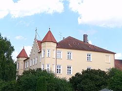 Mengkofen Castle | |
 Coat of arms | |
show Location of Mengkofen within Dingolfing-Landau district | |
 Mengkofen | |
| Coordinates: 48°43′N 12°26′E / 48.717°N 12.433°ECoordinates: 48°43′N 12°26′E / 48.717°N 12.433°E | |
| Country | Germany |
| State | Bavaria |
| Admin. region | Niederbayern |
| District | Dingolfing-Landau |
| Subdivisions | 10 Ortschaften |
| Government | |
| • Mayor (2020–26) | Thomas Hieninger[1] (CSU) |
| Area | |
| • Total | 86.00 km2 (33.20 sq mi) |
| Elevation | 398 m (1,306 ft) |
| Population (2020-12-31)[2] | |
| • Total | 6,036 |
| • Density | 70/km2 (180/sq mi) |
| Time zone | UTC+01:00 (CET) |
| • Summer (DST) | UTC+02:00 (CEST) |
| Postal codes | 84152 |
| Dialling codes | 08733, 08774, 09427 |
| Vehicle registration | DGF |
| Website | Official website |


Mengkofen is a municipality in the district of Dingolfing-Landau in Bavaria in Germany. It lies in the Aiterach River valley.
Subdivision[]
The municipality includes 10 former municipalities (Gemarkungen), and other villages:[3]
- Hofdorf
- Hüttenkofen
- Martinsbuch
- Mengkofen
- Mühlhausen
- Puchhausen
-
- Ginhart
- Hagenau
- Tunding
- Tunzenberg
- Weichshofen
References[]
- ^ Liste der ersten Bürgermeister/Oberbürgermeister in kreisangehörigen Gemeinden, Bayerisches Landesamt für Statistik, 15 July 2021.
- ^ "Tabellenblatt "Daten 2", Statistischer Bericht A1200C 202041 Einwohnerzahlen der Gemeinden, Kreise und Regierungsbezirke". Bayerisches Landesamt für Statistik (in German). June 2021.
- ^ (in German) Infos at municipal website
| Wikimedia Commons has media related to Mengkofen. |
| show Towns and municipalities in Dingolfing-Landau |
|---|
| show Authority control |
|---|
This Dingolfing-Landau location article is a stub. You can help Wikipedia by . |
Categories:
- Municipalities in Bavaria
- Dingolfing-Landau
- Lower Bavaria geography stubs