Mexborough Power Station
| Mexborough Power Station | |
|---|---|
 | |
| Country | England |
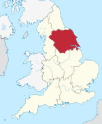
| Location | South Yorkshire, Yorkshire and the Humber |
| Coordinates | 53°29′37″N 1°15′49″W / 53.493734°N 1.26359°WCoordinates: 53°29′37″N 1°15′49″W / 53.493734°N 1.26359°W |
| Status | Decommissioned and demolished |
| Construction began | 1943 |
| Commission date | 1945 |
| Decommission date | October 1981 |
| Owner(s) | Yorkshire Electric Power Company (1939–1948) British Electricity Authority (1948–1955) Central Electricity Authority (1955–1957) Central Electricity Generating Board (1958–1981) |
| Operator(s) | As owner |
| Thermal power station | |
| Primary fuel | Coal |
| Chimneys | 4 |
| Cooling towers | 2 |
| Power generation | |
| Units operational | 4 × 30 MW |
| Units decommissioned | All |
| Nameplate capacity | 120 MW |
| Annual net output | 318 GWh (1972) |
grid reference SK488999 | |

Mexborough Power Station was a coal-fired power station situated on the banks of the River Don, on the border of Mexborough and Denaby, adjoining Doncaster Road, in South Yorkshire, England.
History[]
The plant was planned by the Yorkshire Electric Power Company in 1939 but construction was delayed by the war. The station became operational in 1945.[1] The site housed four English Electric generating sets of approximately 30 MW each, giving the station a total generating capacity of 120 megawatts (MW). There were four Mitchell stoker-fired boilers and four Richardson Westgarth boilers.[2] There were four substantial chimneys giving this local landmark its distinctive appearance. The boilers had the combined capacity to produce 1,260,000 lb/h (158.8 kg/s) of steam at 600 psi (41.4 bar) and 454 °C.[3]
The electricity generating capacity and output of the power station is shown in the table.[2][3][4][5]
| Year | 1946 | 1954 | 1955 | 1956 | 1957 | 1958 | 1961 | 1962 | 1963 | 1967 | 1971 | 1979 |
|---|---|---|---|---|---|---|---|---|---|---|---|---|
| Installed capacity, MW | 57 | 57 | 57 | 57 | 113 | 120 | 120 | 120 | 120 | 120 | 120 | |
| Electricity output, GWh | 315.725 | 253.330 | 225.878 | 188.909 | 251.654 | 352.217 | 495.882 | 409.275 | 394.316 | 327.81 | 317.941 | 25.59 |
The power station closed on 26 October 1981, with a generating capacity of 113 MW.[6] The station was demolished in 1988. The demolition of the station sparked local interest when one of the giant chimneys was toppled accidentally and fell across the site, prematurely demolishing much of it. Contamination at the site was a concern[7]
The site today is the Shimmer housing estate, areas of which are proposed to be demolished to make way for a 62 feet (19 m) high viaduct as part of a new railway infrastructure dubbed HS2, which will make commuting times to London faster.[8][9][10][11]
References[]
- ^ "Nostalgia on Tuesday: Towering presence". Yorkshire Post. 19 June 2019. Retrieved 16 February 2020.
- ^ a b Garrett, Frederick C., ed. (1959). Garcke's Manual of Electricity Supply vol.56. London: Electrical Press. pp. A-77, A-128.
- ^ a b CEGB (1972). CEGB Statistical Yearbook 1972. London: CEGB. p. 15.
- ^ CEGB Annual report and Accounts, 1961, 1962 & 1963
- ^ Electricity Commission, Generation of Electricity in Great Britain year ended 31st December 1946. London: HMSO, 1947.
- ^ Mr. Redmond (16 January 1984). "Coal-fired Power Stations". Hansard. Retrieved 1 September 2009.
- ^ "Homes plan for power station site thrown out". South Yorkshire Times. 29 October 2007. Archived from the original on 2 October 2011. Retrieved 4 May 2020.
- ^ "Fury after new HS2 report reveals 'more Doncaster homes and green spaces' are set for the bulldozer". Doncaster Free Press. 17 October 2018. Retrieved 4 May 2020.
- ^ Pidd, Helen (18 July 2017). "People on estate facing demolition for HS2 could struggle to find new homes". The Guardian. Retrieved 4 May 2020.
- ^ Hughes, Laura (17 July 2017). "HS2 track plans: Brand-new homes to be bulldozed as final plans are revealed". The Telegraph. Retrieved 4 May 2020.
- ^ Burn, Chris (19 October 2018). "'HS2 have blatantly lied to us': Anger as demolition numbers for housing estate treble". infoweb.newsbank.com. Retrieved 4 May 2020.
| Power stations |
|  | ||||||||||||||||||||||||||||||||||||||
|---|---|---|---|---|---|---|---|---|---|---|---|---|---|---|---|---|---|---|---|---|---|---|---|---|---|---|---|---|---|---|---|---|---|---|---|---|---|---|---|---|
| Organisations |
| |||||||||||||||||||||||||||||||||||||||
This article about a British power station is a stub. You can help Wikipedia by . |
- Coal-fired power stations in England
- Mexborough
- Power stations in Yorkshire and the Humber
- Demolished power stations in the United Kingdom
- Buildings and structures demolished in 1988
- British power station stubs