Mexican Hat, Utah
Mexican Hat, Utah | |
|---|---|
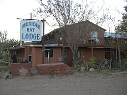 Mexican Hat Lodge | |
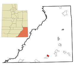 Location in San Juan County and the state of Utah. | |
| Coordinates: 37°9′54″N 109°51′56″W / 37.16500°N 109.86556°WCoordinates: 37°9′54″N 109°51′56″W / 37.16500°N 109.86556°W | |
| Country | United States |
| State | Utah |
| County | San Juan |
| Area | |
| • Total | 8.5 sq mi (22 km2) |
| • Land | 8.2 sq mi (21 km2) |
| • Water | 0.3 sq mi (0.8 km2) |
| Elevation | 4,244 ft (1,294 m) |
| Population (2010) | |
| • Total | 31 |
| • Density | 3.8/sq mi (1.5/km2) |
| Time zone | UTC-7 (Mountain (MST)) |
| • Summer (DST) | UTC-6 (MDT) |
| ZIP code | 84531 |
| Area code(s) | 435 |
| FIPS code | 49-49380[1] |
| GNIS feature ID | 1430248[2] |

Mexican Hat is a census-designated place (CDP) on the San Juan River on the northern edge of the Navajo Nation's borders in south-central San Juan County, Utah, United States. The population was 31 at the 2010 census, a sharp decline from the previous two censuses.
History[]
The name "Mexican Hat" comes from a curiously sombrero-shaped rock outcropping on the northeast edge of town; the rock measures 60-foot (18 m) wide by 12-foot (3.7 m). The "Hat" has two rock climbing routes ascending it. Mexican Hat has frequently been noted on lists of unusual place names.[3]
In 2016, the U.S. Route 163 bridge crossing the San Juan River on the south border of the town was renamed the "Jason R. Workman Memorial Bridge" after a member of SEAL Team Six who was killed in action in Afghanistan on August 6, 2011. Workman was a 1997 graduate of the nearby San Juan High School.[4]
Geography[]

The CDP is on U.S. Route 163, just 3 miles (5 km) south of the junction with State Route 261, and is just outside the northern boundary of both the Navajo Nation and Monument Valley. Goosenecks State Park is located 9 miles (14 km) west-northwest, is 6 miles (10 km) west-southwest, and the Valley of the Gods is to the north on U.S. 163.

According to the United States Census Bureau, the CDP has a total area of 8.5 square miles (22 km2), of which 8.2 square miles (21 km2) is land (96%) and 0.3 square miles (0.78 km2) is water (4%).
Climate[]
According to the Köppen Climate Classification system, Mexican Hat has a semi-arid climate, abbreviated "BSk" on climate maps.[5]
Demographics[]
| Historical population | |||
|---|---|---|---|
| Census | Pop. | %± | |
| 1990 | 259 | — | |
| 2000 | 88 | −66.0% | |
| 2010 | 31 | −64.8% | |
| source:[6][7] | |||
As of the census[1] of 2010, there were 31 people in 17 households residing in the CDP. The population density was 3.8 people per square mile (1.5/km2). There were 23 housing units at an average density of 2.8/sq mi (1.1/km2). The racial make-up of the CDP was 9.7% Native American and 90.3% White.
There were 17 households, out of which 5.9% had children under the age of 18 living with them, 29.4% were married couples living together, 17.6% had a female householder with no husband present, and 47.1% were non-families. 64.7% of all households were made up of individuals, and 5.9% had someone living alone who was 65 years of age or older. The average household size was 1.82 and the average family size was 2.56.
In the CDP, the population skewed older since the last census, with 6.4% under the age of 15, zero residents aged 15 to 24, 25.8% from 25 to 44, 25.9% from 45 to 64, and 42% who were 65 years of age or older. The median age was 54.5 years.
As of 2012, the median income for a household in the CDP was $80,767, and there were no families or individuals living below the poverty line.[8]
See also[]
References[]
- ^ Jump up to: a b "U.S. Census website". United States Census Bureau. Retrieved 2008-01-31.
- ^ "US Board on Geographic Names". United States Geological Survey. 2007-10-25. Retrieved 2008-01-31.
- ^ Parker, Quentin (2010). Welcome to Horneytown, North Carolina, Population: 15: An insider's guide to 201 of the world's weirdest and wildest places. Adams Media. pp. xi.
- ^ "San Juan River Bridge renamed to honor fallen hero". 2016-04-05. Archived from the original on 2016-04-24. Retrieved 2019-06-09.
- ^ Climate Summary for Mexican Hat, Utah
- ^ "CENSUS OF POPULATION AND HOUSING (1790-2000)". U.S. Census Bureau. Retrieved 2010-07-31.
- ^ Part of 1990's census area is now in Halchita.
- ^ Demographics for Mexican Hat, Utah
External links[]
| Wikimedia Commons has media related to Mexican Hat, Utah. |
| show Municipalities and communities of San Juan County, Utah, United States |
|---|

| show Authority control |
|---|
- Census-designated places in San Juan County, Utah
- Census-designated places in Utah