Micro, North Carolina
Micro, North Carolina | |
|---|---|
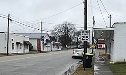 Main Street | |
 Location of Micro, North Carolina | |
| Coordinates: 35°33′46″N 78°12′14″W / 35.56278°N 78.20389°WCoordinates: 35°33′46″N 78°12′14″W / 35.56278°N 78.20389°W | |
| Country | United States |
| State | North Carolina |
| County | Johnston |
| Area | |
| • Total | 0.40 sq mi (1.05 km2) |
| • Land | 0.40 sq mi (1.05 km2) |
| • Water | 0.00 sq mi (0.00 km2) |
| Elevation | 187 ft (57 m) |
| Population (2010) | |
| • Total | 441 |
| • Estimate (2019)[4] | 537 |
| • Density | 1,329.21/sq mi (512.61/km2) |
| Time zone | UTC-5 (Eastern (EST)) |
| • Summer (DST) | UTC-4 (EDT) |
| ZIP code | 27555 |
| Area code(s) | 919 |
| FIPS code | 37-42620[2] |
| GNIS feature ID | 1021423[3] |

Micro is a town in Johnston County, North Carolina, United States. The 2010 population was 441.[5]
Geography[]
Micro is located at 35°33′46″N 78°12′14″W / 35.56278°N 78.20389°W.[6]
According to the United States Census Bureau, the town has a total area of 0.4 square miles (1.0 km2), all of it is land.
Demographics[]
| Historical population | |||
|---|---|---|---|
| Census | Pop. | %± | |
| 1900 | 61 | — | |
| 1910 | 74 | 21.3% | |
| 1920 | 183 | 147.3% | |
| 1930 | 222 | 21.3% | |
| 1940 | 289 | 30.2% | |
| 1950 | 310 | 7.3% | |
| 1960 | 350 | 12.9% | |
| 1970 | 300 | −14.3% | |
| 1980 | 438 | 46.0% | |
| 1990 | 417 | −4.8% | |
| 2000 | 454 | 8.9% | |
| 2010 | 441 | −2.9% | |
| 2019 (est.) | 537 | [4] | 21.8% |
| U.S. Decennial Census[7] | |||
The mayor of Micro is Walter "Jay" Warren Jr.[8] As of the census[2] of 2000, there were 454 people, 211 households, and 124 families residing in the town. The population density was 1,114.9 people per square mile (427.5/km2). There were 225 housing units at an average density of 552.5 per square mile (211.9/km2). The racial makeup of the town was 90.97% White, 7.71% African American, 1.10% from other races, and 0.22% from two or more races. Hispanic or Latino of any race were 3.96% of the population.
There were 211 households, out of which 25.1% had children under the age of 18 living with them, 43.6% were married couples living together, 12.3% had a female householder with no husband present, and 41.2% were non-families. 39.8% of all households were made up of individuals, and 24.2% had someone living alone who was 65 years of age or older. The average household size was 2.15 and the average family size was 2.88.
In the town, the population was spread out, with 22.7% under the age of 18, 7.3% from 18 to 24, 26.0% from 25 to 44, 22.2% from 45 to 64, and 21.8% who were 65 years of age or older. The median age was 40 years. For every 100 females, there were 85.3 males. For every 100 females age 18 and over, there were 75.5 males.
The median income for a household in the town was $28,889, and the median income for a family was $39,773. Males had a median income of $30,962 versus $20,000 for females. The per capita income for the town was $15,629. About 1.4% of families and 8.3% of the population were below the poverty line, including 4.1% of those under age 18 and 27.9% of those age 65 or over.
Education[]
- North Johnston High School
- North Johnston Middle School
- Micro Elementary School
References[]
- ^ "2019 U.S. Gazetteer Files". United States Census Bureau. Retrieved July 27, 2020.
- ^ Jump up to: a b "U.S. Census website". United States Census Bureau. Retrieved 2008-01-31.
- ^ "US Board on Geographic Names". United States Geological Survey. 2007-10-25. Retrieved 2008-01-31.
- ^ Jump up to: a b "Population and Housing Unit Estimates". United States Census Bureau. May 24, 2020. Retrieved May 27, 2020.
- ^ [1]
- ^ "US Gazetteer files: 2010, 2000, and 1990". United States Census Bureau. 2011-02-12. Retrieved 2011-04-23.
- ^ "Census of Population and Housing". Census.gov. Retrieved June 4, 2015.
- ^ http://www.johnstonnc.com/joconcelections/officials.cfm#micro
| show Municipalities and communities of Johnston County, North Carolina, United States |
|---|

| show Authority control |
|---|
- Towns in Johnston County, North Carolina
- Towns in North Carolina