Mile End
| Mile End | |
|---|---|
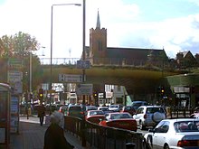
 The Green Bridge carries Mile End Park over the A11 Mile End Road | |
 Mile End Location within Greater London | |
| OS grid reference | TQ365825 |
| • Charing Cross | 3.6 mi (5.8 km) WSW |
| London borough |
|
| Ceremonial county | Greater London |
| Region | |
| Country | England |
| Sovereign state | United Kingdom |
| Post town | LONDON |
| Postcode district | E1, E3 and E14 |
| Dialling code | 020 |
| Police | Metropolitan |
| Fire | London |
| Ambulance | London |
| UK Parliament | |
| London Assembly | |

Mile End is a district in the East End of London, England, 3.6 miles (5.8 km) east-northeast of Charing Cross. Situated on the London-to-Colchester road, it was one of the earliest suburbs of the City of London. It became part of the metropolitan area in 1855, and is connected to the London Underground.
It was also known as Mile End Old Town; the name provides a geographical distinction from the unconnected former hamlet called Mile End New Town. In 2011, Mile End had a population of 28,544.[1]
History[]
Toponymy[]
Mile End is recorded in 1288 as La Mile ende.[2] It is formed from the Middle English 'mile' and 'ende' and means 'the hamlet a mile away'. The mile distance was in relation to Aldgate in the City of London, reached by the London-to-Colchester road.[2] In around 1691 Mile End became known as Mile End Old Town, because a new unconnected settlement to the west and adjacent to Spitalfields had become known as Mile End New Town.[2]
Beginnings[]
Whilst there are many references to settlements in the area, excavations have suggested there were very few buildings before 1300.
Mile End Road is an ancient route from London to the East. It was moved to its present-day alignment after the foundation of Bow Bridge in 1110. In the medieval period, it was known as ‘Aldgatestrete’, as it led to the eastern entrance to the City of London at Aldgate. The area running alongside Mile End Road was known as Mile End Green, and became known as a place of assembly for Londoners, as reflected in the name of Assembly Passage.
For most of the medieval period, this road was surrounded by open fields on either side. Speculative developments existed by the end of the 16th century and continued throughout the 18th century. It developed as an area of working and lower-class housing, often occupied by immigrants and migrants new to the city.
The Stepney Green Conservation Area was designated in January 1973, covering the area previously known as Mile End Old Town. It is a large Conservation Area with an irregular shape that encloses buildings around Mile End Road, Assembly Passage, Louisa Street and Stepney Green itself. It is an area of exceptional architectural and historic interest, with a character and appearance worthy of protection and enhancement. It is situated just north of the medieval village of Stepney, which was clustered around St. Dunstan's Church.[3]
Peasants' Revolt[]
In 1381, an uprising against the tax collectors of Brentwood quickly spread first to the surrounding villages, then throughout the South-East of England, but it was the rebels of Essex, led by a priest named Jack Straw, and the men of Kent, led by Wat Tyler, who marched on London. On 12 June, the Essex rebels, comprising 100,000 men, camped at Mile End and on the following day the men of Kent arrived at Blackheath. On 14 June, the young king Richard II rode to Mile End where he met the rebels and signed their charter. The king subsequently had the leaders and many rebels executed.[4]
Expansion[]

The New Globe pub opened next to the new Globe Bridge in 1820, with its licence possibly transferring from a nearby pub called the Cherry Tree which closed at around this time.[5]
Designed by Frederick Arthur Walters, The Guardian Angels Church was opened in 1903 and paid for by Henry Fitzalan-Howard, 15th Duke of Norfolk as a memorial to his youngest sister, Lady Margaret Howard, who had performed charitable work in the East End.[6]
Novelist and social commentator Walter Besant proposed a Palace of Delight[7] with concert halls, reading rooms, picture galleries, an art school and various classes, social rooms and frequent fêtes and dances. This coincided with a project by the philanthropist businessman Edmund Hay Currie to use the money from the winding up of the Beaumont Trust,[8] together with subscriptions, to build a People's Palace in the East End. Five acres of land were secured on the Mile End Road, and the Queen's Hall was opened by Queen Victoria on 14 May 1887. The complex was completed with a library, swimming pool, gymnasium and winter garden by 1892, providing an eclectic mix of populist entertainment and education. A peak of 8,000 tickets were sold for classes in 1892, and by 1900, a Bachelor of Science degree awarded by the University of London was introduced.[9] In 1931, the building was destroyed by fire, but the Draper's Company, major donors to the original scheme, invested more to rebuild the technical college and create Queen Mary College in December 1934.[10] A new People's Palace was constructed, in 1937, by the Metropolitan Borough of Stepney, in St Helen's Terrace. This finally closed in 1954.[11]
The abandoned Bancroft Road Cemetery was opened by the now closed Maiden Lane synagogue in Covent Garden, which bought its own cemetery at Globe Fields and had its first burial in 1811. By 1884 it was in disrepair and the cemetery was full by 1895.[12]
What is now Mile End Hospital was established as the infirmary for the local workhouse in 1859.[13] A training school for nurses was added in 1892.[13] The facility was rebuilt as the Mile End Old Town Infirmary in 1883, and then served as a military hospital during the First World War.[13] Renamed Mile End Hospital in 1930, it joined the National Health Service in 1948.[13]

Mile End tube station was opened in 1902 by the Whitechapel & Bow Railway (W&BR). Electrified services started in 1905. The first services were provided by the District Railway (now the District line); the Metropolitan line followed in 1936. (In 1988 this section of the Metropolitan was renamed the Hammersmith & City line.) As part of the Central line eastern extension, the station was expanded and rebuilt in 1946 by the Chief Architect of London Underground, Stanley Heaps, and his assistant, Thomas Bilbow, with services starting on 4 December 1946. Following nationalisation of the W&BR, full ownership of the station passed to London Underground in 1950.[14]
Mile End Arena was a ring covered with a canopy with crumbling walls and rickety corrugated iron behind Mile End station; it first opened in 1933, and was only used in summer. It closed in 1953.[15]
Second World War[]

Besides suffering heavily in earlier blitzes, Mile End was hit by the first V-1 flying bomb to strike London. On 13 June 1944, this 'doodlebug' impacted next to the railway bridge on Grove Road, an event now commemorated by a plaque. Eight civilians were killed, 30 injured and 200 made homeless by the blast.[16]
Reconstruction[]
A part of Mile End remained mostly derelict for many years after the Second World War, until it was cleared to extend Mile End Park.[17]
Contemporary[]
Mile End Hospital became the Royal London Hospital (Mile End) in 1990, but reverted to being called Mile End Hospital in 1994 and was taken under the management of Barts Health NHS Trust in 2012.[18] In the same year, Ragged School Museum opened in the premises of the former site of the Copperfield Road Ragged School.[19] In the same year, the Bancroft Unit for the Care of the Elderly opened at Mile End Hospital in June 1990, having moved from Bethnal Green.[20]
On 17 June 1995, the Mile End Stadium hosted a gig by Britpop band Blur where 27,000 fans saw them supported by the Boo Radleys, Sparks, John Shuttleworth, Dodgy and the Cardiacs.[21]
A groundbreaking project funded by the Millennium Commission called the Green Bridge, a pedestrian and cyclist separation structure which was built over the A11 (Mile End Road), opened in 2000, connecting the two halves of Mile End Park to form a linear park. It included new retail frontages.[citation needed]
The St Clement's Hospital site was closed in 2005, with services transferred to a new Adult Mental Health Facility at Mile End Hospital in October 2005.[22]
The Night Tube began service at Mile End tube station on the Central line on 19 August 2016.[23] Since 2016, northern Mile End has fallen under the remit of the Bow Roman Road Neighbourhood Forum. This includes the shops under The Green Bridge on the northern side of Mile End Road (A11), the Mile End Climbing Wall, and Palm Tree.[24]
The Carlton shut in 2018, which was a 165-year-old historically important two-storey pub and an important part of the local community history was closed on May in the same year, was sold to Trustee Properties Ltd who obtained permission from Tower Hamlets Council in 2017 to develop five flats on the site was pulled down and all work was halted due to its not being approved to be knocked down.[25]
Governance[]


Mile End formed a hamlet within the large ancient parish of Stepney, in the Tower division of the Ossulstone hundred of Middlesex. It was grouped into the Stepney poor law union in 1836, becoming a single parish for poor law purposes in 1857. It formed part of the Metropolitan Police District from 1830. Upon the creation of the Metropolitan Board of Works in 1855 the vestry of Mile End Old Town became an electing authority. The vestry hall was located on Bancroft Road. The parish became part of the County of London in 1889 and in 1900 it became part of the Metropolitan Borough of Stepney. In 1965 Stepney was incorporated into the London Borough of Tower Hamlets. There was a Mile End Parliament constituency from 1885 to 1950, which was notable for being one of two constituencies in the UK to elect a Communist Party MP Phil Piratin to the House of Commons between 1945 and 1950. At that time, it had a large Jewish population. The area now is covered by the Bethnal Green and Bow and Poplar and Limehouse constituencies.
Mile End as a parliamentary constituency had a reputation as a Labour Party stronghold, but also sent Communist Member of Parliament (MP) Phil Piratin to the House of Commons between 1945 and 1950. At that time, it had a large Jewish population. The area now is covered by the Bethnal Green and Bow and Poplar and Limehouse constituencies.
Geography[]
Mile End is in a part of London known as the East End and boasts an unusual landmark, the "Green Bridge" (known affectionately as the banana bridge, due to its yellow underside). This structure (designed by CZWG Architects, and opened in 2000) allows Mile End Park to cross over Mile End Road, and makes an interesting contrast with the more usual approach of building bridges for cars. It contains garden and water features and some shops and restaurant space built in below.
Ackroyd Drive Greenlink, Tower Hamlets Cemetery Park and Mile End Park form a large green corridor.[26][27] The Greenlink is a linear site bisected by roads into five rectangular plots. From the south these are Cowslip Meadow, allotments, Blackberry Meadow, Peartree Meadow and Primrose Meadow.[28]
Sport and leisure[]
Mile End has a Non-League football club, Sporting Bengal United F.C., which plays at Mile End Stadium.
Media[]
This section needs additional citations for verification. (October 2015) |
The neighbourhood was immortalised (humorously but unfavourably) in the pop band Pulp's song "Mile End", which was featured on the Trainspotting soundtrack.[29] The song describes a group of squatters taking up residence in an abandoned 15th-floor apartment in a run-down apartment tower. The artistic director of the 2012 Summer Olympics opening ceremony, Danny Boyle, lives in Mile End.[29] Boyle is also the director of Trainspotting.
In 2009, the music video for "Confusion Girl" by electropop musician Frankmusik was filmed in Mile End Park and Clinton Road, Mile End.[30]
In 2011, the music video for "Heart Skips a Beat" by Olly Murs and Rizzle Kicks was filmed in Mile End's skate park.
Transport[]
| show Neighbouring areas of London. |
|---|
Rail[]
Mile End tube station is on the London Underground Central, District and Hammersmith & City lines, all of which connect Mile End directly to the East End, City of London and Central London. The Central line also links the area directly to Stratford and Essex in the east and London's West End.
Bow Road tube station on the District and Hammersmith & City lines is also nearby.
Both stations are in London fare zone 2.[31][32]
Buses[]
There are bus stops on Mile End Road, Burdett Road and Grove Road.
London Bus routes 25, 205, 277, 309, 323, 339, 425, D6, D7 and night buses N25, N205 and N277 stop in the area.
Buses link Mile End directly to destinations across London, including Canary Wharf, the City of London, King's Cross, Paddington and Stratford.[33][34]
Road[]
The A11 (Mile End Road) passes east–west through Mile End, linking the locale to Aldgate in the west and Stratford in the east. At Stratford, the road meets the A12 where eastbound traffic can continue towards Ilford, the M11 (for Stansted Airport) and destinations in Essex.
The A1205 (Grove Road/Burdett Road) carries traffic northbound towards Victoria Park and Hackney. The road terminates to the south at the A13 near Limehouse and Canary Wharf.
Air pollution[]
The London Borough of Tower Hamlets monitors roadside air quality in Mile End. In 2017, average Nitrogen Dioxide (NO2) levels in the locale failed to meet the UK National Air Quality Objective of 40μg/m3 (micrograms per cubic metre).[35]
An automatic monitoring site in Mile End recorded a 2017 annual average of 48μg/m3. Alternative monitoring sites on Mile End Road also failed to meet air quality objectives. A site at the junction with Globe Road in nearby Stepney recorded 52μg/m3 as a 2017 average, whilst a site at the junction with Harford Street recorded 41μg/m3.[35]
Exposure to higher concentrations of NO2 has been linked to lung disease and respiratory problems.[36]
Cycling[]
Mile End is on London-wide, national and international cycle networks. Public cycling infrastructure in the locale is provided by both Transport for London (TfL) and the London Borough of Tower Hamlets. Routes include:
- National Cycle Route 1 (NCR 1) – a long-distance leisure cycle route between Dover, Kent and the Shetland Islands, Scotland and forms part of the National Cycle Network. The route passes through Mile End Park on traffic-free shared use paths. In North London, the route runs from Canary Wharf to Enfield Lock.[37]
- Cycle Superhighway 2 (CS2) – a commuter cycling route from Aldgate in the City to Stratford in the east. The route runs signposted, unbroken and traffic-free on cycle track for the majority of the route. The route follows the A11 (Mile End Road) through Mile End, and the track is coloured blue.[38] It was upgraded between Bow and Aldgate and was completed in April 2016, with separated cycle tracks replacing cycle lanes along the majority of the route.[39]
- Cycleway between Hackney and the Isle of Dogs – a proposed commuter cycle route made in 2019. According to current proposals, the southern portion of the route will run unbroken, signposted and traffic-free on cycle track between Mile End and Canary Wharf.[40]
- EuroVelo 2 ("The Capitals Route") – EuroVelo 2 is an international leisure cycle route between Moscow, Russia and Galway, Ireland. Through Mile End, it follows the route of NCR 1.[41][42]
- Regent's Canal towpath – a shared use path from Limehouse to Angel. The route is unbroken and traffic-free for its entire length, and can be accessed at Mile End through Mile End Park. The route links Mile End directly to Hackney and Dalston en route.[43][44]
Notable people[]
- Mabel Lucie Attwell (1879–1964), the British illustrator for children's books (married to painter and illustrator Harold Cecil Earnshaw), was born in Mile End.[45]
- Rokhsana Fiaz, the Labour Mayor of Newham since 2018, was born in Mile End hospital.[46][47]
- Jason Tindall, the former professional footballer and current assistant manager at AFC Bournemouth, is from Mile End.[48]
- Craig Fairbrass actor in Eastenders and London Heist.[49]
See also[]
- Mile End Hospital
- Stepney Historical Trust
- List of schools in Tower Hamlets
References[]
- ^ "Mile End – Hidden London". hidden-london.com.
- ^ Jump up to: a b c Mills, D. (2000). Oxford Dictionary of London Place Names. Oxford.
- ^ "Stepney Green". Archived from the original on 16 March 2012. Retrieved 30 July 2013.
- ^ R. B. Dobson, editor, (2002), The Peasants' Revolt of 1381 (History in Depth) ISBN 0-333-25505-4; a collection of source materials
- Alastair Dunn (2002), The Great Rising of 1381: The Peasant's Revolt and England's Failed Revolution, ISBN 0-7524-2323-1
- ^ "New Globe, 359 Mile End Road, Mile End E3". pubshistory.com. Retrieved 14 June 2019.
- ^ Mile End: The Guardian Angels, Taking Stock: Catholic Churches in England and Wales, accessed 11 February 2017
- ^ In Walter Besant All Sorts and Conditions of Men (1882)
- ^ In 1841, John Barber Beaumont died and left property in Beaumont Square, Stepney to provide for the education and entertainment of people from the neighbourhood. The charity – and its property – was becoming moribund by the 1870s, and in 1878 it was wound up by the Charity Commissioners, providing its new chair, Sir Edmund Hay Currie, with £120,000 to invest in a similar project. He raised a further £50,000 and secured continued funding from the Draper's Company for ten years (The Whitechapel Society, below)
- ^ G. P. Moss and M. V. Saville From Palace to College – An illustrated account of Queen Mary College (University of London) (1985) pages 39–48 ISBN 0-902238-06-X
- ^ The People's Palace The Whitechapel Society accessed 5 July 2007 Archived 11 October 2007 at the Wayback Machine
- ^ Origins and History Queen Mary, University of London Alumni Booklet Archived 3 March 2016 at the Wayback Machine accessed 5 July 2007
- ^ "Edith's Streets: Great Eastern Railway to Ilford Globe Town". 20 July 2014.
- ^ Jump up to: a b c d "Mile End Hospital". Lost hospitals of London. Retrieved 11 May 2018.
- ^ "Transport Act, 1947" (PDF). The London Gazette. 27 January 1950. p. 480. Archived (PDF) from the original on 30 July 2013.
- ^ "History of Mile End tube station". 28 September 2018.
- ^ Second World War memories (BBC) accessed 27 March 2007
- ^ Best and worst of art bites the dust Archived 6 June 2014 at the Wayback Machine Roberts, Alison The Times, London, 12 January 1994, accessed 5 October 1994
- ^ Meriel Clunas. "Mile End Hospital – Our history". Bartshealth.nhs.uk. Retrieved 10 October 2018.
- ^ "Ragged School Museum". Time Out London.
- ^ "Mile End Hospital - Our history". www.bartshealth.nhs.uk.
- ^ "Blur live at Mile End Stadium, 1995". Veikko's Blur Page. Retrieved 28 June 2010.
- ^ "Hospitals". Derelict London.
- ^ "Over 50,000 journeys completed on London's first Night Tube services". Transport for London. 20 August 2016. Retrieved 28 December 2016.
- ^ "Boundary".
- ^ "Anger as 165-year-old East End pub that survived the Blitz is flattened by developer". 28 September 2018.
- ^ "Ackroyd Drive Greenlink". Local Nature Reserves. Natural England. 13 July 2013. Archived from the original on 22 February 2014. Retrieved 18 February 2014.
- ^ "Map of Ackroyd Drive Greenlink". Local Nature Reserves. Natural England. Retrieved 18 February 2014.
- ^ Noticeboard on the site
- ^ Jump up to: a b Snapes, Laura (22 January 2018). "From Barking to Bow: the songs that champion London's less glamorous corners". The Guardian. Retrieved 21 February 2021.
- ^ "Frankmusik – Confusion Girl". capitalfm.com.
- ^ "London's Rail & Tube services" (PDF). Transport for London (TfL). Archived from the original (PDF) on 11 May 2019.
- ^ "Night Tube and London Overground map" (PDF). Transport for London (TfL). Archived from the original (PDF) on 11 May 2019.
- ^ "Buses from Mile End" (PDF). Transport for London (TfL). Archived from the original (PDF) on 25 May 2019.
- ^ "Buses from Mile End Stadium and Burdett Road" (PDF). Transport for London (TfL). Archived from the original (PDF) on 25 May 2019.
- ^ Jump up to: a b "London Borough of Tower Hamlets Air Quality Annual Status Report for 2017" (PDF). London Borough of Tower Hamlets. Archived from the original (PDF) on 25 May 2019.
- ^ "Nitrogen Dioxide" (PDF). World Health Organization (WHO). p. 10. Archived from the original (PDF) on 4 April 2018.
- ^ "Route 1". Sustrans. Archived from the original on 14 April 2019.
- ^ "CS2 Stratford to Aldgate" (PDF). Transport for London (TfL). Archived from the original (PDF) on 29 April 2019.
- ^ "Cycle Superhighway 2 upgrade". Transport for London. Archived from the original on 9 September 2015. Retrieved 2 August 2015.
- ^ "Cycling and walking improvements between Hackney and the Isle of Dogs". Transport for London (TfL). Archived from the original on 15 May 2019.
- ^ "EuroVelo 2". EuroVelo.
- ^ "EuroVelo 2: United Kingdom". EuroVelo.
- ^ "Cycling". Canal & River Trust. Archived from the original on 7 April 2019.
- ^ "Regent's Canal". Canal & River Trust. Archived from the original on 6 April 2019.
- ^ Dalby, Richard (1991), The Golden Age of Children's Book Illustration, Gallery Books, pp. 132–3, ISBN 0-8317-3910-X
- ^ "Almost 4,000 people may have been denied vote by election ID pilots". The Guardian. 3 May 2018. Retrieved 4 May 2018.
- ^ "About". Rokhsana Fiaz. Retrieved 30 August 2018.
- ^ "Cherries: We're stronger than ever says Tindall". Bournemouth Echo. 16 October 2012.
- ^ Fairbass, Craig. "Biography". Craig Fairbass.
Bibliography[]
- William J. Fishman, East End 1888: Life in a London Borough Among the Laboring Poor (1989)
- William J. Fishman, Streets of East London (1992) (with photographs by )
- William J. Fishman, East End Jewish Radicals 1875–1914 (2004)
- Nigel Glendinning, Joan Griffiths, Jim Hardiman, Christopher Lloyd and Victoria Poland Changing Places: a short history of the Mile End Old Town RA area (Mile End Old Town Residents’ Association, 2001)
- Derek Morris Mile End Old Town 1740–1780: A social history of an early modern London Suburb (East London History Society, 2007) ISBN 978-0-9506258-6-7
- Alan Palmer The East End (John Murray, London 1989)
- Watson, Isobel (1995). "From West Heath to Stepney Green: Building development in Mile End Old Town, 1660–1820". London Topographical Record. XXVII. London Topographical Society. pp. 231–256.
| show London Borough of Tower Hamlets |
|---|

| show Queen Mary University of London |
|---|
| show Authority control |
|---|
- Mile End
- Areas of London
- Districts of the London Borough of Tower Hamlets