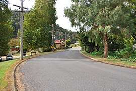
Mitta Mitta, Victoria
| Mitta Mitta Victoria | |||||||||
|---|---|---|---|---|---|---|---|---|---|
 Mitta Mitta | |||||||||
 Mitta Mitta Location in Shire of Towong, Victoria | |||||||||
| Coordinates | 36°32′S 147°22′E / 36.533°S 147.367°ECoordinates: 36°32′S 147°22′E / 36.533°S 147.367°E | ||||||||
| Population | 171 (2016 census)[1] | ||||||||
| Postcode(s) | 3701 | ||||||||
| Elevation | 254 m (833 ft) | ||||||||
| Location |
| ||||||||
| LGA(s) | Shire of Towong | ||||||||
| State electorate(s) | Benambra | ||||||||
| Federal Division(s) | Indi | ||||||||
| |||||||||

Mitta Mitta is a small town in the Australian state of Victoria in the Mitta Mitta Valley. It stands on the Omeo Highway and is 415 km from Melbourne (and the same distance from Canberra), and is located on the Mitta Mitta River not far from Dartmouth Dam. At the 2016 census, Mitta Mitta and the surrounding area had a population of 171.[2]
Etymology[]
The name "Mitta Mitta"[3] derives from the name local Aboriginal people gave to the Mitta Mitta River – "mida-modunga" (where reeds grow, modunga being a particular type of reed).
Geography[]
Mitta Mitta is situated at the southernmost end of the Mitta Mitta Valley on the foothills of the Great Dividing Range. At the airport, Mitta Mitta is 250 m (820 ft) above mean sea level. The town is at the confluence of the Mitta Mitta River and Snowy Creek, 18 km from , the highest mountain in Victoria. Mitta Mitta is on the Omeo Highway, a major transportation connection between Central Victoria and Gippsland.

Education[]
Mitta Mitta Primary School (no 887) was opened[4] on 1 October 1869. It is a small school that has been threatened with closure a number of times. Children rode horses to the school until the 1980s. Secondary children are bussed to Tallangatta, a 140 km daily round trip.
Brief history[]
The Mitta Mitta Valley was settled by early pastoralists in 1835 and Mitta Mitta became a settlement when gold was discovered there in 1852.[5] Substantial hydraulic sluicing replaced alluvial mining, the Pioneer Mine being the most successful, yielding over 441 kg of gold until it closed in 1904. This large open-cut mine still forms the backdrop to the town. Aboriginals used the River as a food source, social connections and sometimes wars. Their presence goes back at least 4,000 years and artifacts are frequently found along the River and creeks. The principle tribe in the district was the Jaitmatang (also spelt yaithmathang) with the theddora-mittung occupying the area around the southern end of the Valley near present Mitta Mitta. Their spoken language was Dhudhoroa (now extinct).
Economy[]
Mining, cropping and cattle provided income until the Federation Drought. Dairy farming was a major pursuit until around 2000 and since then, beef cattle production has since become the principal activity with the Mitta Valley offering some the finest and productive country in the State. Some niche agri-business enterprises are appearing, namely the production of hazelnuts and mushrooms. The town was seriously compromised during the 2003 bushfires and was shut down in 2020 during the January bushfires and subsequent COVID-19 lockdown. Tourism is becoming more important and provides an opportunity for economic and population growth to offset some of the pressures from a falling permanent population and a decline in local production. Houses within the township are more frequently being acquired as 'weekenders', indicating the desirability of Mitta Mitta as a beautiful and peaceful retreat.
Today[]

The town operates a Country Fire Authority (CFA) branch together with a local State Emergency Service (SES) branch. Locally trained Ambulance Community Officers (ACOs) service an area of 2500 km2 on a 24/7 basis on behalf of Ambulance Victoria. There is a Victoria Police Station in the centre of the town.
Mitta Mitta is a tourist destination on Omeo Highway and is becoming increasingly popular with bike riders.[citation needed]
The major annual event is the Mighty Mitta Muster held on the long weekend in March.
The town in conjunction with neighbouring township Eskdale has an Australian Rules football team "Mitta United" competing in the Tallangatta & District Football League.
Golfers play at the course of the Mitta Mitta Golf Club on Magorra Park.[6]
The Mitta Mitta Brewing Co produces craft beers.[7]
There is one pub in the centre of town, the Mitta Pub (formerly the Laurel Hotel). The pub sits next to Paddy's Reserve and backs on to Snowy Creek.[citation needed]
Transportation[]
Mitta Mitta Airport (privately owned) provides access to the town for Air Ambulance, flight training, fire fighting, agriculture services and visitors.
See also[]
References[]
| Wikimedia Commons has media related to Mitta Mitta, Victoria. |
- ^ Australian Bureau of Statistics (27 June 2017). "Mitta Mitta (State Suburb)". 2016 Census QuickStats. Retrieved 24 August 2020.

- ^ Australian Bureau of Statistics (27 June 2017). "Mitta Mitta (State Suburb)". 2016 Census QuickStats. Retrieved 24 May 2010.
- ^ Smyth, Robert Brough, The Aborigines of Victoria, 1878, Government Printer
- ^ Colquohoun,S.A., Mitta Mitta from the Early Pioneer Days, 1972, Mitta Mitta, Victoria
- ^ Kelly, Russell J, Mitta Mining, 2007, Wombat Gully Productions, ISBN 9780957853317
- ^ Golf Select, Mitta Mitta, retrieved 11 May 2009
- ^ https://www.mittabrewing.com.au/
External links[]
- Towns in Victoria (Australia)
- Mining towns in Victoria (Australia)