Moala Island
This article needs additional citations for verification. (September 2014) |
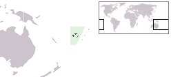
 Map of Fiji | |
 | |
| Geography | |
|---|---|
| Location | Fiji |
| Coordinates | 18°36′S 179°52′E / 18.600°S 179.867°ECoordinates: 18°36′S 179°52′E / 18.600°S 179.867°E |
| Archipelago | Moala Islands |
| Adjacent bodies of water | Koro Sea |
| Area | 65 km2 (25 sq mi)[1] |
| Length | 11 km (6.8 mi) |
| Highest elevation | 468 m (1535 ft) |
| Administration | |
Fiji | |
| Division | Eastern |
| Province | Lau Province |
| Largest settlement | Naroi (pop. 550) |
| Demographics | |
| Population | 3000 (2014) |
| Pop. density | 46.15/km2 (119.53/sq mi) |
| Ethnic groups | Native Fijians, Indo-Fijians ; other (Asian, Europeans, other Pacific Islander) |

Moala is a volcanic island in the Moala subgroup of Fiji's Lau archipelago. It has an area of 62.5 square kilometers (24.1 sq mi), making it the ninth largest island of Fiji. The highest point on the island of Moala, at a maximum elevation of 468 meters (1,535 ft), is called which has rich vegetation and consists of dark thick forest. The population of around 3000 live in eight villages. The chiefly village of these is Naroi, whose population is over 500. Economic activities include coconut farming, cocoa production, fishing and yaqona (kava) production.
Oral history of the Island depicted by the genealogical records which is funded by the British through Ratu Sukuna, whose mother is from Naocovonu. The genealogical records or Vola-ni-Kawa Bula kei Viti abbreviated as VKB, dictates that all Moalans are to be registered under two great sons of pre-Colonial Fiji, and these are: Kubuavanua (now claimant to the title Tui Moala) and Rovarovaivalu. This separates the Island into two sub-regions: Moala Levu (as the claimant want to call themselves) and Moala Lailai. Moala Levu includes the clan that called themselves Yavusa Ratu, and Turagalevu or Turaga Ulu, whose influence is mainly felt on the north-west of the island from Naroi to Vadra. Moala Lailai, whose village of influence once felt all over the islands from Manukui (post-Colonially called Vunuku) and Wainikelei (post-Colonially referred to as Keteira). These group of Moalans are on the south and eastern end of the Island from Vunuku, Cakova and to Nasoki.
The eight village that occupies the Island is said to be for the children of Rokomautu whose sons include Rovarovaivalu, whose children in known as the "yavusa tinitini" (the clans of ten or ten clans), led by Naivalukuru. The village initially settled were Uciwai, with later settlers being Yavusa Ratu from Verata and Yavusa Nacuritutu on their return from Tonga. The three clans settled in the bay in proximity of each other. The villages that occupy Moala first was Wainikelei (post-colonial Keteira); followed by Nasau or Korosau (Naroi); Manukui (Vunuku; Cakova and Nasoki); Keteicake (Turagalevu), and later Nuku, Vadra, and; Maloku. The latter villages were results of tokens of war between Manukui and Nasau.
Post-Colonial Fiji resulted in the relocation of Nasau to Naroi today and the resettlement of Manukui to Vunuku, Cakova and Nasoki. Other settlers came in the form of Vadra, Nuku and Maloku from other parts of Fiji as a formalization of their effort in the last tribal war that occurred on the Island, that politicised the establishment through the effort to registration Fijians by Sukuna (Rt).
Unfortunately the island of moala has been facing problems in their fishing industry, forcing them to import from the main land of Viti Levu, mostly tinned fish. Pollution of the sea has been a major factor that has driven marine life away from the island and worse killing them especially towards north of the island in Naroi.
The Methodist Church is strong in Moala. Other Protestant beliefs exist in Moala today and these include the JW's; SDA's, as well as Catholicism or relative thereof. Since the island is populated by Indigenous population, which surprisingly was not by the well known Maafu movement as depicted by some. Josaia Donumaibulu one of the first laymen of Moalan stock to bring biblical message to the island, was rejected by his own kin in Nasau, hence he settled with his relative and kin in Wainikelei. [The church first missionary or laymen to reach the island was a Tongan, whose name is yet unknown, and house of worship before it was burned to the ground is located near, now Vunuku]. Donumaibulu served his last mission in Rewa where he died and was commemorated and named after the church (building) at Lomanikoro.
Local folk stories, well known to all, despised by many, depict that "Rokomautu" (the sturdy one), however, remained on the island upon arrival on the Kaunitoni (dipping stick), on a maiden voyage° approved by his father, the "Ratu". In other folk stories, the Ratu left Totoya, and made his way to now known Verata, which upon his deathbed render the race on the "nukukatudrau" (hundred fathomed beach) of all his eldest sons' to appoint his successor. This resulted in treachery that shook the Fijian historical narrative and culture to its core. Other popular, now, legends have it that Kubunavanua came to Moala from Tonga, upon returning on the Kaunitera. Kaunitera is his way of taking over the Kaunitoni, by way of changing its name and made his voyage to Tonga. Thus the name, "Kubuavanua" or "Kabuavanua" (shadows of land). Note, legends have it that his return was not acceptable to his clan at Moala as he eloped the high princess ("tabusiga") of Tonga, this supposedly ensured a rescue party from Tonga which seemingly in the face of Maafu. Kubuavanua led the group that calls themselves the "Turagalevu" or "Big King". Folk history would have these two, Rokomautu and Kubuavanua, to be of the first landers or land people, with Rokomautu of the Tuiwai stock and Kuduavanua the Tura stock or the progeny of Degei and Lutunasosba respectively. Local legends has it that the Tuiwai Stock are akin to sailing whose natural skill in navigation is immediately experienced when at the helm. Legend has it that the two stock both arrived at Moala, the Tuiwai stock stayed behind while the Tura stock took helm to Tonga, taskin with them the Kaunitoni, and returning with a new name Kaunitera. The purpose of each name Tuiwai and Tura was akin to duties each have on every sea voyage: the Tuiwai stock took the helm, while the Tura stock is to change of the mast that must be transferred to either end of the canoe when necessitated to catch wind. Thus the two bow design of Fijian sailing canoe.
Soon before Colonial era, ensured after the Manukui War, the Navucunimasi (now commonly referred to as Namoala), on their arrival saw that the island is already occupied and thus the name of the Island "Muala" (just get on)). The Nasau clan is believed to be from Verata (the winner of the nukukatudrau race), on the west of Uciwai decided to solidify their claim to chiefdom by bestowing the Tui Nasau, after the Manukui war. Soon after the Colonials stepped into forcing the establishment of the Tui Moala, which the Tui Nasau agreed to appoint let the Turagaevu at the time and was instructed: "to represent/entertain Government at Naroi, whilst bringing all news and request to the Tui Nasau for deliberation to the "vanua" or other Villages". The bestowment of the Tui Nasau was only made possible by the Wainikelei stock, despite not being remotely related to the Manukui War. Legend has it that to complete the ritual, a basket of soil and a bunch of young coconuts will have to be presented as the symbol of land and people. Since neither in the warring faction have such status, the elders at Wainekeli was approached and agreed in the name of peace to partake in the bestowment ceremony.
The Moalan stock are one of Fiji oldest in the group, whose respect and strength can be adorned by the linkage between the island and a few islands in the Fiji group, including Taveuni, Verata, Bau, Gau, Levuka, Cicia, Vatoa, Ono Kadavu and a few others. For instance the Tuicakau in denoted to be of Moalan stock, who legends have it to be bestowed as Tuicakau by villages upon seeing him on the reef. Lineage also ran from village to village in the Lomaitivi group, to the Takalai Gau.
See also[]
- List of islands
References[]
- ^ Gillespie, Rosemary G.; D. A. Clague (2009). Encyclopedia of Islands. University of California Press. p. 299. ISBN 0520256492.
| Authority control |
|---|
- Islands of Fiji
- Lau Islands