Moers
This article needs additional citations for verification. (October 2013) |
Moers | |
|---|---|
 Moers Castle (2014) | |
 Flag  Coat of arms | |
show Location of Moers within Wesel district | |
 Moers | |
| Coordinates: 51°27′33″N 6°37′11″E / 51.45917°N 6.61972°ECoordinates: 51°27′33″N 6°37′11″E / 51.45917°N 6.61972°E | |
| Country | Germany |
| State | North Rhine-Westphalia |
| Admin. region | Düsseldorf |
| District | Wesel |
| Subdivisions | 3 |
| Government | |
| • Mayor (2020–25) | Christoph Fleischhauer[1] (CDU) |
| Area | |
| • Total | 67.68 km2 (26.13 sq mi) |
| Elevation | 23 m (75 ft) |
| Population (2020-12-31)[2] | |
| • Total | 103,487 |
| • Density | 1,500/km2 (4,000/sq mi) |
| Time zone | UTC+01:00 (CET) |
| • Summer (DST) | UTC+02:00 (CEST) |
| Postal codes | 47441 - 47447 |
| Dialling codes | 0 28 41 |
| Vehicle registration | MO (alternative: WES or DIN) |
| Website | www |


show This article may be expanded with text translated from the corresponding article in German. (March 2020) Click [show] for important translation instructions. |
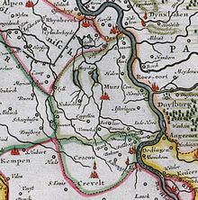
Moers (German pronunciation: [ˈmœʁs] (![]() listen); older form: Mörs; archaic Dutch: Murse, Murs or Meurs) is a German city on the western bank of the Rhine, close to Duisburg. Moers belongs to the district of Wesel.
listen); older form: Mörs; archaic Dutch: Murse, Murs or Meurs) is a German city on the western bank of the Rhine, close to Duisburg. Moers belongs to the district of Wesel.
History[]
Known earliest from 1186, the county of Moers was an independent principality within the Holy Roman Empire.
During the Eighty Years' War it was alternately captured by Spanish and Dutch troops, as it bordered the Upper Quarter of Guelders. During the war it finally fell to Maurice of Orange. As it was separated from the Dutch Republic by Spanish Upper Guelders it did not become an integral part of the Republic, though Dutch troops were stationed there.
After the death of William III of Orange in 1702, Moers was inherited by the king of Prussia. All Dutch troops and civil servants were expelled.
In 1795 it was annexed by France. At the Congress of Vienna, in 1815 it was returned to Prussia and in 1871 it became part of the German Empire.
A target of the Oil Campaign of World War II, the Steinkohlenbergwerke (English: coal mine) Rheinpreussen synthetic oil plant in Moers,[3] was partially dismantled post-war.
| Significant minority groups | |
| Nationality | Population (2014) |
|---|---|
| 4,245 | |
| 725 | |
| 586 | |
| 427 | |
| 327 | |
Mayors[]

- 1815–1820: Wilhelm Urbach
- 1822–1830: von Nievenheim
- 1830–1850: Friedrich Adolf Vinmann
- 1850–1859: Karl von Strampff
- 1860–1864: Gottlieb Meumann
- 1864–1897: Gustav Kautz
- 1898–1910: August Craemer
- 1910–1915: Richard Glum
- 1917–1937: Fritz Eckert
- 1937–1941: Fritz Grüttgen
- 1943–1945: Peter Linden
- 1945–1946: Otto Maiweg
- 1946: Karl Peschken
- 1946–1952: Wilhelm Müller
- 1952–1977: Albin Neuse (SPD)
- 1977–1999: Wilhelm Brunswick (SPD)
- 1999–2004: Rafael Hofmann (CDU)
- 2004–2014: Norbert Ballhaus (SPD)
- 2014–: Christoph Fleischhauer (CDU)
Sports[]
In 1985, the Moers Sports Club (volleyball) was formed, winning the 1989 Bundesliga championship.
Notable people[]

- Gerhard Tersteegen (1697–1769), lay preacher, mystic and poet
- Georg Perthes (1869–1927), surgeon and radiologist (Perthes disease)
- Anna Erler-Schnaudt (1878–1963), contralto
- Hans Dammers (1913–1944), Luftwaffe ace
- Walter Niephaus (1923–1992), chess master
- Hanns Dieter Hüsch (1925–2005), comedian, writer
- Hubert Hahne (1935–2019), race car driver
- Herman Weigel (born 1950), film producer and screenwriter
- Jürgen Renn (born 1956), physicist and historian of science
- Helga Trüpel (born 1958), politician (Alliance 90/The Greens)
- Jörg van Ommen (born 1962), race car driver
- Katja Nass (born 1968), fencer
- Stephan Paßlack (born 1970), footballer
- Christian Ehrhoff (born 1982), ice hockey player
- Timo Weß (born 1982), field hockey player
- Benjamin Weß (born 1985), field hockey player
Twin towns – sister cities[]
 Maisons-Alfort, France (1966)
- Bapaume, France (1974)
 Knowsley, England, United Kingdom (1980)
 Ramla, Israel (1987)
 La Trinidad, Nicaragua (1989)
 Seelow, Germany (1990)
 Stazzema, Italy (2019)
See also[]
- Moers Festival
- Burma-Shave, which awarded a trip to Moers in a 1955 promotion
References[]
- ^ Wahlergebnisse in NRW Kommunalwahlen 2020, Land Nordrhein-Westfalen, accessed 30 June 2021.
- ^ "Bevölkerung der Gemeinden Nordrhein-Westfalens am 31. Dezember 2020" (in German). Landesbetrieb Information und Technik NRW. Retrieved 21 June 2021.
- ^ "Index - Tom Reel 304 : Documents taken from Steinkohlenbergwerk Rheinpreussen, Moers" (PDF). Fischer-tropsch.org. Archived from the original (PDF) on 2013-10-18. Retrieved 2013-10-17.
- ^ "Partnerstädte der Stadt Moers". moers.de (in German). Moers. Retrieved 2021-02-26.
External links[]
| Wikimedia Commons has media related to Moers. |
| show Towns and municipalities in Wesel (district) |
|---|
| show Authority control |
|---|
- Towns in North Rhine-Westphalia
- Moers
- Cities in North Rhine-Westphalia
- Oil campaign of World War II
- Populated places on the Rhine
- Wesel (district)
- Rhine Province