Seelow
Seelow | |
|---|---|
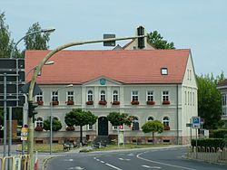 Seelow Town Hall | |
 Coat of arms | |
show Location of Seelow within Märkisch-Oderland district | |
 Seelow | |
| Coordinates: 52°31′00″N 14°22′59″E / 52.51667°N 14.38306°ECoordinates: 52°31′00″N 14°22′59″E / 52.51667°N 14.38306°E | |
| Country | Germany |
| State | Brandenburg |
| District | Märkisch-Oderland |
| Government | |
| • Mayor (2017–25) | Jörg Schröder[1] (SPD) |
| Area | |
| • Total | 25.28 km2 (9.76 sq mi) |
| Elevation | 52 m (171 ft) |
| Population (2020-12-31)[2] | |
| • Total | 5,394 |
| • Density | 210/km2 (550/sq mi) |
| Time zone | UTC+01:00 (CET) |
| • Summer (DST) | UTC+02:00 (CEST) |
| Postal codes | 15306 |
| Dialling codes | 03346 |
| Vehicle registration | MOL, FRW, SEE, SRB |
| Website | Official website |


Seelow is a German town, seat of the Märkisch-Oderland, a district of Brandenburg. As of 2013 its population was of 5,464.
Geography[]
It is situated in the extreme east of Germany, 70 km (40 miles) east of Berlin, 16 km (10 miles) west of the boundary with Poland.
History[]

The village appears in the records held in 1252 by Archbishop Wilbrand of Magdeburg. At that time, listed as Villa Zelou, it was included in the property of the formerly Polish Bishopric of Lebus (Lubusz Land), contested between the Magdeburg archbishops and the Ascanian margraves of Brandenburg.
Seelow suffered damaging town fires in 1630, 1788 and again in 1809.
From 1816 Seelow was included for administrative purposes in the , a subdivision of the Frankfurt Region within the Prussian Province of Brandenburg. In 1863 the district council office was relocated to Seelow and in 1950 "Lebus district" was renamed "Seelow district"; following frontier changes agreed with the Soviet Union in 1945, the town of Lebus itself had lost to Poland much of the agricultural area that had traditionally supported it. Between 1952 and 1993, Seelow was the administrative centre for the within the larger Frankfurt territory.
Seelow was the location of one of the last major pitched battles in Europe during the Second World War - the Battle of the Seelow Heights. In this battle, from 16 to 19 April 1945, Soviet troops under Marshal Zhukov opened the way to Berlin. By the time the slaughter was over the town was largely destroyed, primarily through a major air attack which took place on 17 April 1945, and which was followed by extensive burning and plunder.
Cultural references[]
Because of its importance in the Second World War, Seelow is today featured in many video games, books and films. Seelow is a playable map in the popular PS3 and Xbox 360 game Call of Duty: World at War. The Battle of the Seelow Heights is featured extensively in Men of War. The planet Тзаэло (Tzaelow) in the Warhammer 40,000 universe is a likely reference to the town of Seelow, particularly the way that the battle is fought[citation needed].
Demography[]

Development of Population since 1875 within the Current Boundaries (Blue Line: Population; Dotted Line: Comparison to Population Development of Brandenburg state; Grey Background: Time of Nazi rule; Red Background: Time of Communist rule)

Recent Population Development and Projections (Population Development before Census 2011 (blue line); Recent Population Development according to the Census in Germany in 2011 (blue bordered line); Official projections for 2005-2030 (yellow line); for 2017-2030 (scarlet line); for 2020-2030 (green line)


|
|
|
Twin towns – sister cities[]
 Moers, Germany (1990)
 Kostrzyn nad Odrą, Poland (1998)
- Międzychód, Poland (1998)
 Nangis, France (1998)
See also[]
- Seelow Heights
- Battle of the Seelow Heights
References[]
- ^ Landkreis Märkisch-Oderland Wahl der Bürgermeisterin / des Bürgermeisters, accessed 1 July 2021.
- ^ "Bevölkerung im Land Brandenburg nach amtsfreien Gemeinden, Ämtern und Gemeinden 31. Dezember 2020". Amt für Statistik Berlin-Brandenburg (in German). June 2021.
- ^ Detailed data sources are to be found in the Wikimedia Commons.Population Projection Brandenburg at Wikimedia Commons
- ^ "Städtepartnerschaften". seelow.de (in German). Seelow. Retrieved 2020-03-24.
External links[]
![]() Media related to Seelow at Wikimedia Commons
Media related to Seelow at Wikimedia Commons
| show Towns and municipalities in Märkisch-Oderland |
|---|
| show Authority control |
|---|
- Towns in Brandenburg
- Seelow
- Localities in Märkisch-Oderland
- Province of Brandenburg
- Bezirk Frankfurt