Mokrý Háj
Mokrý Háj | |
|---|---|
Municipality | |
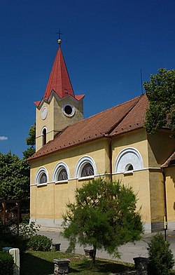 Church of All Saints | |
 Mokrý Háj Location of Mokrý Háj in the Trnava Region | |
| Coordinates: 48°49′N 17°15′E / 48.817°N 17.250°ECoordinates: 48°49′N 17°15′E / 48.817°N 17.250°E | |
| Country | Slovakia |
| Region | Trnava |
| District | Skalica |
| First mentioned | 1569 |
| Area | |
| • Total | 6.871 km2 (2.653 sq mi) |
| Elevation | 261 m (856 ft) |
| Population | |
| • Total | 623 |
| • Density | 91/km2 (230/sq mi) |
| Time zone | UTC+1 (CET) |
| • Summer (DST) | UTC+2 (CEST) |
| Postal code | 908 65 |
| Area code(s) | 421-34 |
| Car plate | SI |
| Website | mokryhaj.sk |


Mokrý Háj is a village and municipality in Skalica District in the Trnava Region of western Slovakia.
History[]
In historical records the village was first mentioned in 1569.
Geography[]
The municipality lies at an altitude of 261 metres and covers an area of 6.871 km². It has a population of about 623 people.
External links[]
![]() Media related to Mokrý Háj at Wikimedia Commons
Media related to Mokrý Háj at Wikimedia Commons
- Official page
- https://web.archive.org/web/20080111223415/http://www.statistics.sk/mosmis/eng/run.html
Municipalities of Skalica District | ||
|---|---|---|
This Trnava Region geography article is a stub. You can help Wikipedia by . |
Categories:
- Villages and municipalities in Skalica District
- Trnava Region geography stubs