Monticello, Arkansas
Monticello, Arkansas | |
|---|---|
 | |
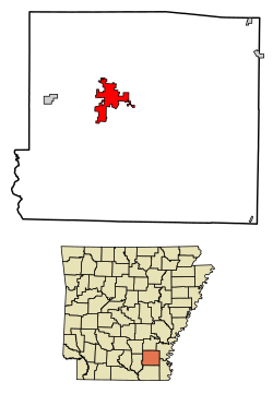 Location of Monticello in Drew County, Arkansas. | |
| Coordinates: 33°37′38″N 91°47′38″W / 33.62722°N 91.79389°WCoordinates: 33°37′38″N 91°47′38″W / 33.62722°N 91.79389°W | |
| Country | United States |
| State | Arkansas |
| County | Drew |
| Government | |
| • Type | Mayor-council government |
| • Mayor | Paige Chase |
| Area | |
| • Total | 10.91 sq mi (28.24 km2) |
| • Land | 10.89 sq mi (28.21 km2) |
| • Water | 0.01 sq mi (0.04 km2) |
| Elevation | 292 ft (89 m) |
| Population (2010) | |
| • Total | 9,467 |
| • Estimate (2019)[1] | 9,372 |
| • Density | 860.53/sq mi (332.27/km2) |
| Time zone | UTC-6 (Central (CST)) |
| • Summer (DST) | UTC-5 (CDT) |
| ZIP codes | 71655-71657 |
| Area code(s) | 870 |
| FIPS code | 05-46580 |
| GNIS feature ID | 0052144 |
| Website | monticelloarkansas |

Monticello (/ˌmɒntɪˈsɛloʊ/ MON-tih-SEL-oh) is a college town in, and the county seat of, Drew County, Arkansas, United States.[3] As of the 2010 census it had a population of 9,467.[4] Founded in 1849 in the Arkansas Timberlands very near the Arkansas Delta region, the city has long been a commercial, cultural and educational hub for southeast Arkansas. With a historically agriculture- and silviculture-based economy, Monticello has diversified to include growth from the medical sector and the University of Arkansas at Monticello (UAM).
History[]
When Drew County was formed in 1846, its citizens decided that a new town should be built to serve as the county seat. In 1849, land was donated for the town site. The first courthouse was built in 1851, and a second courthouse was erected in 1857. Two trials were held in that courthouse in March and September 1859 to consider whether the slave Abby Guy ought to be freed. The first trial resulted in a hung jury but the second jury of twelve local men found in her favor and she was set free.[5]
During the Civil War, several small skirmishes were fought around Monticello. The Rodger's Female Academy was used as a hospital for Confederate soldiers.[6]
Geography[]
Monticello is located west of the center of Drew County at 33°37′38″N 91°47′38″W / 33.62722°N 91.79389°W (33.627183, −91.793787).[7] U.S. Routes 425 and 278 intersect in the city, west of downtown. U.S. 425 leads north 50 miles (80 km) to Pine Bluff and south 29 miles (47 km) to Hamburg, while US 278 leads west 16 miles (26 km) to Warren and east 26 miles (42 km) to McGehee.
According to the United States Census Bureau, Monticello has a total area of 11.0 square miles (28.6 km2), of which 0.02 square miles (0.04 km2), or 0.14%, is water.[4]
Climate[]
Monticello lies in the humid subtropical climate zone (Köppen Cfa). The climate in this area is characterized by hot, humid summers and generally mild to cool winters.
| hideClimate data for Monticello, Arkansas (Monticello Municipal Airport) 1991–2020 normals, extremes 1876–present | |||||||||||||
|---|---|---|---|---|---|---|---|---|---|---|---|---|---|
| Month | Jan | Feb | Mar | Apr | May | Jun | Jul | Aug | Sep | Oct | Nov | Dec | Year |
| Record high °F (°C) | 83 (28) |
85 (29) |
90 (32) |
96 (36) |
99 (37) |
104 (40) |
109 (43) |
108 (42) |
108 (42) |
97 (36) |
89 (32) |
82 (28) |
109 (43) |
| Average high °F (°C) | 54.0 (12.2) |
58.3 (14.6) |
66.7 (19.3) |
74.7 (23.7) |
82.3 (27.9) |
89.2 (31.8) |
92.1 (33.4) |
92.3 (33.5) |
87.4 (30.8) |
76.7 (24.8) |
64.8 (18.2) |
55.9 (13.3) |
74.5 (23.6) |
| Daily mean °F (°C) | 44.0 (6.7) |
47.9 (8.8) |
55.8 (13.2) |
63.6 (17.6) |
72.1 (22.3) |
79.4 (26.3) |
82.6 (28.1) |
81.9 (27.7) |
76.2 (24.6) |
65.0 (18.3) |
53.9 (12.2) |
46.2 (7.9) |
64.0 (17.8) |
| Average low °F (°C) | 34.0 (1.1) |
37.6 (3.1) |
44.8 (7.1) |
52.5 (11.4) |
61.9 (16.6) |
69.7 (20.9) |
73.0 (22.8) |
71.6 (22.0) |
64.9 (18.3) |
53.3 (11.8) |
43.1 (6.2) |
36.6 (2.6) |
53.6 (12.0) |
| Record low °F (°C) | −4 (−20) |
−6 (−21) |
11 (−12) |
22 (−6) |
36 (2) |
43 (6) |
50 (10) |
46 (8) |
33 (1) |
20 (−7) |
11 (−12) |
−1 (−18) |
−6 (−21) |
| Average precipitation inches (mm) | 4.61 (117) |
5.03 (128) |
5.46 (139) |
5.98 (152) |
4.74 (120) |
3.80 (97) |
3.19 (81) |
3.00 (76) |
2.84 (72) |
4.28 (109) |
4.25 (108) |
5.85 (149) |
53.03 (1,347) |
| Average snowfall inches (cm) | 0.6 (1.5) |
0.1 (0.25) |
0.0 (0.0) |
0.0 (0.0) |
0.0 (0.0) |
0.0 (0.0) |
0.0 (0.0) |
0.0 (0.0) |
0.0 (0.0) |
0.0 (0.0) |
0.0 (0.0) |
0.0 (0.0) |
0.7 (1.8) |
| Average precipitation days (≥ 0.01 in) | 9.2 | 9.2 | 10.3 | 9.0 | 9.2 | 7.0 | 7.1 | 6.4 | 5.8 | 6.9 | 7.8 | 9.4 | 97.3 |
| Average snowy days (≥ 0.1 in) | 0.1 | 0.1 | 0.0 | 0.0 | 0.0 | 0.0 | 0.0 | 0.0 | 0.0 | 0.0 | 0.0 | 0.1 | 0.3 |
| Source: NOAA[8][9] | |||||||||||||
Demographics[]
| Historical population | |||
|---|---|---|---|
| Census | Pop. | %± | |
| 1880 | 891 | — | |
| 1890 | 1,285 | 44.2% | |
| 1900 | 1,579 | 22.9% | |
| 1910 | 2,274 | 44.0% | |
| 1920 | 2,378 | 4.6% | |
| 1930 | 3,076 | 29.4% | |
| 1940 | 3,650 | 18.7% | |
| 1950 | 4,501 | 23.3% | |
| 1960 | 4,412 | −2.0% | |
| 1970 | 5,085 | 15.3% | |
| 1980 | 8,259 | 62.4% | |
| 1990 | 8,116 | −1.7% | |
| 2000 | 9,146 | 12.7% | |
| 2010 | 9,467 | 3.5% | |
| 2019 (est.) | 9,372 | [1] | −1.0% |
| U.S. Decennial Census[10] | |||
As of the census[11] of 2000, there were 9,146 people, 3,592 households, and 2,316 families residing in the city. The population density was 852.0 inhabitants per square mile (329.0/km2). There were 3,972 housing units at an average density of 370.0 per square mile (142.9/km2). The racial makeup of the city was 64.96% White, 32.62% Black or African American, 0.15% Native American, 0.70% Asian, 0.01% Pacific Islander, 0.58% from other races, and 0.98% from two or more races. Hispanic or Latino of any race were 1.29% of the population.
There were 3,592 households, out of which 32.5% had children under the age of 18 living with them, 42.5% were married couples living together, 18.3% had a female householder with no husband present, and 35.5% were non-families. 29.3% of all households were made up of individuals, and 11.2% had someone living alone who was 65 years of age or older. The average household size was 2.37 and the average family size was 2.94.
In the city, the population was spread out, with 25.8% under the age of 18, 16.1% from 18 to 24, 25.9% from 25 to 44, 18.7% from 45 to 64, and 13.4% who were 65 years of age or older. The median age was 31 years. For every 100 females, there were 87.2 males. For every 100 females age 18 and over, there were 83.5 males.
The median income for a household in the city was $26,821, and the median income for a family was $36,615. Males had a median income of $32,029 versus $21,546 for females. The per capita income for the city was $16,113. About 14.8% of families and 20.1% of the population were below the poverty line, including 24.5% of those under age 18 and 20.2% of those age 65 or over.
Government[]
Monticello operates under a mayor-council government, with two aldermen representing the city's four wards on the city council. Aldermen are elected to two-year terms. The mayor, city attorney, and municipal judge are elected to four-year terms.
Education[]
Primary and secondary[]
Most of Monticello is served by the Monticello School District while small portions are served by the Drew Central School District.[12]
The Monticello School District consists of Monticello Elementary School (grades K to 2), Monticello Intermediate School (grades 3 to 5) Monticello Middle School (grades 6 to 8), and Monticello High School (grades 9 to 12).
The Drew Central School District primarily serves the outlying areas of Monticello. It consists of Drew Central Elementary School (grades PreK to 4), Drew Central Middle School (grades 5 to 8), and Drew Central High School (grades 9 to 12).
Monticello also has two private academies. serves grades K through 12, and Grace Christian Academy serves grades K through 8.
Athletics[]
High School football is a popular community event; the Monticello High School Billies won the AAA (now AAAAA) state championship in 1994 and in 2009.;[13] the Monticello Middle School football team was undefeated in the years from 2005 to 2008.[citation needed] The Drew Central High School football team was recently reincorporated after a fire destroyed the team's equipment.[citation needed]
Post-secondary[]
Monticello is the home of the University of Arkansas at Monticello.
Media[]
Radio stations[]
Newspaper[]
- The Advance Monticellonian (weekly)
- South Ark Weather (daily)
Notable people[]
- James Milton Carroll, Baptist pastor and historian
- Saul Davis, Negro league baseball player
- Rodney Shelton Foss, potentially the first American killed in World War II
- Hershel Gober, former United States Deputy Secretary of Veterans Affairs
- Jesse Gonder, baseball player for New York Mets
- Catherine Dorris Norrell, U.S. Representative, 1961-1963
- William F. Norrell, U.S. Representative, 1939-1961
- Eric Reed, Major League Baseball player
- William F. Slemons, U.S. Representative, 1875-1881
- Trent Harmon, winner of the 15th season of American Idol
In popular culture[]
- A season 5 episode of the Discovery Channel series A Haunting, called The Haunting of Allen House, takes place in Monticello in 2005.
References[]
- ^ Jump up to: a b "Population and Housing Unit Estimates". Retrieved May 21, 2020.
- ^ "2019 U.S. Gazetteer Files". United States Census Bureau. Retrieved June 30, 2020.
- ^ "Find a County". National Association of Counties. Archived from the original on 2011-05-31. Retrieved 2011-06-07.
- ^ Jump up to: a b "Geographic Identifiers: 2010 Demographic Profile Data (G001): Monticello city, Arkansas". U.S. Census Bureau, American Factfinder. Retrieved October 13, 2015.[dead link]
- ^ Mahan, Russell, Abby Guy: Race and Slavery on Trial in an 1855 Southern Court; Historical Enterprises, Santa Clara, Utah, 2017.
- ^ DeArmond-Huskey, Rebecca. "Monticello (Drew County)". The Encyclopedia of Arkansas History & Culture. Central Arkansas Library System. Archived from the original on 16 June 2010. Retrieved 9 December 2009.
- ^ "US Gazetteer files: 2010, 2000, and 1990". United States Census Bureau. 2011-02-12. Retrieved 2011-04-23.
- ^ "NowData – NOAA Online Weather Data". National Oceanic and Atmospheric Administration. Retrieved June 20, 2021.
- ^ "Station: Monticello Muni AP, AR". U.S. Climate Normals 2020: U.S. Monthly Climate Normals (1991-2020). National Oceanic and Atmospheric Administration. Retrieved June 20, 2021.
- ^ "Census of Population and Housing". Census.gov. Retrieved June 4, 2015.
- ^ "U.S. Census website". United States Census Bureau. Retrieved 2008-01-31.
- ^ "SCHOOL DISTRICT REFERENCE MAP (2010 CENSUS): Drew County, AR Archived 2018-04-23 at the Wayback Machine." U.S. Census Bureau. Retrieved on October 15, 2017.
- ^ fearlessfriday.com. "Monticello Billies on FearlessFriday.com". www.fearlessfriday.com. Archived from the original on 2 October 2017. Retrieved 23 April 2018.
External links[]
- City of Monticello official website
- Drew Central School District
- Monticello (Drew County) entry in the Encyclopedia of Arkansas History & Culture
- Monticello Economic Development Commission
| show Municipalities and communities of Drew County, Arkansas, United States |
|---|

| show Authority control |
|---|
- Cities in Drew County, Arkansas
- Cities in Arkansas
- County seats in Arkansas
- Populated places established in 1849
- 1849 establishments in Arkansas