Monticello, Guilford County, North Carolina
Monticello, Guilford County, North Carolina | |
|---|---|
Unincorporated community | |
 Monticello | |
| Coordinates: 36°13′9″N 79°40′40″W / 36.21917°N 79.67778°WCoordinates: 36°13′9″N 79°40′40″W / 36.21917°N 79.67778°W | |
| Country | United States |
| State | North Carolina |
| County | Guilford |
| Elevation | 855 ft (261 m) |
| Time zone | UTC-5 (Eastern (EST)) |
| • Summer (DST) | UTC-4 (EDT) |
| ZIP code | 27214 |
| GNIS feature ID | 990156 |


Monticello is an unincorporated community in Guilford County, North Carolina, United States. It is east of Browns Summit and lies east of U.S. Route 29, on North Carolina Highway 150. Its elevation is 855 feet (261 m) above sea level.
Other communities in North Carolina[]
Another community named Monticello is located in Iredell County, North Carolina at coordinates 354756N 0805606W, and another was located in Washington County, North Carolina at coordinates 35.7657178 -76.7363312 354557N 0764411W, but no longer exists, according to the Geographic Names Information System of the United States Geological Survey.[1]
References[]
Municipalities and communities of Guilford County, North Carolina, United States | ||
|---|---|---|
| Cities | 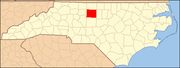 | |
| Towns | ||
| CDPs | ||
| Unincorporated communities | ||
| Footnotes | ‡This populated place also has portions in an adjacent county or counties | |
| ||
Categories:
- Unincorporated communities in Guilford County, North Carolina
- Unincorporated communities in North Carolina
- Guilford County, North Carolina geography stubs