Whitsett, North Carolina
Whitsett, North Carolina | |
|---|---|
 Location in Guilford County and the state of North Carolina. | |
| Coordinates: 36°4′47″N 79°34′0″W / 36.07972°N 79.56667°WCoordinates: 36°4′47″N 79°34′0″W / 36.07972°N 79.56667°W | |
| Country | United States |
| State | North Carolina |
| County | Guilford |
| Area | |
| • Total | 2.61 sq mi (6.76 km2) |
| • Land | 2.58 sq mi (6.69 km2) |
| • Water | 0.03 sq mi (0.07 km2) |
| Elevation | 686 ft (209 m) |
| Population (2010) | |
| • Total | 590 |
| • Estimate (2019)[2] | 639 |
| • Density | 247.29/sq mi (95.48/km2) |
| Time zone | UTC-5 (Eastern (EST)) |
| • Summer (DST) | UTC-4 (EDT) |
| ZIP code | 27377 |
| Area code(s) | 336 |
| FIPS code | 37-73760[3] |
| GNIS feature ID | 1027480[4] |
| Website | www |

Whitsett is a town in Guilford County, North Carolina, United States. The population was 590 at the 2010 census.
History[]
The Daniel P. Foust House, Foust-Carpenter and Dean Dick Farms, Holly Gate, Low House, William Rankin and Elizabeth Wharton Smith House, Wadsworth Congregational Church, and Whitsett Historic District are listed on the National Register of Historic Places.[5]
In 2012, Lenovo announced it would open a manufacturing plant in Whitsett.[6]
Geography[]
Whitsett is located at 36°4′47″N 79°34′0″W / 36.07972°N 79.56667°W (36.0796745, -79.5667605).[7]
According to the United States Census Bureau, the town has a total area of 2.8 square miles (7.3 km2), all of it land.
Demographics[]
| Historical population | |||
|---|---|---|---|
| Census | Pop. | %± | |
| 2000 | 686 | — | |
| 2010 | 590 | −14.0% | |
| 2019 (est.) | 639 | [2] | 8.3% |
| U.S. Decennial Census[8] | |||
As of the census[3] of 2000, there were 686 people, 279 households, and 215 families residing in the town. The population density was 243.4 people per square mile (93.9/km2). There were 308 housing units at an average density of 109.3 per square mile (42.2/km2). The racial makeup of the town was 93.29% White, 5.98% African American, 0.15% Asian, and 0.58% from two or more races. Hispanic or Latino of any race were 0.73% of the population.
There were 279 households, out of which 26.9% had children under the age of 18 living with them, 64.5% were married couples living together, 7.2% had a female householder with no husband present, and 22.9% were non-families. 20.8% of all households were made up of individuals, and 8.6% had someone living alone who was 65 years of age or older. The average household size was 2.46 and the average family size was 2.82.
In the town, the population was spread out, with 20.4% under the age of 18, 6.6% from 18 to 24, 27.0% from 25 to 44, 28.7% from 45 to 64, and 17.3% who were 65 years of age or older. The median age was 42 years. For every 100 females, there were 100.0 males. For every 100 females age 18 and over, there were 97.8 males.
The median income for a household in the town was $44,250, and the median income for a family was $48,750. Males had a median income of $38,958 versus $26,250 for females. The per capita income for the town was $21,936. About 5.5% of families and 7.5% of the population were below the poverty line, including 14.3% of those under age 18 and 4.2% of those age 65 or over.
References[]
- ^ "2019 U.S. Gazetteer Files". United States Census Bureau. Retrieved July 27, 2020.
- ^ a b "Population and Housing Unit Estimates". United States Census Bureau. May 24, 2020. Retrieved May 27, 2020.
- ^ a b "U.S. Census website". United States Census Bureau. Retrieved 2008-01-31.
- ^ "US Board on Geographic Names". United States Geological Survey. 2007-10-25. Retrieved 2008-01-31.
- ^ "National Register Information System". National Register of Historic Places. National Park Service. July 9, 2010.
- ^ Shah, Agam (2012-10-02). "Lenovo to open first U.S. manufacturing plant in N.C." Computerworld. Retrieved 2021-10-21.
- ^ "US Gazetteer files: 2010, 2000, and 1990". United States Census Bureau. 2011-02-12. Retrieved 2011-04-23.
- ^ "Census of Population and Housing". Census.gov. Retrieved June 4, 2015.
Municipalities and communities of Guilford County, North Carolina, United States | ||
|---|---|---|
| Cities | 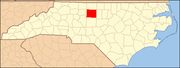 | |
| Towns | ||
| CDPs | ||
| Unincorporated communities | ||
| Footnotes | ‡This populated place also has portions in an adjacent county or counties | |
| ||
- Towns in Guilford County, North Carolina
- Towns in North Carolina