Montlake Bridge
Montlake Bridge | |
|---|---|
 Montlake Bridge from the west | |
| Coordinates | 47°38′51″N 122°18′14″W / 47.6475°N 122.304°W |
| Carries | |
| Crosses | Montlake Cut |
| Locale | Seattle, Washington |
| Characteristics | |
| Design | Bascule bridge |
| Total length | 344 ft (105 m) |
| Clearance below | 46 ft (14 m) |
| History | |
| Designer | Carl F. Gould |
| Opened | June 27, 1925 |
| Statistics | |
| Toll | |
Montlake Bridge | |
| Location | Spans Lake Union Ship Canal, Seattle, Washington |
| Coordinates | 47°38′51″N 122°18′13″W / 47.64750°N 122.30361°WCoordinates: 47°38′51″N 122°18′13″W / 47.64750°N 122.30361°W |
| Area | less than one acre |
| Built | 1913 |
| Built by | Wallace Equipment Company (steel fabrication and erection) |
| Engineer | J.D. Blackwell, A. Munster, D.W. McMorris |
| MPS | Historic Bridges/Tunnels in Washington State TR |
| NRHP reference No. | 82004242[1] |
| Significant dates | |
| Added to NRHP | July 16, 1982 |
| Designated SEATL | December 13, 1979[2] |
| Location | |
 | |

The Montlake Bridge is a double-leaf bascule bridge that carries State Route 513 (Montlake Boulevard) over Seattle's Montlake Cut—part of the Lake Washington Ship Canal—connecting Montlake and the University District.
It is the easternmost bridge spanning the canal. The bridge is 344 ft (105 m) long, and was designed by Carl F. Gould, one of the original architects of the University of Washington campus. The bridge and its control towers were designed in conjunction with the university's Collegiate Gothic style. It provides a clearance of 46 ft (14 m)[3] and is reported as providing 48 ft (15 m) of vertical clearance above the mean regulated level of Lake Washington for the central 100 ft (30 m) of the bascule span.[4] It is one of four original bascule-type drawbridges over the Ship Canal, the others being the Ballard, Fremont, and University Bridges. It was the last one to be completed, has the highest clearance of the four, and is the only one that is part of the state highway system. It is also one of six bascule bridges based on a design derived from the Chicago bascule bridge, but is unique because of its trunnion supports, employed to avoid a patent infringement lawsuit by the Strauss Bascule Bridge Company.

Piers and abutments for a permanent bridge were built in 1914 as part of construction for the Ship Canal, but a serious proposal for a bridge at Montlake didn't come until 1916.[5] The first bridge in its place was a makeshift walkway made from a series of barges, set up by graduate manager to allow football fans to cross for the Washington/Dartmouth game in 1920. The temporary bridge was so heavily traveled, it demonstrated the need for a permanent structure,[6] which was finished in June 1925. The permanent bridge was opened on June 27, 1925, a month ahead of schedule and as the centerpiece for a local parade that drew thousands of residents.[7]

A report from 1993 states that the Montlake Bridge averaged a volume of 60,900 vehicles each weekday,[8] while another report from 2001 puts normal weekend traffic across the bridge at about 40,000 vehicles each day.[4] In addition to the vehicular traffic, the bridge conveys pedestrians and bicyclists across the canal by way of sidewalks on each side of the roadway. The bridge does not open during morning and evening rush hours. It opens at designated times (usually on the hour and half-hour) during the hours just prior to and after rush periods, and on demand at other times. The bridge openings last for an average of four minutes from when traffic stops to when it resumes again.[9] Most of the openings are for sailboats, as most of the tugs that operate this far east are able to pass under the bridge in its closed position. The bridge creates a bottleneck for traffic heading to and from State Route 520 (SR-520), and the creation of alternate routes has been proposed multiple times over the years. Traffic can become backed up for more than a mile when the bridge is open, as can be seen in aerial photographs.[10] Plans to replace SR-520 include adding a second bascule bridge across the Montlake Cut next to the current Montlake Bridge.[11]
Historical significance[]
The Montlake Bridge is celebrated as the site of boating season's "opening day" festivities the first Saturday in May.
The bridge was constructed by the city of Seattle at a cost of $670,000. The steel was fabricated and erected by the Wallace Equipment Company. A. Munster, acting bridge engineer of the City of Seattle supervised the construction, J.D. Blackwell was city engineer and D.W. McMorris was assistant engineer.[1]
The bridge and the Montlake Cut together are a (ID #107995),[12] and the bridge was added to the National Register of Historic Places in 1982, as well as the Washington Heritage Register. It is owned and operated by the Washington State Department of Transportation.[3]
Gallery[]

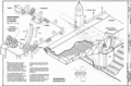
HAER description
Gears and Machinery

Center lock mechanism


References[]
- ^ Jump up to: a b "National Register Information System". National Register of Historic Places. National Park Service. July 9, 2010.
- ^ "Landmarks and Designation". City of Seattle. Retrieved 2013-03-04.
- ^ Jump up to: a b Home > Missions > Civil Works > Locks and Dams > Chittenden Locks > Boater Information, Seattle District US Army Corps of Engineers
- ^ Jump up to: a b Drawbridge Operations Regulations; Lake Washington Ship Canal, WA | Federal Register Environmental Documents | USEPA
- ^ Montlake History by Jim Gould Archived 2005-07-20 at the Wayback Machine
- ^ News: Historic Gearheads Tour (Seattle Weekly)[permanent dead link]
- ^ Caldbick, John (September 30, 2012). "Seattle's Montlake Bridge spanning Montlake Cut opens on June 27, 1925". HistoryLink. Retrieved May 30, 2019.
- ^ 110 Wn. App. 731, MONTLAKE CMTY. CLUB v. HEARINGS BD Archived 2013-04-15 at archive.today
- ^ "Bridges and Roadway Structures: Bridge Openings. Seattle Department of Transportation. Retrieved September 3, 2017.
- ^ Aerial image from USGS via Microsoft Research Maps
- ^ SR-520 Bridge Program: I-5 to Medina Project Design
- ^ Landmarks Alphabetical Listing for M Archived 2011-07-21 at the Wayback Machine, Individual Landmarks, Department of Neighborhoods, City of Seattle. Accessed 28 December 2007.
External links[]
| Wikimedia Commons has media related to Montlake Bridge. |
- Washington State Department of Transportation: Montlake Bridge
- Montlake Bridge (Seattle) at HistoryLink
| show Authority control |
|---|
- Bascule bridges in the United States
- Bridges in Seattle
- Bridges completed in 1925
- Road bridges on the National Register of Historic Places in Washington (state)
- National Register of Historic Places in Seattle
- Road bridges in Washington (state)
- Washington Heritage Register
- Drawbridges on the National Register of Historic Places
- 1925 establishments in Washington (state)