Motorway 1 (Greece)
This article needs additional citations for verification. (January 2017) |
 | |
|---|---|
| Αυτοκινητόδρομος 1 | |
 | |
 | |
| Route information | |
| Part of E75 | |
| Length | 550 km (340 mi) |
| Major junctions | |
| North end | Evzonoi |
| South end | Athens |
| Location | |
| Regions | Central Macedonia, Thessaly, Central Greece, Attica |
| Major cities | Thessaloniki, Katerini, Larisa, Lamia, Athens |
| Highway system | |
| Motorways in Greece
| |
Motorway 1 (code: A1, also known as Athens-Thessaloniki-Evzonoi (A.TH.E.) motorway,[1] and previously as Patras-Athens-Thessaloniki-Evzonoi (P.A.TH.E.) motorway)[2]the 2nd longest motorway in Greece with a length of 550 km. It is the principal north–south road connection in Greece,[3] connecting the country's capital Athens with the regions of Thessaly and Macedonia, as well as the country's second largest city, Thessaloniki. It starts from Neo Faliro in Attica and continues north to reach the Evzonoi border station, on the Greek border with North Macedonia.
Today, the construction, operation and maintenance of Motorway 1 have been largely outsourced to private companies: Aftokinitodromos Aigaiou SA. ( - ), Kentriki Odos SA (Raches, Fthiotida - ) and Nea Odos SA (Skarfia, Fthiotida - ). The section of Kleidi, Imathia-Evzoni since 2014 operates and is maintained by Egnatia Odos SA.[4]
Route[]
The motorway passes through Mainland Greece and has largely replaced National Road 1. It begins at Kifissou Avenue, Athens, just north of the Bay of Phaliro, and continues northward to Evzonoi, on the border with the country's northern neighbour, North Macedonia, where it continues as the A1. Before the European routes numbers were changed, the northern part from Efzoni to EO2 was , while today the entire road is part of European route E75. The task of maintaining and charging for parts of the motorway has recently been ceded to private consortia, part of the deal for the construction of the Ionia Odos, the E65, as well as the bypass of Tempe Valley.[citation needed]
The part west of downtown Athens runs over the Cephisus river and Kifissou Avenue. From north of the boundary of Voiotia - Phthiotis, up to near Velestino, the tollway runs close to the coast of the Aegean Sea. It then continues north of the Tempe Valley and up to the junction of the European route E90. It then shares a 25 km common part with A2 / E90 (on a west–east direction), and then, at the "Axios Interchange", continues north to Evzonoi and the national border with North Macedonia. Its total length is approximately 550 km.[citation needed]
Cities[]
Motorway 1 passes near major urban centers in the country:
- Athens
- Thebes
- Chalcis (20 km south - connection via A11)
- Lamia
- Larissa
- Katerini
- Thessaloniki (20 km west - connection via Egnatia Motorway and Thessaloniki's New West Entrance)
- Polykastro
Airports[]
The ATHE motorway is connected to the following airports:
- Thessaloniki (Macedonia Airport) (45 km west - connection via Egnatia Motorway, Thessaloniki's new West Entrance and Thessaloniki's Ring Road)
- Nea Anchialos - (10 km west - connection via National Road 30)
- Athens (Eleftherios Venizelos Airport) - (25 km west - connection via Attiki Odos)
Harbours[]
The ATH motorway is connected to the following harbours:
- Thessaloniki
- Volos
- Piraeus
Distances in kilometers[]
| Distance in km | 1 | 2 | 3 | 4 | 5 | 6 | 7 | 8 | 9 | 10 | 11 |
|---|---|---|---|---|---|---|---|---|---|---|---|
| (1) Evzonoi | – | 49 | 63 | 75 | 110 | 171 | 208 | 252 | 354 | 533 | 550 |
| (2) Gefyra | 49 | – | 12 | 26 | 61 | 122 | 159 | 203 | 305 | 505 | 501 |
| (3) Axios | 63 | 12 | – | 12 | 47 | 108 | 145 | 188 | 290 | 490 | 507 |
| (4) Kleidi | 75 | 49 | 12 | – | 35 | 98 | 135 | 178 | 280 | 480 | 497 |
| (5) Katerini | 110 | 61 | 47 | 35 | – | 61 | 98 | 141 | 243 | 443 | 460 |
| (6) Evangelismos | 171 | 122 | 108 | 98 | 61 | – | 37 | 80 | 182 | 382 | 399 |
| (7) Larissa | 208 | 159 | 145 | 135 | 108 | 37 | – | 43 | 145 | 345 | 362 |
| (8) Velestino | 252 | 212 | 198 | 186 | 151 | 80 | 43 | – | 102 | 302 | 319 |
| (9) Lamia | 354 | 305 | 293 | 279 | 244 | 183 | 146 | 102 | – | 200 | 217 |
| (10) Athens | 533 | 484 | 472 | 458 | 423 | 362 | 325 | 282 | 200 | – | 17 |
History[]
1950s-1970s[]
The old Greek National Road 1, was a historic road, which connected Athens with the Customs of Evzoni, through , Atalanti, Kamena Vourla, Thermopylae, Lamia, Stylida, Almyros, Velestino, Larissa, , Katerini, Alexandria, Gefyra and Polykastro. The road followed the route of the streets of antiquity.[5] However, over time, its specifications began to be considered obsolete, as in the rest of Europe, modern highways began were started to be built. Thus, in the mid-1950s, construction work began on a new road, which began in 1959 with the delivery of the Larissa-Katerini section (Later, the Athens-Lamia section in 1962 and the Lamia-Larissa section in 1967) and were completed in 1973, with the delivery of the part Katerini - Thessaloniki - Evzoni. For the most part it was 13 metres (43 ft) - 14 metres (46 ft) (except for the part of the Valley of Tempi, which was 10 metres (33 ft), because it was built on a mountain) and 2 traffic lanes (1 lane + 1 auxiliary lane in each direction), without a median strip. The Polykastro - Evzoni section was the first section with motorway specifications.[6]
1980-today[]
Work on the conversion to a motorway began in the mid-1980s, with the construction of the sections interchange- Gallikos river (delivered in 1988), camp - Kryoneri interchange (delivered in 1989) (4.5 km) , Inofyta interchange- Schimatari interchange (delivered in 1989) (12.5 km), Ritsona interchange - Thebes interchange (delivered in 1989) (14.8 km). In the early 1990s, work began on the entire length of the sections Athens - Thebes interchange, and Katerini - Klidi.[6]
As early as 1995, National Road 1 had highway specifications in the sections Athens - Yliki, Katerini - Klidi - Thessaloniki and Polykastro - Evzoni.[6]
In 1998, it had six lanes in the Athens (Metamorfosi) -Thebe section and four in the Thebes-Tempi section, with the exception of a few sections in Magnesia, which still had two.[6]
In 2002 the Yliki-Agios Konstantinos section was completed.[7]
In 2004 the first tunnel of the A1 was built, the tunnel of Katerini (tunnels of Alexander the Great and Philip) ,[8] while in the same year Kifissos Avenue was handed over, which is the part of the road that connects Metamorfosi with Faliro, above the Kifissos river, inside Athens.
In November 2017, with the launch of the tender for the privatization of Egnatia Motorway and the announcement of its terms, it was announced that the upgrade of the Halastra-Polykastro section from an expressway to as motorway was under planning.[9] This was confirmed in September 2018. Construction costs are estimated to exceed € 200 million, and the remainder of the axis from Polykastro to Evzoni, which has already been characterized a motorway will be upgraded with more modern features such as safety barriers, new signage and road improvements.[10]
In 2005, it was completed along its entire length, except for the "Horseshoe" of Maliakos and Tempi.[6]
On June 13, 2007, the Aegean Motorway SA was established, which undertook the construction and operation of the motorway in the Raches-Klidi section.[6]
In the same year, the first sections of Maliakos, the Agios Konstantinos Bypass, the Kamenon Vourlon Bypass and the 4.5 km long Agia Paraskevi-Agia Marina section were opened to traffic.[11][12][13] In 2008 the Thermopylae-Bralos Bypass section was delivered.[14]
In 2014, the Velestino interchange was completed, which connects ATHE with Volos.
In 2015, the last section of Maliakos Stylida-Raches with the tunnels of Stylida, with the upgraded Lamia interchange and the new bridge of Sperchios (bypass of Lamia) was handed over to traffic.[15]
In 2016, the northern interchange of Katerini was completed, after about 26 years of construction, due to expropriation and financing problems.[16] On April 6, 2017, the section Evangelismos - Skotina (bypass of Tempi and Platamonas), 25 km long, was delivered. In November 2017, with the start of the tender for the privatization of Egnatia Odos and the announcement of its terms, it became known that the HRDH may include in the object of the Concession Agreement the upgrade of the section Halastra - Polykastro from expressway to motorway, which was confirmed in September 2018. The construction cost is estimated to exceed 200 million euros, while the rest of the axis from Polykastro to Evzoni, which already has highway features, will be upgraded with more modern features such as safety railings, new signage and pavement improvement.[17]
Exit list[]
The exits of the completed sections of the A1 motorway:[18]
| Notes | |
|---|---|
| Under construction | |
| Planned | |
Gallery[]

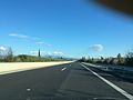
A1 Motorway near Katerini

A1 Motorway tunnel near Agios Konstantinos
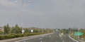
A1 Motorway close to Larissa

A1 near the Greek border with North Macedonia at Evzoni

A1 Motorway's biggest tunnel, Tempi T2 Tunnel

A1 Motorway near Xalkidona
A1 Motorway near Nea Agathoupoli


References[]
- ^ Καθημερινή, Άλλαξε η λίστα των αυτοκινητόδρομων (Kathemerine, The list of motorways has changed)
- ^ Newsroom (2015-11-24). "Η Εθνική Οδός είχε τη δική της ιστορία (The National Road had its own history)". CNN.gr (in Greek). Retrieved 2018-06-23.
- ^ Καραγιάννης, Νίκος. "ΠΑΘΕ: Τα μεγάλα έργα που ολοκληρώνουν την βασική οδική αρτηρία της Ελλάδας: Ο βασικός οδικός διάδρομος της χώρας". ypodomes.com (in Hebrew). Archived from the original on 2014-10-02. Retrieved 8 January 2014.
- ^ "ΕΓΝΑΤΙΑ ΟΔΟΣ Α.Ε. Συντήρηση της Εγνατίας Οδού και των Καθέτων Αξόνων (EGNATIA ODOS SA Maintenance of the Egnatia Odos and the Vertical Axes )". www.egnatia.eu. Retrieved 2020-06-04.
- ^ Newsroom (2015-11-24). "Η Εθνικ�� Οδός είχε τη δική της ιστορία". CNN.gr (in Greek). Retrieved 2021-01-23.
- ^ Jump up to: a b c d e f ΨΑΡΡΑΣ-ΤΑΣΙΟΠΟΥΛΟΣ, ΙΩΑΝΝΗΣ (2007). ΚΟΙΝΩΝΙΚΟΟΙΚΟΝΟΜΙΚΗ ΚΑΙ ΠΕΡΙΒΑΛΛΟΝΤΙΚΗ ΑΞΙΟΛΟΓΗΣΗ ΤΩΝ ΕΠΙΠΤΩΣΕΩΝ ΤΟΥ ΟΔΙΚΟΥ ΑΞΟΝΑ ΠΑΘΕ ΣΤΟ ΠΕΤΑΛΟ ΤΟΥ ΜΑΛΙΑΚΟΥ ΚΟΛΠΟΥ (PDF). Βόλος: ΠΑΝΕΠΙΣΤΗΜΙΟ ΘΕΣΣΑΛΙΑΣ. p. 64-65.
- ^ "Λαλιώτης: Tέλος 2001 έτοιμο το 80% του ΠΑΘΕ". m.naftemporiki.gr (in Greek). Retrieved 2021-01-23.
- ^ Newsroom (2018-01-30). "Κατερίνη: Η απομάκρυνση πινακίδων που πυροδότησε θεωρίες… συνομωσίας". CNN.gr (in Greek). Retrieved 2021-01-23.
- ^ "Εγνατία: Πρόβλεψη κατασκευής αυτοκινητόδρομου στο Χαλάστρα-Εύζωνοι βάζει το ΤΑΙΠΕΔ - ypodomes.com" (in Greek). Retrieved 2018-08-20.[permanent dead link]
- ^ "Εγνατία Οδός: Οριστικά στο αντικείμενο η αναβάθμιση σε αυτοκινητόδρομο του Χαλάστρα-Πολύκαστρο - ypodomes.com" (in Greek). Retrieved 2018-10-07.
- ^ "Παράδοση τμημάτων στο πέταλο του Μαλιακού". www.euro2day.gr. Retrieved 2021-01-23.
- ^ Newsroom. "Παράδοση άλλων 32 χλμ. στον Μαλιακό | Η ΚΑΘΗΜΕΡΙΝΗ". Retrieved 2021-01-23.
- ^ "ΥΠΕΧΩΔΕ: Στην κυκλοφορία τμήματα του αυτοκινητόδρομου στο Πέταλο Μαλιακού". m.naftemporiki.gr (in Greek). Retrieved 2021-01-23.
- ^ "Δόθηκε στην κυκλοφορία το τμήμα παράκαμψης των Θερμοπυλών στον Μαλιακό". ΤΑ ΝΕΑ (in Greek). 2008-09-18. Retrieved 2021-01-23.
- ^ Λιάλιος, Γιώργος. "Στην κυκλοφορία όλα τα τμήματα στον Μαλιακό | Η ΚΑΘΗΜΕΡΙΝΗ". Retrieved 2021-01-23.
- ^ Μπάρμπα, Βάσια. "Στην κυκλοφορία ο Βόρειος Ανισόπεδος Κόμβος Κατερίνης (φωτο+vid)". Στην κυκλοφορία ο Βόρειος Ανισόπεδος Κόμβος Κατερίνης (φωτο+vid). Retrieved 2021-01-23.
- ^ Καραγιάννης, Νίκος (2018-09-28). "Εγνατία Οδός: Οριστικά στο αντικείμενο η αναβάθμιση σε αυτοκινητόδρομο του Χαλάστρα-Πολύκαστρο". Ypodomes.com (in Greek). Retrieved 2021-01-23.
- ^ "Aυτοκινητόδρομος (Aftokinitodromos) A1 - Νέα Οδός (Nea Odos), Aυτοκινητόδρομος Αιγαίου (Aftokinitodromos Aigaiou)". 2018-03-17. Archived from the original on 2018-03-17. Retrieved 2020-02-02.
- ^ Or 2.8 m, depending on the gate


- Motorways in Greece
- Toll roads in Greece
- Roads in Central Macedonia
- Roads in Thessaly
- Roads in Central Greece
- Roads in Attica