Katerini
Katerini
Κατερίνη | |
|---|---|
 Katerini's town hall | |
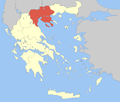
 Katerini show Location within the region | |
| Coordinates: 40°16′N 22°30′E / 40.267°N 22.500°ECoordinates: 40°16′N 22°30′E / 40.267°N 22.500°E | |
| Country | Greece |
| Administrative region | Central Macedonia |
| Regional unit | Pieria |
| Municipality | Katerini |
| Municipal unit | Katerini |
| Government | |
| • Mayor | Konstantinos Koukodimos (New Democracy) |
| Area | |
| • Municipality | 681.863 km2 (263.269 sq mi) |
| • Municipal unit | 93.659 km2 (36.162 sq mi) |
| Elevation | 14 m (46 ft) |
| Population (2011)[1] | |
| • Municipality | 85,851 |
| • Municipality density | 130/km2 (330/sq mi) |
| • Municipal unit | 62,205 |
| • Municipal unit density | 660/km2 (1,700/sq mi) |
| Community | |
| • Population | 58,309 (2011) |
| • Area (km2) | 63.196 |
| Time zone | UTC+2 (EET) |
| • Summer (DST) | UTC+3 (EEST) |
| Postal code | 60100, 60131, 60132, 60133, 60134 |
| Area code(s) | 23510 |
| Vehicle registration | KN |
| Website | www.katerini.gr |


Katerini (Greek: Κατερίνη, Kateríni, pronounced [ka̠te̞ˈɾini]) is a city and municipality in northern Greece, the capital city of Pieria regional unit in Central Macedonia, Greece. It lies on the Pierian plain, between Mt. Olympus and the Thermaikos Gulf, at an altitude of 14 m. The municipal unit of Katerini has a population of 85,851 (according to the 2014 census) and it is the second most populous urban area at the Region of Macedonia after Thessaloniki. The close distance between two cities (68 km), has been beneficial for Katerini's development over recent years. Katerini is accessible from the main Thessaloniki–Athens highway GR-1/E75 (with the Katerini's South, East and North interchanges) and the Egnatia Odos to the north. It is served by Intercity, Proastiakos (Suburban Railway) and local trains on the main railway line from Athens to Thessaloniki and there is a comprehensive regional and national bus service with its hub in the city.
A popular tourist destination in northern Greece, Katerini is close to the sea (7 km) and to several archaeological sites of great interest such as the ancient city of Dion (5th century BC, 17 km away), the ancient Leivithra (27 km away),ancient Pydna (16km away) and the Castle of Platamon. The beaches of Korinos, Paralia and Olympiaki Akti (or Katerinoskala) are visited by both Greek and foreign tourists during the Summer. The base of Mount Olympus and the town of Litochoro, are at a distance of around 20 km from the centre of Katerini, whereas there is the Ski center of Elatochori in Mount Pieria at a distance of 33.4 km from the city's centre.
Name and history[]
The origin of the name is obscure. Since the 13th century, travellers as well as maps record the existence of a settlement called Hatera (Ἅτηρα), which may have been the origin of the modern name. Thus Felix Beaujour recorded its name as "Katheri", while François Pouqueville gives the name of the settlement as "Kateri Hatera".[2] According to another theory, the city derives its name from the small chapel dedicated to Saint Catherine (Aikaterini in Greek) to the east of the city, dating to at least the early 19th century. The latter hypothesis influenced official usage in Greek, where the city is found as "Aikaterini" or "Agia Aikaterini" until the early 20th century, when the vernacular name Katerini prevailed.[2]
According to the reports of travellers, at the turn of the 19th century, the city had four to five thousand inhabitants, mostly Greeks. In 1806, William Martin Leake recorded 100 hearths, while four years later Daniel recorded 140. For the remainder of the 19th century, the number of homes remained steady at about 300, with a population in 1900 of 2,070 Orthodox mostly Vlach and Arvanites (Albanians), and 600 Muslims, most of them of Albanian origin.[2]
The city was captured by the Greek 7th Infantry Division on 16 October 1912, during the First Balkan War, and has been part of Greece since then.[2] With the population exchange between Greece and Turkey in 1923, the city's Muslims left, and Greek refugees, particularly from Eastern Thrace and Greek Evangelicals from Asia Minor, took their place, almost doubling the city's population from 5,540 in 1920 to 10,138 in 1928.[2]
Geography[]
Administrative division[]
The municipality of Katerini was formed at the 2011 local government reform by the merger of the following 6 former municipalities, that became municipal units of the newly formed Katerini municipality.[3][1]
| Municipality of Katerini[3][1][4] | Municipal Unit of Katerini[3][1] | Municipal Community of Katerini[3][1][5] | |||
|---|---|---|---|---|---|
| Municipal Units | Population | Municipal Communities | Population | Settlements | Population |
|
|
|
|
| |
| Total Area | Total Population | Total Area | Total Population | Total Area | Total Population |
|
|
|
|
|
|
Climate[]
Katerini has a Mediterranean climate that is characterised by warm to hot, dry summers and cool and more humid winters (Köppen climate classification: Csa).
| hideClimate data for Katerini | |||||||||||||
|---|---|---|---|---|---|---|---|---|---|---|---|---|---|
| Month | Jan | Feb | Mar | Apr | May | Jun | Jul | Aug | Sep | Oct | Nov | Dec | Year |
| Average high °C (°F) | 9.0 (48.2) |
11.9 (53.4) |
15.0 (59.0) |
20.0 (68.0) |
25.1 (77.2) |
30.3 (86.5) |
33.3 (91.9) |
32.9 (91.2) |
28.5 (83.3) |
22.4 (72.3) |
15.7 (60.3) |
10.9 (51.6) |
21.3 (70.2) |
| Daily mean °C (°F) | 4.9 (40.8) |
6.8 (44.2) |
9.8 (49.6) |
14.2 (57.6) |
18.9 (66.0) |
23.6 (74.5) |
26.3 (79.3) |
25.9 (78.6) |
22.1 (71.8) |
17 (63) |
11.5 (52.7) |
7 (45) |
15.7 (60.3) |
| Average low °C (°F) | 0.8 (33.4) |
1.8 (35.2) |
4.6 (40.3) |
8.5 (47.3) |
12.8 (55.0) |
16.9 (62.4) |
19.4 (66.9) |
19.0 (66.2) |
15.7 (60.3) |
11.6 (52.9) |
7.4 (45.3) |
3.2 (37.8) |
10.1 (50.2) |
| Average precipitation mm (inches) | 38 (1.5) |
36 (1.4) |
43 (1.7) |
33 (1.3) |
46 (1.8) |
31 (1.2) |
24 (0.9) |
18 (0.7) |
28 (1.1) |
45 (1.8) |
53 (2.1) |
53 (2.1) |
448 (17.6) |
| Source: Climate-data.org [6] | |||||||||||||
Local delicacies[]
Katerini is located near several villages which are renowned for their high quality products. In particular kiwis and cherries are one of the more important productions in the region, as well as strawberries. There is also cultivation of tobacco in the region and lot of people spend considerable resources for its development and for exports of the product.
Politics[]
Local Government[]
The mayor of Katerini is Konstantinos Koukodimos, a member of the Political Committee of New Democracy, who was elected in the 2019 local elections.
| Results of the May 26, 2019 local elections in the Municipality of Katerini | |||
|---|---|---|---|
| Candidate | Supporting Parties | Votes | % |
Economy[]


Katerini is the administrative and economic centre of Pieria. The Chamber of commerce and industry of Pieria is based in Katerini.[7] The same applies for the Union of Agricultural Cooperatives of Pieria and the Union of hotel owners of Pieria.[8][9]
Agriculture[]
Katerini lies in the middle of a plain and thus, it is greatly an agricultural city. As of 2000 26,775 people were occupied in agriculture, in Pieria.[10] The Union of Agricultural Cooperatives of Pieria has 9,000 members, of which 2,000 grow tobacco.[11] Kiwifruit is also produced in Katerini.[11]
Tourism[]
Katerini is a popular tourist destination, that attracts tourist both from Greece and abroad. Within the boundaries of the municipality, there are over 230 hotels that can accommodate more that 8,600 people.[12] The vast majority of the tourist infrastructure lie in Paralia and Olympiaki Akti and it also includes tens of tavernas and cafes.[13] Winter tourism has started developing in the area, since the construction of the Elatochori ski resort.[14] Katerini is surrounded by ancient archaeological sites as Dion, Leivithra, Pydna, Louloudies and Platamon Castle which are worth a visit.
Places of interest[]
The Katerini Municipal Park, also includes the Park of colors (Greek: Πάρκο των Χρωμάτων), is located on the city center area classified as urban amusement public park. It is popular for walking, jogging, wedding and baptism photography spot. It contains landscape gardens, water fountains with two bridges, trees covering the parkland, ornamental rock hill, artificial ponds (lakes), pedestrian walkway, a small zoo of deer, ducks, peacocks, and a variety of birds, the Municipal Open-Air Theatre of Park that is an amphitheater, and the Municipal Culture Centre (former name "Εκάβη") building for public and individual conferences, meetings, events, having an event hall auditorium with stage and also F&B catering service.
Transport[]
Local transport[]
The national bus service is from the Katerini long-distance bus station of coach KTEL. The local bus lines serve the connection between Katerini and its nearby settlements.[15] The bus hub is in Katerini and it has lines towards Moschochori, Paralia, Olympiaki Akti, Dion, Pieria, Aronas and Nea Trapezounta. These lines serve all the settlements that lie between Katerini and the aforementioned final destinations.[15]
Road transport[]
Katerini is served by A1 and National Road 1 that run north-south from Evzonoi to Athens. The connection between Katerini and Elassona is served by National Road 13. Single carriageways run from Katerini to every settlement of the Pieria. Bus lines, delivered by the Intercity KTEL of Pieria, connect Katerini directly with Athens, Thessaloniki, Elassona, Alexandreia and all the settlements of Pieria that are not served by the Urban KTEL of Katerini.[16] There are also privately held international bus lines that connect Katerini with several cities in Albania and Bulgaria.
Rail links[]
Katerini railway station is located just outside the city centre. The main line of the Greek railway system that connects Athens with Thessaloniki passes through Katerini. As a result, the city is connected directly with Larisa and Thessaloniki via the Proastiakos.[17] It is also connected with Athens and all the intermediate stations by Intercity train lines.
Demographics[]
Historical population[]
| Year | Community population | Municipal unit population | Municipality population |
|---|---|---|---|
| 2001 | 53,418 | 57,098 | 83,387 |
| 2011 | 58,309 | 62,205 | 85,851 |
| 2021 | - | - | - |
| 2031 | - | - | - |
| 2041 | - | - | - |
| Year | Community population |
|---|---|
| 1961 | 28,046 |
| 1971 | 29,046 |
| 1981 | 38,404 |
| 1991 | 42,381 |
| - | - |
| Year | Community population |
|---|---|
| 1913[18] | 7,393 |
| 1920[2] | 6,540 |
| 1928 | 10,138 |
| 1940 | 16,938 |
| 1951 | 24,605 |
Local communities[]


Katerini is home to a significant Aromanian population that exceeds 3,000 people.[19] Aromanians of Katerini mainly descend from nearby Aromanian settlements of Livadi and Kokkinopilos, and in lesser numbers from Samarina, Moscopole, Avdella, Perivoli and Smixi.[19] According to some sources the Aromanians formed a majority amongst the city's Christian population in the beginning of the 20th century.[19]
Immigrants[]
As of 2001, the Municipal unit of Katerini (then Municipality of Katerini) was home to 2,794 foreign nationals (4.9% of the total population). Amongst them the most populous ethnic group was Albanians (2.5%) followed by Georgians (0.5%), Russians (0.4%) and Bulgarians (0.3%).[20]
Religion[]
The Diocese of Metropolis of Kitros, Katerini and Platamonas has 16 congregations within the city of Katerini. There is also an Old Calendarist church in the city.[21] Katerini has a relatively numerous Protestant community, as a result of the organised settlement of Evangelical Greek refugees from Asia Minor and Pontus (region).[22] Today the Greek Evangelical Church of Katerini has almost 1,100 followers.[22] Other Protestant denominations, that have a church within the city, are the Free Apostolic Church of Pentecost, the Greek Apostolic Church of Pentecost and the Seventh-day Adventist Church.[23][24] The Protestant community is fully integrated in the life of the city, but in the past there were tensions between the Evangelical community and the Greek Orthodox majority. These tensions led to the arson of the Evangelical Church of Katerini from a Greek Orthodox mob in March 1930.[22]
Public education[]
The Katerini city public schools is a part of the public education system consisting of member schools include, the Preschool, Primary, Secondary (Katerini City Gymnasium, Katerini City High School, and others), Post Upper Secondary, and Higher Education.
| Public Education ‒ Katerini City | Lower Secondary Education | ||
| Data as at January 2021[25][26][27] | Katerini City Gymnasium School | ||
| The preschool (PS) is compulsory, comprises the 1-year pre-kindergarten and 1-year kindergarten, and has exactly name (number) with the primary school name where is attached. Preschools and primary schools share buildings. A second extra preschool attached in a primary school is to be shown as (PS) in round brackets. Students who successfully complete the lyceum are awarded the School Leaving Certificate (Apolytirio, Apolytirio Lyceum, High School Diploma, Upper Secondary Leaving Certificate). |
1st | 48 Klisouras str, 601 32 | |
| 2nd | 48 Klisouras str, 601 32 | ||
| 3rd | 1 Militou str, 601 33 | ||
| 4th | 2 Mitropoleos str, 601 31 | ||
| 5th | 34 Eirinis str, 601 34 | ||
| 6th | 104 Agiou Savva str, 601 33 | ||
| 7th | 1, 19th Maiou str, 601 34 | ||
| Music | 1 Stadiou str, 601 32 | ||
| Evening | 34 Eirinis str, 601 34 | ||
| Unified Special Vocational Gymnasium-Lyceum | 150 Terzopoulou str, 601 32 | ||
| Special Vocational Education | |||
| Special Vocational Education (ΕΕΕΕΚ) School | Neo Keramidi (Area), 601 50 | ||
| Primary Education | Second Chance Adult School (SDE) | ||
| Katerini City Primary School | Evening School for Adults, Gymnasium level equivalent | 2 Mitropoleos str, 601 31 | |
| 1st | 3 Ippokratous str, 601 32 | Laboratory Centre (EK) | |
| 2nd | 10 Kioutaxias str, 601 33 | A vocational education and training school | 150 Terzopoulou str, 601 32 |
| 3rd | 13 Marathonos str, 601 32 | Vocational School (EPAS) | |
| 4th | 2 Aristotelous str, 601 32 | EPAS of OAED (Workforce Employment Organization) | End Terzopoulou str, 601 32 |
| 5th, (21st PS) | 30 Filippou str, 601 33 | Upper Secondary Education | |
| 6th, (16th PS) | 15, 28 October str, 601 34 | Katerini City High School | |
| 7th, (20th PS) | 8 Mitropolitou Kirillou str, 601 31 | 1st | 48 Klisouras str, 601 32 |
| 8th | 13 Stratigou Roka str, 601 34 | 2nd | 10 Ipirou str, 601 32 |
| 8th KG, (24th PS) | A’ Parodos Priamou, 601 34 | 3rd | 1 Militou str, 601 33 |
| 9th | 2 Loukianou str, 601 32 | 4th | 2 Mitropoleos str, 601 31 |
| 10th | 16 Tenedou str, 601 33 | 5th | 10 Ipirou str, 601 32 |
| 11th, (23rd PS) | 1 Fleming str, 601 34 | Music | 1 Stadiou str, 601 32 |
| 12th | 14 Romanou str, 601 31 | Evening | 34 Eirinis str, 601 34 |
| 13th | 39 Platonos str, 601 33 | Vocational (I) | 150 Terzopoulou str, 601 32 |
| 14th | 6 Kilkis str, 601 34 | Vocational (II) | Neo Keramidi (Area), 601 50 |
| 15th | 14 Svoronou str, 601 33 | Evening Vocational | 150 Terzopoulou str, 601 32 |
| 16th, (25th PS) | 1 Agios Christoforos str, 601 33 | Unified Special Vocational Gymnasium-Lyceum | 150 Terzopoulou str, 601 32 |
| 17th | 17 Odyssea Elyti str, 601 33 | Post Upper Secondary Education | |
| 18th | 1 Antisthenous str, 601 31 | General Hospital of Katerini Institute of Vocational Training | 1 Old Hospital str, 601 31 |
| 19th | 2 Tyrtaiou str, 601 32 | Higher Education | |
| Special Primary | Ganochora (Area), 601 50 | International Hellenic University, Department of Logistics | 2 Kanellopoulou str, 601 32 |
Sports[]
Football[]
Katerini is represented by two football teams in the national leagues; Pierikos, a club currently playing in the Football League 2, and the women's football club of Pierides Muses, playing in the Women's Second National Division.
Other Sports[]
Pierikos-Archelaos B.C. currently competes in the A2 League, the second tier of Greek basketball. GAS Archelaos plays in the A2 League the second tier of the Greek handball league system.
| Sport clubs based in Katerini | |||
|---|---|---|---|
| Club | Founded | Sports | Achievements |
| Pierikos (Former:Megas Alexandros Katerini & Olympos Katerini) |
1961 (1922) (1946) |
Football , Volleyball | Earlier presence in A Ethniki football, finalist Greek cup |
| GAS Archelaos | 1956 | Handball, Track and Field and other sports | Panhellenic titles in Greek Handball |
| Ethnikos Katerini | 1973 | Football | Earlier presence in Gamma Ethniki |
| Vataniakos F.C. | 1978 | Football | Earlier presence in Beta Ethniki |
| Pierikos-Archelaos B.C. | 2008 | Basketball | Presence in A2 Ethniki |
Notable people[]
- Eleni Chatziliadou (born 1993), athlete, karate world champion 2018
- Giorgos Fourniadis (born 1937),[28][29] actor, director
- Dimitris Giannoulis (born 1995), Greek footballer
- Stelios Malezas (born 1985), Greek footballer
- Katerina Nikolaidou (Greek: Κατερίνα Νικολαίδου, born 1992), rower athlete, 4th place 2016 Olympic Games, 2nd place in the lightweight single sculls at the 2013 World Rowing Championships
- Konstantinos Papachronis (1977-2008), actor
- Kyriakos Papadopoulos (born 1992), Greek footballer
- Yannis K. Semertzidis, physicist
- Maria Tsionoglou (Greek: Μαρία Τσιόνογλου, born 1991),[30] 10m air pistol athlete of the Archelaos Katerinis Sport Club, Member of the Hellenic Shooting Federation (HSF) and Hellenic National Shooting Team
- Alexandros Tziolis, (born 1985), Greek footballer
International relations[]
Katerini is twinned with:
See also[]
- List of settlements in the Pieria regional unit
- Folklore Museum (Katerini)
References[]
- ^ Jump up to: a b c d e f "Απογραφή Πληθυσμού - Κατοικιών 2011. ΜΟΝΙΜΟΣ Πληθυσμός" (in Greek). Hellenic Statistical Authority.
- ^ Jump up to: a b c d e f Η Ιστορία της Κατερίνης (in Greek). Municipality of Katerini. Retrieved 14 January 2013.
- ^ Jump up to: a b c d "Kallikratis Programme" (PDF) (in Greek). KEDKE. Archived from the original (PDF) on 2020-01-10.
Ministry of the Interior. Kallikratis Plan. Ministerial Decision 45892, Government Gazette 1292/B/11-8-2010
- ^ "Population census 2011 of Greece" (in Greek and English). Hellenic Statistical Authority. Archived from the original on 2020-12-07.
- ^ "Population & housing census 2001 (incl. area and average elevation)" (PDF) (in Greek). National Statistical Service of Greece. Archived from the original (PDF) on 2015-09-21.
- ^ "Climate, Climate data for Katerini". Climate Data Organization. 2009. Retrieved 13 January 2013.
- ^ Επικοινωνία (in Greek). Pieria Chamber of Commerce. Archived from the original on 2013-01-20. Retrieved 7 July 2012.
- ^ Στοιχεία Επικοινωνίας (in Greek). Ένωση Αγροτικών Συνεταιρισμών Πιερίας. Archived from the original on 2012-05-27. Retrieved 7 July 2012.
- ^ Γνωρίστε μας (in Greek). Ένωση Ξενοδόχων Πιερίας. Retrieved 7 July 2012.
- ^ "Number of holdings, physical persons, owners and their household members" (PDF) (in Greek and English). Hellenic Statistical Authority. 2000. Archived from the original (PDF) on 2010-11-14. Retrieved 7 July 2012.
- ^ Jump up to: a b Η Ένωση (in Greek). Ένωση Αγροτικών Συνεταιρισμών Πιερίας. Archived from the original on 2012-06-26. Retrieved 7 July 2012.
- ^ "Hospitality Accommodations - Hotels". Pieria Tourism. Retrieved 7 July 2012.
- ^ "Restaurants and Taverns". Pieria Tourism. Retrieved 7 July 2012.
- ^ Σχετικά με το Ελατοχώρι (in Greek). web-greece.gr. Retrieved 7 July 2012.
- ^ Jump up to: a b "Urban Bus KTEL (Αστικό ΚΤΕΛ)" (in Greek). Αστικό ΚΤΕΛ Κατερίνης.
- ^ "Schedule". Υπεραστικό Κτελ Πιερίας. Retrieved 13 January 2013.
- ^ "TrainOSE Timetables Table 7A-7B" (PDF) (in Greek). Archived from the original (PDF) on 2012-05-11. Retrieved 11 May 2012.
- ^ Απαρίθμηση κατά οικισμό των κατοίκων του ελληνικού τμήματος της Μακεδονίας το έτος 1913 (in Greek). Η προσωπική Ιστοσελίδα του Δημήτρη Λιθοξόου. Retrieved 28 January 2012.
- ^ Jump up to: a b c Οι Βλάχοι της Κατερίνης (in Greek). Βλάχοι.Net. 25 November 2006. Retrieved 26 January 2012.
- ^ Αλλοδαποί κατά υπηκοότητα, ομάδες ηλικιών και φύλο, Νομοί, Δήμοι / Κοινότητες (PDF) (in Greek). Hellenic Statistical Authority. pp. 166–168. Archived from the original (PDF) on 2011-11-14. Retrieved 26 January 2012.
- ^ Ιεροί Ναοί Εκκλησίας Γ.Ο.Χ. Ελλάδος (in Greek). Εκκλησία Γ.Ο.Χ. Ελλάδος. Archived from the original on 2012-01-28. Retrieved 29 January 2012.
- ^ Jump up to: a b c Η ιστορία μας (in Greek). Ελληνική Ευαγγελική Εκκλησία Κατερίνης. Archived from the original on 2012-09-13. Retrieved 10 November 2012.
- ^ Διευθύνσεις Εκκλησιών και παραρτημάτων (in Greek). Ελευθέρα Αποστολική Εκκλησία Πεντηκοστής. Retrieved 10 November 2012.
- ^ Χριστιανικές Συναθροίσεις Επαρχίας (in Greek). Σύνοδος Αποστολικής Εκκλησίας Πεντηκοστής Ελλάδας. Archived from the original on 2012-10-14. Retrieved 10 November 2012.
- ^ "Primary and Kindergarten Schools in Katerini" (in Greek). Pieria Regional Directorate of Primary and Kindergarten Education. Archived from the original on 2020-10-22.
- ^ "Secondary Education Schools in Katerini" (in Greek). Pieria Regional Directorate of Secondary Education.
- ^ "The English Times of Katerini". Muses Net.
- ^ "Giorgos Fourniadis - National Theatre of Northern Greece (NTNG)". National Theatre of Northern Greece (in Greek and English). Retrieved 2020-01-05.
- ^ "Giorgos Fourniadis, actor and director". IMDb. Retrieved 2020-01-05.
- ^ "Maria Tsionoglou air pistol athlete". International Shooting Sport Federation (ISSF). Archived from the original on 2021-04-15. Retrieved 2021-04-15.
External links[]
| Wikimedia Commons has media related to Katerini. |
| show Macedonia (Greece) |
|---|

| show Administrative division of the Central Macedonia Region |
|---|
| show Authority control |
|---|
- Katerini
- Greek prefectural capitals
- Populated places in Pieria (regional unit)