Mount Baldy (Alberta)
| Mount Baldy | |
|---|---|
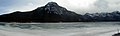
 Mount Baldy from over Barrier Lake | |
| Highest point | |
| Elevation | 2,192 m (7,192 ft)[1] |
| Prominence | 348 m (1,142 ft)[2] |
| Coordinates | 51°00′42″N 115°02′54″W / 51.01167°N 115.04833°WCoordinates: 51°00′42″N 115°02′54″W / 51.01167°N 115.04833°W[2] |
| Geography | |
 Mount Baldy Location in Alberta | |
| Location | Alberta, Canada |
| Parent range | Fisher Range |
| Topo map | NTS 82O3 Canmore |
| Climbing | |
| Easiest route | Easy scramble to North peak moderate to others. |

Mount Baldy is a mountain located in the Kananaskis River valley alongside Highway 40 in the Canadian Rockies.
During World War II, prisoners in a nearby internment camp were occasionally permitted to make the ascent of Mt. Baldy as long as they promised to return.[1] A University of Calgary research centre now occupies the former location of the camp.[2][3]
Up until 1984, when it was given its current day official name, it was commonly referred to as Barrier Mountain, due to its proximity to Barrier Lake.
Photos[]

South and west peaks from the summit of the north peak
View from Barrier Lake

Towering over Barrier Lake


References[]
- ^ a b "Mount Baldy". PeakFinder.com. Retrieved 2019-08-20.
- ^ a b c "Mount Baldy". Bivouac.com. Retrieved 2008-12-25.
- ^ "Field Station Facilities". Biogeoscience Institute. University of Calgary. Retrieved 2008-12-25.
External links[]
| Wikimedia Commons has media related to Mount Baldy (Alberta). |
- "Mount Baldy". Peakware.com. Archived from the original on 2016-03-04.
- Mount Baldy scramble description
This Alberta location article is a stub. You can help Wikipedia by . |
Categories:
- Two-thousanders of Alberta
- Kananaskis Improvement District
- Alberta's Rockies
- Alberta geography stubs