Mount Hope Bridge
Mount Hope Bridge | |
|---|---|
 | |
| Coordinates | 41°38′23.59″N 71°15′29.54″W / 41.6398861°N 71.2582056°W |
Mount Hope Bridge | |
 | |
| Coordinates | 41°38′23.6″N 71°15′29.5″W / 41.639889°N 71.258194°WCoordinates: 41°38′23.6″N 71°15′29.5″W / 41.639889°N 71.258194°W |
| NRHP reference No. | 76000038[1] |
| Added to NRHP | 1976 |
| Carries | 2 lanes of |
| Crosses | Mount Hope Bay |
| Locale | Portsmouth, Rhode Island and Bristol, Rhode Island |
| Maintained by | Rhode Island Turnpike and Bridge Authority |
| Characteristics | |
| Design | Suspension bridge |
| Total length | 6,130 feet (1,868 m) |
| Width | 28 ft (9 m) |
| Height | 285 feet (87 m) |
| Longest span | 1,200 feet (366 m) |
| Clearance below | 135 feet (41 m) |
| History | |
| Construction start | December 1, 1927 |
| Opened | October 24, 1929 |
| Location | |
 | |

The Mount Hope Bridge is a two-lane suspension bridge spanning the Mount Hope Bay in eastern Rhode Island at one of the narrowest gaps in Narragansett Bay. The bridge connects the Rhode Island towns of Portsmouth and Bristol and is part of Route 114. Its towers are 285 feet (87 m) tall, the length of the main span is 1,200 feet (370 m), and it offers 135 feet (41 m) of clearance over high water. The total length of the bridge is 6,130 feet (1,870 m). The railing along the bridge is only 35 inches (89 cm) and since 2016 there is a dedicated coalition (Bridging the Gap for Safety & Healing) advocating for the installation of physical safety/suicide prevention barriers on Mount Hope Bridge (along with the Claiborne Pell Newport Bridge, Jamestown-Verrazzano and Sakonnet Bridge).
History[]
Before the bridge was built, a ferry operated between Bristol and Portsmouth. The 1855 Bristol Ferry Light still remains at the base of the bridge. The Mount Hope Bridge was originally proposed in 1920, and the New Hope Bridge Company was incorporated in 1927, after a few years of resistance from the Rhode Island General Assembly and with the influence of state senator and business leader William Henry Vanderbilt III. Construction began on December 1, 1927, using a design by Robinson & Steinman.
Serious structural problems were discovered four months before it was to open, forcing the contractor to disassemble and reassemble portions of the bridge.

On October 24, 1929, Vanderbilt gave the opening address at the dedication ceremony where a radio link was set up with Washington, D.C..[2] The $5,000,000 bridge was opened to traffic and, five days later, the Wall Street Crash of 1929 occurred. It was owned by the Mount Hope Bridge Company as a private toll bridge, with the initial toll costing 60 cents one way, and $1 for a round-trip. By 1931, the Bridge company went bankrupt, and prominent local brewer Rudolf F. Haffenreffer acquired the bridge in receivership.[3]
It remained the longest suspension bridge in New England for 40 years, until the Claiborne Pell Bridge opened a few miles to the south in Newport, Rhode Island.
In 1971, the Mount Hope Bridge was considered for inclusion as part of the never-built Interstate 895. This plan would have required the construction of a parallel span, and the entire I-895 plan was eventually dropped due to community opposition throughout the projected route.
The Mount Hope Bridge was listed on the National Register of Historic Places in 1976.[1]
It underwent more than $15 million in renovations between 1998 and 2004.
Bicycles are permitted on this bridge, but bicyclists are advised to use extreme caution.[4] The bridge also has narrow sidewalks on both sides,[5] but pedestrians are strictly prohibited from using it.
The bridge is in close proximity to the East Bay Bikeway which runs from Providence to Bristol, RI. The bridge itself is demarcated as a continuation (not connected to the main bike path and not safe for those with young children as there is no sidewalk for the majority of the way) of that state bike route by the State of Rhode Island and Providence Plantations, although it does not contain a bicycle lane or separate bike route. Signs have been posted on the bridge urging motorists to "share the road". A full, off-road bike route will be completed in an estimated three years which will cross the bridge from the current terminus of the bike path in Bristol and continue on the other side through the full length of Aquidneck Island to Newport.[6]
Bridge tokens[]
The Mount Hope Bridge was purchased by the State of Rhode Island in 1954, with the company in receivership. The bridge's toll was eventually reduced from 60 cents to 30 cents for a one-way trip. It was finally discontinued in 1998, after calculations indicated that the toll was not high enough to cover the cost of collecting it.
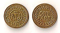
Mount Hope Bridge one fare token, front and back

Commemorative medal (front and back) struck in 1929, honoring the opening of the Mount Hope Bridge


See also[]
- National Register of Historic Places listings in Bristol County, Rhode Island
- List of bridges on the National Register of Historic Places in Rhode Island
References[]
- ^ a b "National Register Information System". National Register of Historic Places. National Park Service. March 13, 2009.
- ^ http://www.rihs.org/[bare URL]
- ^ Mount Hope Farm
- ^ Bike Rhode Island Archived 2007-10-30 at the Wayback Machine and Guide to Bicycling in the Ocean State 2005-2006, Rhode Island Department of Transportation
- ^ Steve Anderson's Bostonroads.com: Mount Hope Bridge (RI 114)
- ^ "TPR : The Public's Radio : TPR".
External links[]
| Wikimedia Commons has media related to Mount Hope Bridge. |
- Photograph of Mount Hope Bridge by Kathleen Murtagh
- Mount Hope Bridge page on BostonRoads.com
- Mount Hope Bridge at Structurae
- Mount Hope Bridge Records from the Rhode Island State Archives
- Mount Hope Bridge building, opening and maintenance photographs from the Rhode Island State Archives
- Report of the Mount Hope Toll Bridge Commission from the Rhode Island State Archives
| Islands |  | |
|---|---|---|
| Major rivers | ||
| Cities & towns | ||
| Bridges | ||
| Topics |  | ||||||||||
|---|---|---|---|---|---|---|---|---|---|---|---|
| Lists by county | |||||||||||
| Lists by city |
| ||||||||||
| |||||||||||
- Road bridges in Rhode Island
- Narragansett Bay
- Suspension bridges in Rhode Island
- Bridges in Newport County, Rhode Island
- Buildings and structures in Bristol, Rhode Island
- Buildings and structures in Portsmouth, Rhode Island
- Towers in Rhode Island
- Bridges in Bristol County, Rhode Island
- 1929 establishments in Rhode Island
- Bridges completed in 1929
- National Register of Historic Places in Newport County, Rhode Island
- Road bridges on the National Register of Historic Places in Rhode Island
- Former toll bridges in Rhode Island
- National Register of Historic Places in Bristol County, Rhode Island