Mount Iriga
| Mount Iriga | |
|---|---|
| Mount Asog | |
 | |
| Highest point | |
| Elevation | 1,196 m (3,924 ft)[1] |
| Prominence | 1,009 m (3,310 ft) |
| Listing | Active volcanoes in the Philippines |
| Coordinates | 13°27′24″N 123°27′24″E / 13.45667°N 123.45667°ECoordinates: 13°27′24″N 123°27′24″E / 13.45667°N 123.45667°E[1] |
| Geography | |
 Mount Iriga | |
| Country | Philippines |
| Region | Bicol Region |
| Province | Camarines Sur |
| City/municipality | |
| Geology | |
| Age of rock | Quaternary |
| Mountain type | Stratovolcano |
| Volcanic arc/belt | Bicol Arc |
| Last eruption | 1642 |
 | |


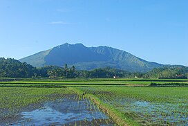
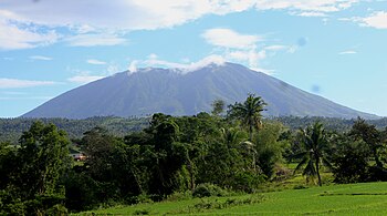
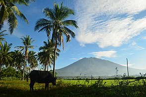
Mount Iriga, also known as Mount Asog, is an active stratovolcano in the province of Camarines Sur, in the Philippines.
Mount Iriga is a stratovolcano about a kilometre from Lake Buhi. It rises 1,196 m (3,924 ft) with a base diameter of 10 kilometres (6.2 mi).[1][2] It has a large crater formed due to a debris avalanche.
Iriga erupted in 1628 and 1642.[2] Iriga is generally known for its phreatic explosions. After these eruptions, it remains dormant as of now.
Gallery[]
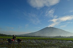
View from San Ramon, Iriga

View from Iriga Central Terminal


See also[]
- List of potentially active volcanoes in the Philippines
- List of inactive volcanoes in the Philippines
- Philippine Institute of Volcanology and Seismology
- Iriga City
References[]
- ^ a b c "Iriga". Global Volcanism Program. Smithsonian Institution. Retrieved September 17, 2011.
- ^ a b "Mount Iriga". Philippine Institute of Volcanology and Seismology (PHIVOLCS). Archived from the original on September 1, 2011. Retrieved September 17, 2011.
External links[]
 Media related to Mount Iriga at Wikimedia Commons
This article about a location in Bicol Region is a stub. You can help Wikipedia by . |
Categories:
- Mountains of the Philippines
- Stratovolcanoes of the Philippines
- Subduction volcanoes
- Volcanoes of Luzon
- Active volcanoes of the Philippines
- Landforms of Camarines Sur
- Iriga
- Bicol Region geography stubs