Mount Petrie
| Mount Petrie | |
|---|---|
 The top of Mount Petrie | |
| Highest point | |
| Elevation | 170 m (560 ft) |
| Listing | List of mountains in Australia |
| Coordinates | 27°32′S 153°08′E / 27.533°S 153.133°ECoordinates: 27°32′S 153°08′E / 27.533°S 153.133°E |
| Geography | |
| Climbing | |
| First ascent | Andrew Petrie[1] |

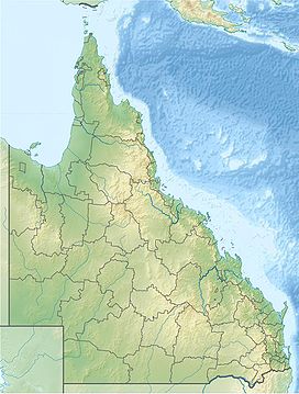
Mount Petrie is a mountain in the south east of the city of Brisbane, Queensland, Australia.[2] The 170 metre rise is sometimes referred to as Petrie Hill. It elevates semi-rural residential parts in the suburbs of Mackenzie and Burbank.
The mountain was named after Andrew Petrie[3] Superintendent of Works, Moreton Bay Colony, who climbed it to get his bearings when lost in the bush in the company of the Commandant of Moreton Bay Colony Major Cotton in 1838. It is believed that this was the first climbing of this mountain by white men.[1][4]
The southern summit of the mountain has an abandoned triangulation station with a collapsed radio tower, while the top of the mountain has a trig tower for taking bearings and measurements. At the top of the mountain one can get great views of Brisbane and Moreton Bay.
For many years the undeveloped bushland around this hilly area was empty, except for the occasional dirt track. This was partly due to the proximity to the Belmont Rifle Range, around which access is restricted for safety reasons. The bushlands near Mount Petrie are an important habitat for koala, wallaby, and echidna colonies.[5]
A few kilometres east of Mount Petrie is the Leslie Harrison Dam. This places the large hill in the catchment area for Redland City, another reason that development has been curtailed in this part of the city.
The construction of permanent facilities for the Western Corridor Recycled Water Project in 2008 had a significant impact on the bushland on the mountain.[6]
The other two tallest mountains in Brisbane are Mount Coot-tha and Mount Gravatt. The Gateway Motorway passes a few kilometres to the west of the mountain.
1942 DH-86 aircraft crash[]
On 20 February 1942, a Qantas de Havilland 86 passenger aircraft, VH-USE "Sydney", crashed into the base of Mount Petrie, killing all nine people on board.[7]
See also[]
References[]
- ^ a b "History of Belmont". Our Brisbane. Brisbane City Council. Archived from the original on 5 April 2008. Retrieved 4 May 2008.
- ^ "Mount Petrie – mountain in the City of Brisbane (entry 26541)". Queensland Place Names. Queensland Government. Retrieved 1 August 2021.
- ^ Roberts, Beryl (2013). Naming Brisbane: Origins of Brisbane's Suburb & Locality Names. p. 69. ISBN 9780987231529.
- ^ Petrie, Constance Campbell (1983). "V". Tom Petrie's Reminiscences of Early Queensland. Angus and Robertson.
- ^ "Belmont: Environment". BRISbites. Brisbane City Council. Archived from the original on 20 July 2008. Retrieved 4 May 2008.
- ^ Moore, Tony (16 April 2008). "Recycled water project scars bushland". Brisbane Times. Retrieved 13 May 2008.
- ^ Dunn, Peter. "CRASH OF A QANTAS DE HAVILLAND DH-86 AIRCRAFT AT THE FOOT OF MOUNT PETRIE, NEAR BRISBANE, QLD ON 20 FEBRUARY 1942". www.ozatwar.com. Retrieved 30 January 2013.
- Geography of Brisbane
- Mountains of South East Queensland

