Mouthoumet
show This article may be expanded with text translated from the corresponding article in French. (December 2008) Click [show] for important translation instructions. |
Mouthoumet | |
|---|---|
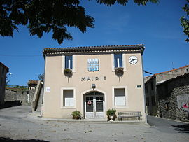 The town hall in Mouthoumet | |
 Coat of arms | |
show Location of Mouthoumet | |
 Mouthoumet | |
| Coordinates: 42°57′39″N 2°31′39″E / 42.9608°N 2.5275°ECoordinates: 42°57′39″N 2°31′39″E / 42.9608°N 2.5275°E | |
| Country | France |
| Region | Occitanie |
| Department | Aude |
| Arrondissement | Narbonne |
| Canton | Les Corbières |
| Government | |
| • Mayor (2020–2026) | Christelle Hermand |
| Area 1 | 13.73 km2 (5.30 sq mi) |
| Population (Jan. 2018)[1] | 106 |
| • Density | 7.7/km2 (20/sq mi) |
| Time zone | UTC+01:00 (CET) |
| • Summer (DST) | UTC+02:00 (CEST) |
| INSEE/Postal code | 11260 /11330 |
| Elevation | 400–704 m (1,312–2,310 ft) |
| 1 French Land Register data, which excludes lakes, ponds, glaciers > 1 km2 (0.386 sq mi or 247 acres) and river estuaries. | |


Mouthoumet (French pronunciation: [mutumɛ] (![]() listen); Languedocien: Motomet) is a commune in the Aude department in southern France.
listen); Languedocien: Motomet) is a commune in the Aude department in southern France.
Population[]
|
|

See also[]
- Corbières Massif
- Communes of the Aude department
References[]
- ^ "Populations légales 2018". INSEE. 28 December 2020.
| Wikimedia Commons has media related to Mouthoumet. |
| show Communes of the Aude department |
|---|
| show Authority control |
|---|
This Aude geographical article is a stub. You can help Wikipedia by . |
Categories:
- Communes of Aude
- Aude geography stubs