Muqur District, Ghazni
Muqur
مقر | |
|---|---|
District | |
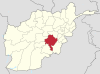
 Muqur Location within Afghanistan | |
| Coordinates: 32°53′16″N 67°54′06″E / 32.887660°N 67.901573°E | |
| Country | |
| Province | Ghazni Province |
| Population (2002)[1] | |
| • Total | 70,900 |

Muqur (also spelt Moqur) is a district in the southwest of Ghazni Province, Afghanistan. Its population, which is mostly Hazara along with several Pashtun and Tajik, was estimated at 70,900 in 2002, of whom 19,538 were children under 12.[1]
On 8 May 2016, a vehicular accident on a stretch of the Kabul-Kandahar Highway occurred in the district, killing 73. Two buses travelling from Kabul to Kandahar collided with a fuel tanker. The stretch of highway in this district is reportedly dangerous due to Taliban presence, and the vehicles were speeding to avoid ambush.[2]
Divisions[]
The district is divided in four main areas:[1]
- Khoband
- Khodzaie
- Gadakhel
- Manger Khel
Agriculture[]
Main crops include wheat, alfalfa, peas, beans and honey melons. Animal husbandry includes sheep, goats, domestic poultry and a limited number of donkeys and horses.[1]
Politics and Governance[]
This section is empty. You can help by . (August 2020) |
Geography[]
This section is empty. You can help by . (August 2020) |
Healthcare[]
This section is empty. You can help by . (August 2020) |
Education[]
This section is empty. You can help by . (August 2020) |
Demographics[]
This section is empty. You can help by . (August 2020) |
Infrastructure[]
This section is empty. You can help by . (August 2020) |
Natural Resources[]
This section is empty. You can help by . (August 2020) |
External links[]
- Map of Muqur (PDF)
References[]
- ^ a b c d "District Profile" (PDF). UNHCR. Archived from the original (PDF) on 2016-03-03. Retrieved 30 October 2015.
- ^ "Fuel-tanker crash kills over 70 in Afghanistan's Ghazni". Al-Jazeera May 8, 2016. http://www.aljazeera.com/news/2016/05/afghanistan-road-crash-ghazni-160508115025713.html
Ghazni Province | ||
|---|---|---|
Capital: Ghazni | ||
| Districts |
|  |
| Populated places |
| |
| Landforms |
| |
| Other |
| |
This Ghazni Province, Afghanistan location article is a stub. You can help Wikipedia by . |
- Districts of Ghazni Province
- Afghanistan geography stubs