Námestovo
Námestovo | |
|---|---|
Town | |
 Hviezdoslav Square in Námestovo | |
 Flag  Coat of arms | |
 Námestovo Location of Námestovo in Slovakia | |
| Coordinates: 49°24′10″N 19°28′53″E / 49.40278°N 19.48139°ECoordinates: 49°24′10″N 19°28′53″E / 49.40278°N 19.48139°E | |
| Country | |
| Region | Žilina |
| District | Námestovo |
| First mentioned | 1557 |
| Government | |
| • Mayor | Ján Kadera |
| Area | |
| • Total | 44.474 km2 (17.172 sq mi) |
| Elevation | 614 m (2,014 ft) |
| Population (2018-12-31[1]) | |
| • Total | 7,827 |
| • Density | 180/km2 (460/sq mi) |
| Time zone | UTC+1 (CET) |
| • Summer (DST) | UTC+2 (CEST) |
| Postal code | 029 01 |
| Area code(s) | 421-43 |
| Car plate | NO |
| Website | www.namestovo.sk |


Námestovo (Hungarian: Námesztó; Polish: Namiestów) is a town in northern Slovakia. It is the capital and largest town of Námestovo District in the Žilina Region. As of 2018 its population was 7,827.
Etymology[]
The name is derived from a word námesta (a representative, a deputy; like modern Slovak námestník or Czech náměstek) referring to a representative of Vlach settlers whose seat was in Námestovo.[2] Alternatively, it could be derived from a personal name Namest (a less probable theory).[2]
Geography[]
The town is located under the Orava Highlands at the shores of the Orava reservoir, not far from the Polish border, around 15 km (9.32 mi) from Tvrdošín and 30 km (18.64 mi) from Dolný Kubín.
History[]
The town was mentioned in the 16th century, when the massive colonisation of Orava took place. It was growing quickly, thanks to its favourable location on the trade route to Poland. The town was burned down at the end of World War II. The construction of the Orava reservoir affected the way of life in the town, as two-thirds of the town were inundated, including the town centre. Boom of the industry and the following apartment construction in the 1970s contributed to the growth of the town.
Demographics[]
According to the 2001 census, the town had 8,135 inhabitants. 98.65% of inhabitants were Slovaks and 0.65% Czechs.[3] The religious makeup was 92.12% Roman Catholics, 4.95% people with no religious affiliation and 0.84% Lutherans.[3]
Pictures[]

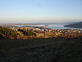
Summer afternoon at Orava Reservoir

A sailboat on the Orava Reservoir
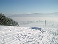
Námestovo in winter

Winter on the bank of Orava Reservoir
Námestovo in autumn

Statue of Anton Bernolák on Slanica Isle
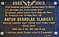
A memorial plaque to Anton Bernolák on Slanica Isle


People[]
See also[]
References[]
- ^ "Population and migration". Statistical Office of the Slovak Republic. Retrieved 2019-04-16.
- ^ Jump up to: a b Krajčovič, Rudolf (2013). "Z lexiky stredovekej slovenčiny s výkladmi názvov obcí a miest (38)". Kultúra slova (in Slovak). Martin: Vydavateľstvo Matice slovenskej (3): 92.
- ^ Jump up to: a b "Municipal Statistics". Statistical Office of the Slovak republic. Archived from the original on 2008-01-11. Retrieved 2008-01-26.
External links[]
- The Town of Námestovo (in Slovak)
| show Municipalities of Námestovo District |
|---|
| show Authority control |
|---|
This Žilina Region geography article is a stub. You can help Wikipedia by . |
- Cities and towns in Slovakia
- Žilina Region geography stubs