Námestovo District
Námestovo District | |
|---|---|
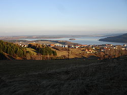 Sky view of the Námestovo District | |
 | |
| Country | Slovakia |
| Region (kraj) | Žilina Region |
| Area | |
| • Total | 691 km2 (267 sq mi) |
| Population (2001) | |
| • Total | 56,043 |
| • Density | 81/km2 (210/sq mi) |
| Time zone | UTC+01:00 (CET) |
| • Summer (DST) | UTC+02:00 (CEST) |
| Telephone prefix | 43 |
Námestovo District (okres Námestovo) is a district in the Žilina Region of central Slovakia. Until 1918, the district was part of Árva County, an administrative division of the Kingdom of Hungary.
Municipalities[]
| Municipality | Area (km2)[1] | Population[2][3] |
|---|---|---|
| Babín | 17.39 | 1,445 ( |
| Beňadovo | 6.69 | 920 ( |
| Bobrov | 25.63 | 1,923 ( |
| Breza | 22.52 | 1,625 ( |
| Hruštín | 36.51 | 3,133 ( |
| Klin | 12.73 | 2,480 ( |
| Krušetnica | 16.55 | 975 ( |
| Lokca | 24.19 | 2,411 ( |
| Lomná | 21.55 | 946 ( |
| Mútne | 64.45 | 3,092 ( |
| Námestovo | 44.44 | 7,723 ( |
| Novoť | 37.97 | 3,692 ( |
| Oravská Jasenica | 23.68 | 1,894 ( |
| Oravská Lesná | 65.62 | 3,450 ( |
| Oravská Polhora | 84.51 | 4,018 ( |
| Oravské Veselé | 41.21 | 2,991 ( |
| Rabča | 25.15 | 5,160 ( |
| Rabčice | 22.18 | 2,035 ( |
| Sihelné | 14.4 | 2,180 ( |
| Ťapešovo | 6.71 | 777 ( |
| Vasiľov | 9.13 | 838 ( |
| Vavrečka | 8.95 | 1,590 ( |
| Zákamenné | 42.9 | 5,575 ( |
| Zubrohlava | 15.25 | 2,395 ( |
References[]
- ^ "Statistic of Slovak places by Dušan Kreheľ – Export". Retrieved 2021-07-05.
- ^ "Statistic of Slovak places by Dušan Kreheľ – Export". Retrieved 2021-07-19.
- ^ "Statistic of Slovak places by Dušan Kreheľ – Export". Retrieved 2021-09-01.
Coordinates: 49°24′23″N 19°29′2″E / 49.40639°N 19.48389°E

This Žilina Region geography article is a stub. You can help Wikipedia by . |
Categories:
- Districts of Slovakia
- Žilina Region geography stubs