Nanima
| Nanima New South Wales | |||||||||||||||
|---|---|---|---|---|---|---|---|---|---|---|---|---|---|---|---|
 | |||||||||||||||
 Nanima Location in New South Wales | |||||||||||||||
| Coordinates | 35°00′32″S 149°07′46″E / 35.00889°S 149.12944°ECoordinates: 35°00′32″S 149°07′46″E / 35.00889°S 149.12944°E | ||||||||||||||
| Population | 165 (2016 census)[1] | ||||||||||||||
| Postcode(s) | 2618 | ||||||||||||||
| Location |
| ||||||||||||||
| LGA(s) | Yass Valley Council | ||||||||||||||
| Region | Southern Tablelands | ||||||||||||||
| County | Murray | ||||||||||||||
| Parish | , | ||||||||||||||
| State electorate(s) | Goulburn | ||||||||||||||
| Federal division(s) | Hume | ||||||||||||||
| |||||||||||||||

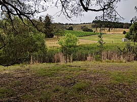
Nanima is a locality in the Yass Valley Council area, New South Wales, Australia.[2][3] It lies on both sides of the Murrumbateman Road between Murrumbateman and Gundaroo, about 37 km north of Canberra. At the 2016 census, it had a population of 165.[1]
Nanima is also a civil parish of Murray County. It is located northwest of the current locality of Nanima in the Murrumbateman area, although there is also a Murrumbateman parish that lies further north.[4][5]
References[]
- ^ a b Australian Bureau of Statistics (27 June 2017). "Nanima". 2016 Census QuickStats. Retrieved 3 August 2017.

- ^ "Nanima". Geographical Names Register (GNR) of NSW. Geographical Names Board of New South Wales. Retrieved 3 August 2017.
- ^ "Nanima". OpenStreetMap. Retrieved 17 April 2018.
- ^ Robert McLean, The New atlas of Australia : the complete work containing over one hundred maps and full descriptive geography of New South Wales, Victoria, Queensland, South Australia and Western Australia, together with numerous illustrations and copious indices (Sydney :J. Sands, [1886) Map 11.
- ^ "Nanima Parish". Geographical Names Register (GNR) of NSW. Geographical Names Board of New South Wales. Retrieved 17 April 2018.
| Towns and residential areas | |
|---|---|
| Localities | |
Main Article: Local government areas of New South Wales | |
This Southern Tablelands geography article is a stub. You can help Wikipedia by . |
Categories:
- Towns in New South Wales
- Yass Valley Council
- Localities in New South Wales
- Southern Tablelands
- Southern Tablelands geography stubs