Nasukarasuyama
Nasukarasuyama
那須烏山市 | |
|---|---|
 Nasukarasuyama City Hall | |
 Flag  Seal | |
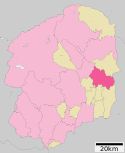 Location of Nasukarasuyama in Tochigi Prefecture | |
 Nasukarasuyama | |
| Coordinates: 36°39′24.8″N 140°9′5.1″E / 36.656889°N 140.151417°ECoordinates: 36°39′24.8″N 140°9′5.1″E / 36.656889°N 140.151417°E | |
| Country | Japan |
| Region | Kantō |
| Prefecture | Tochigi |
| Area | |
| • Total | 174.35 km2 (67.32 sq mi) |
| Population (August 1, 2020) | |
| • Total | 25,783 |
| • Density | 150/km2 (380/sq mi) |
| Time zone | UTC+9 (Japan Standard Time) |
| - Tree | Zelkova serrata |
| - Flower | Magnolia kobus |
| - Bird | Crow |
| Phone number | 0287-83-1111 |
| Address | 1-1-1 Chuo, Nasukarasuyama-shi, Tochigi-ken 321-0692 |
| Website | Official website |


Nasukarasuyama (那須烏山市, Nasukarasuyama-shi) is a city located in Tochigi Prefecture, Japan. As of 1 August 2020, the city had an estimated population of 25,783 in 10,509 households,[1] and a population density of 150 persons per km². The total area of the city is 174.35 square kilometres (67.32 sq mi).
Geography[]
Nasukarasuyama is located in the center-eastern part of Tochigi Prefecture, at the western foot of the Yamizo Mountains, at the southern end of the Shiona Hills, and in the middle reaches of the Naka River. The old Karasuyama town area is located on the right bank of the Naka River. The city is approximately 30 kilometers from the prefectural capital of Utsunomiya. Nasukarasuyama is the political, economic, and administrative base city of the eastern part of the prefecture. 30-35km northeast from the city of Utsunomiya, which is the prefectural capita
Surrounding municipalities[]
Climate[]
Nasukarasuyama has a Humid continental climate (Köppen Cfa) characterized by warm summers and cold winters with heavy snowfall. The average annual temperature in Nasukarasuyama is 13.1 °C. The average annual rainfall is 1416 mm with September as the wettest month. The temperatures are highest on average in August, at around 25.2 °C, and lowest in January, at around 1.8 °C.[2]
| hideClimate data for Nsukarasuyama (2010) | |||||||||||||
|---|---|---|---|---|---|---|---|---|---|---|---|---|---|
| Month | Jan | Feb | Mar | Apr | May | Jun | Jul | Aug | Sep | Oct | Nov | Dec | Year |
| Record high °C (°F) | 17.0 (62.6) |
18.5 (65.3) |
20.9 (69.6) |
24.4 (75.9) |
30.0 (86.0) |
31.0 (87.8) |
37.3 (99.1) |
35.5 (95.9) |
35.2 (95.4) |
28.1 (82.6) |
21.8 (71.2) |
— | 37.3 (99.1) |
| Average high °C (°F) | 9.5 (49.1) |
8.7 (47.7) |
11.6 (52.9) |
15.6 (60.1) |
22.4 (72.3) |
27.2 (81.0) |
31.2 (88.2) |
32.5 (90.5) |
27.9 (82.2) |
21.1 (70.0) |
16.6 (61.9) |
— | — |
| Average low °C (°F) | −6.1 (21.0) |
−2.8 (27.0) |
0.4 (32.7) |
4.1 (39.4) |
10.3 (50.5) |
16.4 (61.5) |
21.8 (71.2) |
22.9 (73.2) |
18.1 (64.6) |
11.9 (53.4) |
2.5 (36.5) |
— | — |
| Record low °C (°F) | −10.3 (13.5) |
−8.8 (16.2) |
−5.1 (22.8) |
−2.4 (27.7) |
2.7 (36.9) |
7.0 (44.6) |
18.9 (66.0) |
20.3 (68.5) |
7.6 (45.7) |
1.6 (34.9) |
−2.3 (27.9) |
— | −10.3 (13.5) |
| Average precipitation mm (inches) | 1.0 (0.04) |
75.0 (2.95) |
123.0 (4.84) |
189.0 (7.44) |
179.0 (7.05) |
206.0 (8.11) |
189.0 (7.44) |
23.0 (0.91) |
270.0 (10.63) |
161.5 (6.36) |
57.0 (2.24) |
— | — |
| Source: Japan Meteorological Agency[3] | |||||||||||||
Demographics[]
Per Japanese census data,[4] the population of Nasukarasuyama has declined over the past 30 years.
| Year | Pop. | ±% |
|---|---|---|
| 1960 | 39,046 | — |
| 1970 | 33,539 | −14.1% |
| 1980 | 33,562 | +0.1% |
| 1990 | 33,699 | +0.4% |
| 2000 | 32,790 | −2.7% |
| 2010 | 29,177 | −11.0% |
History[]
The area began as a castle town for Karasuyama Domain in the Edo period, centered on Karasuyama Castle, a fortification dating to the Kamakura period. Karasuyama Town was established with the creation of the modern municipalities system on April 1, 1889. It merged with the neighboring villages of Mukada, Sakai, and Nanago on March 31, 1954. The modern city of Nasukarasuyama was established on October 1, 2005, from the merger of the towns of Karasuyama and Minaminasu (both from Nasu District).
Government[]
Nasukarasuyama has a mayor-council form of government with a directly elected mayor and a unicameral city assembly of 17 members. Nasukarasuyama, together with the town of Nakagawa a collectively contributes one member to the Tochigi Prefectural Assembly. In terms of national politics, the town is part of Tochigi 3rd district of the lower house of the Diet of Japan.
Economy[]
Nasukarasuyama has primarily an agricultural economy, with a secondary emphasis on tourism.
Education[]
- Nasukarasuyama has five public primary schools and two public middle schools operated by the city government, and one public high school operated by the Tochigi Prefectural Board of Education.
Transportation[]
Railway[]
![]() JR East – Karasuyama Line
JR East – Karasuyama Line
- Kōnoyama - Ōgane - Kobana - Taki - Karasuyama
Highway[]
Local attractions[]

- Yamaage Kaikan
- Karasuyama Castle
References[]
- ^ "Naskarasuyama City official statistics" (in Japanese). Japan.
- ^ Nasukarasuyama climate data
- ^ "那須烏山 2010年". Japan Meteorological Agency. Retrieved 2010-12-18.
- ^ Nasukarasuyama population statistics
External links[]
![]() Media related to Nasukarasuyama, Tochigi at Wikimedia Commons
Media related to Nasukarasuyama, Tochigi at Wikimedia Commons
- Official Website (in Japanese)
| show Authority control |
|---|
- Cities in Tochigi Prefecture
- Nasukarasuyama