National Register of Historic Places listings in Monroe County, Tennessee
Location of Monroe County in Tennessee
This is a list of the National Register of Historic Places listings in Monroe County, Tennessee.
This is intended to be a complete list of the properties and districts on the National Register of Historic Places in Monroe County, Tennessee, United States. Latitude and longitude coordinates are provided for many National Register properties and districts; these locations may be seen together in a map.[1]
There are currently 19 properties listed on the National Register in the county, including 1 National Historic Landmark.
| Anderson – Bedford – Benton – Bledsoe – Blount – Bradley – Campbell – Cannon – Carroll – Carter – Cheatham – Chester – Claiborne – Clay – Cocke – Coffee – Crockett – Cumberland – Davidson – Decatur – DeKalb – Dickson – Dyer – Fayette – Fentress – Franklin – Gibson – Giles – Grainger – Greene – Grundy – Hamblen – Hamilton – Hancock – Hardeman – Hardin – Hawkins – Haywood – Henderson – Henry – Hickman – Houston – Humphreys – Jackson – Jefferson – Johnson – Knox – Lake – Lauderdale – Lawrence – Lewis – Lincoln – Loudon – Macon – Madison – Marion – Marshall – Maury – McMinn – McNairy – Meigs – Monroe – Montgomery – Moore – Morgan – Obion – Overton – Perry – Pickett – Polk – Putnam – Rhea – Roane – Robertson – Rutherford – Scott – Sequatchie – Sevier – Shelby – Smith – Stewart – Sullivan – Sumner – Tipton – Trousdale – Unicoi – Union – Van Buren – Warren – Washington – Wayne – Weakley – White – Williamson – Wilson |
- This National Park Service list is complete through NPS recent listings posted February 11, 2022.[2]
Current listings[]
| [3] | Name on the Register[4] | Image | Date listed[5] | Location | City or town | Description |
|---|---|---|---|---|---|---|
| 1 | Calderwood Dam |  |
August 21, 1989 (#89001069) |
Tennessee River at the end of Calderwood Rd. 35°29′32″N 83°58′58″W / 35.492222°N 83.982778°W | Calderwood | Extends into Blount County |
| 2 |  |
August 30, 1973 (#73001813) |
Address Restricted | Vonore | Archaeological sites for 18th-century Cherokee villages of Chota and Tanasi; now submerged under Tellico Lake, though both sites memorialized with monuments along the shoreline | |
| 3 | Citico Site |  |
November 2, 1978 (#78002614) |
Address Restricted | Vonore | Archaeological site for 18th-century Cherokee village; now submerged by Tellico Lake |
| 4 |  |
October 17, 1988 (#74001921) |
Kefauver Lane 35°30′40″N 84°21′28″W / 35.511111°N 84.357778°W | Madisonville | ||
| 5 | First Presbyterian Church |  |
July 25, 2001 (#01000772) |
601 Church St. 35°36′09″N 84°27′49″W / 35.6025°N 84.463611°W | Sweetwater | Gothic Revival-style church; congregation founded in 1860, church built in 1887 |
| 6 | Fort Loudoun | 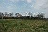 |
October 15, 1966 (#66000729) |
U.S. Route 411 35°35′45″N 84°12′13″W / 35.595833°N 84.203611°W | Vonore | |
| 7 | January 27, 1983 (#83003057) |
Sweetwater Rd. 35°38′35″N 84°18′43″W / 35.643056°N 84.311944°W | ||||
| 8 | Icehouse Bottom Site |  |
October 19, 1978 (#78002615) |
Address Restricted | Vonore | Archaic and Woodland period site excavated in the early 1970s; now submerged by Tellico Lake |
| 9 | December 24, 1974 (#74001923) |
Ballplay Rd. 35°21′30″N 84°16′25″W / 35.358333°N 84.273611°W | Tellico Plains | |||
| 10 | John McCroskey House |  |
February 18, 2000 (#00000125) |
3224 Sweetwater-Vonore Rd. 35°36′33″N 84°21′15″W / 35.609167°N 84.354167°W | Sweetwater | Built in 1859 |
| 11 | Mialoquo Site | October 19, 1978 (#78002616) |
Address Restricted | Vonore | Archaeological site for 18th-century Cherokee village; now submerged by Tellico Lake | |
| 12 | Monroe County Courthouse |  |
March 30, 1995 (#95000341) |
Town Sq. 35°31′11″N 84°21′46″W / 35.519722°N 84.362778°W | Madisonville | |
| 13 |  |
July 15, 1998 (#98000875) |
1019 Mayes St. 35°36′31″N 84°27′47″W / 35.608611°N 84.463056°W | Sweetwater | Federal-style house built in the late 1820s | |
| 14 | January 21, 1993 (#92001816) |
Scott Mansion Rd., about 1¼ miles east of State Route 68 35°23′13″N 84°17′20″W / 35.386944°N 84.288889°W | Tellico Plains | |||
| 15 |  |
September 10, 1974 (#74001922) |
West of the junction of U.S. Route 411 and State Route 68 35°31′09″N 84°21′58″W / 35.519167°N 84.366111°W | Madisonville | Greek Revival-style house built in 1846, and designed by architect Thomas Blanchard | |
| 16 | Tellico Blockhouse Site |  |
August 11, 1975 (#75001771) |
2 miles east of Vonore off State Route 72 35°36′00″N 84°12′11″W / 35.6°N 84.203056°W | Vonore | Late 18th-century trading outpost; layout marked by posts and stones, with interpretive signs |
| 17 |  |
May 7, 2019 (#100003903) |
1310, 1311 & 1313 Peachtree St. 35°36′46″N 84°27′54″W / 35.6128°N 84.4651°W | Sweetwater | ||
| 18 | Tomotley Site | 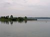 |
October 19, 1978 (#78002617) |
Address Restricted | Vonore | Archaeological site for 18th-century Cherokee village; now submerged by Tellico Lake |
| 19 | Toqua Site |  |
November 16, 1978 (#78002618) |
Address Restricted | Vonore | Archaeological site for 18th-century Cherokee village; now submerged by Tellico Lake |

Former listings[]
| [3] | Name on the Register | Image | Date listed | Date removed | Location | City or town | Description |
|---|---|---|---|---|---|---|---|
| 1 | August 28, 1974 (#74001924) | January 25, 1985 | E of Vonore on Fort Loudoun Rd. | Vonore | Also known as Tuskega. Burned down by arsonist November 14, 1984. |
See also[]
| Wikimedia Commons has media related to National Register of Historic Places in Monroe County, Tennessee. |
- List of National Historic Landmarks in Tennessee
- National Register of Historic Places listings in Tennessee
References[]
- ^ The latitude and longitude information provided in this table was derived originally from the National Register Information System, which has been found to be fairly accurate for about 99% of listings. Some locations in this table may have been corrected to current GPS standards.
- ^ National Park Service, United States Department of the Interior, "National Register of Historic Places: Weekly List Actions", retrieved February 11, 2022.
- ^ a b Numbers represent an alphabetical ordering by significant words. Various colorings, defined here, differentiate National Historic Landmarks and historic districts from other NRHP buildings, structures, sites or objects.
- ^ "National Register Information System". National Register of Historic Places. National Park Service. April 24, 2008.
- ^ The eight-digit number below each date is the number assigned to each location in the National Register Information System database, which can be viewed by clicking the number.
| Topics | |
|---|---|
| Lists by state |
|
| Lists by insular areas | |
| Lists by associated state | |
| Other areas | |
| Related | |
| |
Municipalities and communities of Monroe County, Tennessee, United States | ||
|---|---|---|
| Cities | ||
| Towns | ||
| CDPs | ||
| Other communities | ||
| Footnotes | ‡This populated place also has portions in an adjacent county or counties | |
| ||
Categories:
- Lists of National Register of Historic Places in Tennessee by county
- Monroe County, Tennessee
- Buildings and structures in Monroe County, Tennessee
- National Register of Historic Places in Monroe County, Tennessee