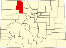
Location of Routt County in Colorado
This is a list of the National Register of Historic Places listings in Routt County, Colorado .
This is intended to be a complete list of the properties and districts on the National Register of Historic Places in Routt County , Colorado , United States . The locations of National Register properties and districts for which the latitude and longitude coordinates are included below, may be seen in a map.[1]
There are 26 properties and districts listed on the National Register in the county. Another property was once listed but has been removed.
This National Park Service list is complete through NPS recent listings posted February 11, 2022. [2]
Current listings [ ]
[3] Name on the Register[4]
Image
Date listed[5]
Location
City or town
Description
1
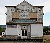
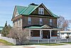
Antlers Cafe and Bar
May 27, 2014 (#14000251 ) 40 and 46 Moffat Ave. 40°09′01″N 106°54′31″W / 40.150412°N 106.908509°W / 40.150412; -106.908509 (Antlers Cafe and Bar ) Yampa
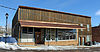
2
December 26, 2012 (#12001081 ) 101 Main St. 40°09′05″N 106°54′31″W / 40.151489°N 106.908733°W / 40.151489; -106.908733 (Bell and Canant Mercantile-Crossan's M and A Market ) Yampa
3
Bell Mercantile
June 7, 1990 (#90000871 ) 101-111 Moffat Ave. 40°16′32″N 106°57′22″W / 40.275556°N 106.956111°W / 40.275556; -106.956111 (Bell Mercantile ) Oak Creek
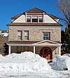
4
Chamber of Commerce Building
April 16, 2010 (#08001010 ) 1201 Lincoln Ave. 40°29′20″N 106°50′21″W / 40.488767°N 106.839111°W / 40.488767; -106.839111 (Chamber of Commerce Building ) Steamboat Springs
5
Christian Science Society Building
August 22, 2007 (#07000839 ) 641 Oak St. 40°29′10″N 106°49′55″W / 40.486111°N 106.831944°W / 40.486111; -106.831944 (Christian Science Society Building ) Steamboat Springs
6
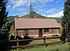
Columbine
August 7, 2007 (#07000791 ) 645 Routt County Rd. 129 40°51′18″N 106°57′55″W / 40.855°N 106.965278°W / 40.855; -106.965278 (Columbine ) Clark
7
Crawford House
August 7, 2005 (#05000782 ) 1184 Crawford Ave. 40°29′27″N 106°50′12″W / 40.490833°N 106.836667°W / 40.490833; -106.836667 (Crawford House ) Steamboat Springs
8
May 6, 1998 (#97000047 ) 13250 W. U.S. Route 40 40°29′40″N 107°10′58″W / 40.494444°N 107.182778°W / 40.494444; -107.182778 (Dawson-Carpenter Ranch ) Hayden
9
First National Bank Building
January 11, 2001 (#00001624 ) 803-807 Lincoln Ave., and 57½ 8th St. 40°29′10″N 106°50′04″W / 40.486111°N 106.834444°W / 40.486111; -106.834444 (First National Bank Building ) Steamboat Springs
10
Foidel Canyon School
May 9, 1983 (#83001332 ) Northwest of Oak Creek 40°21′24″N 107°03′18″W / 40.356667°N 107.055°W / 40.356667; -107.055 (Foidel Canyon School ) Oak Creek
11
Hahns Peak Schoolhouse
February 15, 1974 (#74000594 ) Main St. 40°48′23″N 106°56′40″W / 40.80627°N 106.94440°W / 40.80627; -106.94440 (Hahns Peak Schoolhouse ) Hahns Peak Village One-room schoolhouse which operated from 1912 to 1943
12
October 23, 2015 (#15000740 ) 198 E. Lincoln Ave. 40°29′48″N 107°15′26″W / 40.4967°N 107.2572°W / 40.4967; -107.2572 (Hayden Co-Operative Elevator Company ) Hayden
13
October 22, 1992 (#92001409 ) 300 W. Pearl St. 40°29′47″N 107°15′36″W / 40.496389°N 107.26°W / 40.496389; -107.26 (Hayden Depot ) Hayden
14
Hayden Rooming House
September 17, 1999 (#99001144 ) 295 S. Poplar St. 40°29′32″N 107°15′31″W / 40.492222°N 107.258611°W / 40.492222; -107.258611 (Hayden Rooming House ) Hayden
15
November 28, 2012 (#12000972 ) 41090 County Road 80 40°30′54″N 107°15′03″W / 40.514908°N 107.25077°W / 40.514908; -107.25077 (Kimsey-Bolten Ranch Rural Historic Landscape ) Hayden
16
September 29, 1995 (#95001148 ) 840 Lincoln Ave. 40°29′12″N 106°50′03″W / 40.486667°N 106.834167°W / 40.486667; -106.834167 (Maxwell Building ) Steamboat Springs
17
Mesa Schoolhouse
November 1, 2007 (#07001113 ) 33985 S. U.S. Highway 40 40°24′45″N 106°48′22″W / 40.4125°N 106.806111°W / 40.4125; -106.806111 (Mesa Schoolhouse ) Steamboat Springs
18
July 14, 1995 (#95000794 ) 40755 Routt County Road 36 40°30′33″N 106°49′34″W / 40.509167°N 106.826111°W / 40.509167; -106.826111 (Perry-Mansfield School of Theatre and Dance ) Steamboat Springs
19
Rock Creek Stage Station Upload image October 21, 1982 (#82004860 ) East of Toponas off State Highway 134 40°03′27″N 106°38′42″W / 40.0575°N 106.645°W / 40.0575; -106.645 (Rock Creek Stage Station ) Toponas
20
May 20, 2002 (#02000538 ) 802-806 Lincoln Ave. 40°29′11″N 106°50′02″W / 40.486389°N 106.833889°W / 40.486389; -106.833889 (Routt County National Bank Building ) Steamboat Springs
21
August 10, 2011 (#11000521 ) 150 W. Jackson St. 40°29′37″N 107°15′24″W / 40.493611°N 107.256667°W / 40.493611; -107.256667 (Solandt Memorial Hospital ) Hayden
22
December 7, 2011 (#11000877 ) 302 11th St. 40°29′23″N 106°50′10″W / 40.489741°N 106.836112°W / 40.489741; -106.836112 (Steamboat Apartments ) Steamboat Springs
23
August 7, 2007 (#07000790 ) 127 and 131 11th St. 40°29′12″N 106°50′07″W / 40.486667°N 106.835278°W / 40.486667; -106.835278 (Steamboat Laundry Building ) Steamboat Springs
24
Steamboat Springs Depot
December 20, 1978 (#78000884 ) 39265 Routt County Road 33B 40°29′21″N 106°50′31″W / 40.489167°N 106.841944°W / 40.489167; -106.841944 (Steamboat Springs Depot ) Steamboat Springs
25
July 11, 2014 (#14000387 ) Lincoln Ave. roughly bounded by 5th to 11th Sts. 40°29′09″N 106°50′01″W / 40.4857°N 106.8336°W / 40.4857; -106.8336 (Steamboat Springs Downtown Historic District ) Steamboat Springs
26
July 28, 2004 (#04000735 ) County Road 129 40°58′47″N 106°58′34″W / 40.979722°N 106.976111°W / 40.979722; -106.976111 (Summit Creek Ranger Station ) Columbine
Former listing [ ]
[3] Name on the Register
Image
Date listed Date removed Location
City or town
Description
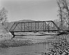
1
February 4, 1985 (#85000237) July 22, 1994 County Road 42 over Elk River Steamboat Springs Replaced in 1989.
See also [ ] References [ ]
^ The latitude and longitude information provided in this table was derived originally from the National Register Information System, which has been found to be fairly accurate for about 99% of listings. Some locations in this table may have been corrected to current GPS standards.
^ National Park Service, United States Department of the Interior , "National Register of Historic Places: Weekly List Actions" , retrieved February 11, 2022.
^ a b Numbers represent an alphabetical ordering by significant words. Various colorings, defined here , differentiate National Historic Landmarks and historic districts from other NRHP buildings, structures, sites or objects.
^ "National Register Information System" . National Register of Historic Places National Park Service . July 9, 2010.^ The eight-digit number below each date is the number assigned to each location in the National Register Information System database, which can be viewed by clicking the number.
Topics Lists by state Lists by insular areas Lists by associated state Other areas Related
National Register of Historic Places portal Category