Naubinway, Michigan
Naubinway, Michigan | |
|---|---|
 Looking east along U.S. Route 2 | |
 Naubinway Location within the state of Michigan | |
| Coordinates: 46°05′33″N 85°26′51″W / 46.09250°N 85.44750°WCoordinates: 46°05′33″N 85°26′51″W / 46.09250°N 85.44750°W | |
| Country | United States |
| State | Michigan |
| County | Mackinac |
| Township | Garfield |
| Settled | 1843 |
| Founded | 1873 |
| Elevation | 932 ft (284 m) |
| Time zone | UTC-5 (Eastern (EST)) |
| • Summer (DST) | UTC-4 (EDT) |
| ZIP code(s) | 49762 |
| Area code(s) | 906 |
| GNIS feature ID | 633624[1] |


Naubinway (/nɒbˈɪnˈweɪ/ knob-IN-way) is an unincorporated community and census-designated place (CDP) in Mackinac County in the U.S. state of Michigan.[1] The community is located within Garfield Township. As an unincorporated community, Naubinway has no legal autonomy of its own but does have its own post office with the 49762 ZIP Code.[2][3]
Naubinway is located along U.S. Route 2 and is the northernmost community on the shores on Lake Michigan. It is also the largest commercial fishing port in the state's Upper Peninsula.[4][5]
Geography[]

Naubinway is located along the northernmost shores of Lake Michigan within Garfield Township in the state's Upper Peninsula. The community is centered along U.S. Route 2 (Lake Michigan Scenic Highway) about 42 miles (68 km) west of St. Ignace and 45 miles (72 km) east of Manistique.[4][5] Hiawatha Trail (County Highway 40) is located just north of the center of Naubinway, and M-117 is to the west. Portions of the surrounding area are part of Lake Superior State Forest.[6] The community sits at an elevation of 932 feet (284 m) above sea level.[1]
Other smaller communities nearby include Engadine and Millecoquins to the northwest, Gould City to the west, Garnet to the northeast, and Epoufette to the east. Other waterways near Naubinway include Lower Millecoquins River and the east and west branches of Mile Creek, which all drain into Lake Michigan.[7][8][9] The southernmost point of land in the community is called Millecoquins Point.[10] This cape creates a small natural harbor known as Naubinway Harbor, which contains a park and marina called the Naubinway–Garfield Township Marina.[11][12] The Michigan Department of Natural Resources maintains a public boating access site in Naubinway on Lake Michigan.[13]
Naubinway and the surrounding area is served by Engadine Consolidated Schools.[14] Naubinway contains its own post office that uses the 49762 ZIP Code. The post office serves the southern portion of Garfield Township and a much larger area to the east of Naubinway, including most of Hudson Township, all of Hendricks Township, and a small western portion of Moran Township. The Garlyn Zoo, located to the east in Hudson Township, also uses the Naubinway ZIP Code.[2][3]
Naubinway Island is a small island located about 0.63 miles (1.01 km) south of the community in Lake Michigan.[15] The Naubinway Island Light was first constructed in 1931 on the island. The original structure has been replaced with a cylindrical tower and continues as an active lighthouse.[16][17][18] The lighthouse was necessary to alert vessels of the shallow underwater Naubinway Reef, which can pose a hazard for vessels heading in and out of Naubinway Harbor. The rocky reef is located about 1.4 miles (2.3 km) south of the island and creates very shallow waters of only 4 feet (1.2 m) deep.[19][20]
History[]

The first European traveler to settle in the area was William Boucha (or Boucher), who partook in the fur trade from Mackinac Island and moved west in 1843. He and his family built their home near Millecoquins Point. They stayed in the area until around 1857. Later in 1873, Boucha received a federal deed under President Ulysses S. Grant to occupy 27.3 acres (11.0 ha) of land at a very inexpensive cost.[5] The new community was settled as Bouchaville but soon renamed as Naubinway.[6] The name Naubinway came from the Ojibwe language translation meaning "place of echoes."[17]
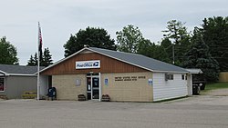
A post office was first established in Naubinbay on November 28, 1879 with Benjamin Perkins serving as the first postmaster.[21] The post office has continuously remained in operation and is currently located at West 11631 US Highway 2 in the center of the community.[22] The Naubinway Cemetery (also referred to as the Garfield Township Cemetery) is located just north of the community.[23] The active cemetery contains graves dating back to 1881.[24]
Naubinway began as a lumbering community at the beginning of the lumber boom in the Upper Peninsula by 1880. The history of the nearby community of Engadine had a similar origin, and the two communities grew rapidly and became centers of large lumbering companies. Naubinway's population was estimated as high as 10,000 residents during the decade. The Canadian Pacific Railway built a line through the area in 1889. The railway line passed to the north of Naubinway through Engadine, and both communities benefited greatly from the railroad and the exportation of its lumber. Naubinway also benefited from being a port community on Lake Michigan. In addition to the growing lumber industry, the community also had a large commercial fishing industry. When the lumber industry declined after the turn of the century, the fishing industry continued.[5]
The community received a railroad depot just to the north of the community. The depot was referred to as the Naubinway Junction, although its exact location and dates of operation are unknown.[25][26] The line was served by the Minneapolis, St. Paul and Sault Ste. Marie Railroad and connected many of the Upper Peninsula's lumber communities. The railway line remains active and is operated by Canadian National Railway but no longer contains a stop or railway station within Naubinway.[27] Beginning in the 1940s, U.S. Route 2 was constructed and rerouted to pass directly through the community of Naubinway along Lake Michigan. U.S. Route 2 provided a major transportation route through the area.[28]
As Naubinway is at the northernmost stretches of Lake Michigan, the point was designated as a Michigan State Historic Site named "the Northernmost Point of Lake Michigan" on April 14, 1964. This point was used to draw the westernmost boundary of the Michigan Territory when it was created in 1805. West of this point belonged to the Indiana Territory until the Michigan Territory expanded westward in 1818.[29]
In recent years, due to the community's remoteness and lack of amenities, the area's population has steadily declined. The community is supported primarily by commercial fishing and tourism.[30] For the 2020 census, Naubinway was included as a newly-listed census-designated place, which is included for statistical purposes only. Naubinway continues to remain an unincorporated community with no legal autonomy of its own.[31][32]
References[]
- ^ a b c U.S. Geological Survey Geographic Names Information System: Naubinway, Michigan
- ^ a b Google (July 4, 2021). "49762 ZIP Code map" (Map). Google Maps. Google. Retrieved July 4, 2021.
- ^ a b UnitedStatesZipCodes.org (2021). "ZIP Code 49762: Naubinway". Retrieved July 4, 2021.
- ^ a b Michigan Economic Development Corporation (2021). "St. Ignace Visitors Bureau: Naubinway". Retrieved July 7, 2021.
- ^ a b c d Top of the Lakes Community Association (2021). "Area History". Retrieved July 4, 2021.
- ^ a b U.P. Engineers & Architects, Inc. (2006). "Mackinac County Fact Book: Mackinac County, Michigan" (PDF). Retrieved July 8, 2021.
- ^ U.S. Geological Survey Geographic Names Information System: Lower Millecoquins River
- ^ U.S. Geological Survey Geographic Names Information System: East Mile Creek
- ^ U.S. Geological Survey Geographic Names Information System: West Mile Creek
- ^ U.S. Geological Survey Geographic Names Information System: Millecoquins Point
- ^ Michigan Great Lakes Water Trails (2021). "Naubinway Harbor". Retrieved July 4, 2021.
- ^ Michigan Department of Natural Resources (2021). "Naubinway - Garfield Township Marina". Retrieved July 6, 2021.
- ^ Michigan Department of Natural Resources (2021). "Michigan Recreational Boating Information System (MRBIS): Boating Access Site Detail (Naubinway Marina)". Retrieved July 7, 2021.
- ^ Michigan Geographic Framework (15 November 2013). "Mackinac County School Districts" (PDF). Retrieved July 4, 2021.
- ^ U.S. Geological Survey Geographic Names Information System: Naubinway Island
- ^ U.S. Geological Survey Geographic Names Information System: Naubinway Island Light
- ^ a b Exploring The North (2021). "Upper Peninsula Lighthouses Open to the Public on Lake Michigan and Lake Superior". Retrieved July 5, 2021.
- ^ Amateur Radio Lighthouse Society (2021). "Naubinway Island (Lake Michigan) Light". Retrieved July 9, 2021.
- ^ United States Lake Survey (1968). The U.S. Lake Survey Story. New York Public Library. p. 518.
- ^ U.S. Geological Survey Geographic Names Information System: Naubinway Reef
- ^ Romig, Walter (October 1, 1986) [1973]. Michigan Place Names: The History of the Founding and the Naming of More Than Five Thousand Past and Present Michigan Communities. Great Lakes Books Series (Paperback). Detroit, Michigan: Wayne State University Press. p. 389. ISBN 978-0-8143-1838-6.
- ^ U.S. Geological Survey Geographic Names Information System: Naubinway Post Office
- ^ U.S. Geological Survey Geographic Names Information System: Naubinway Cemetery
- ^ Find a Grave (2021). "Naubinway Cemetery". Retrieved July 11, 2021.
- ^ United States Lake Survey (1911). Michigan, Southern Peninsula: Michigan, Northern Peninsula. Michigan: Rand McNally & Company. p. 39.
- ^ MichiganRailroads.com (2021). "Mackinac County Stations - Other". Retrieved July 4, 2021.
- ^ Michigan Department of Transportation (March 2017). "Michigan's Railroad System: Railroads Operating in Michigan" (PDF). Retrieved July 4, 2021.
- ^ Michigan State Highway Department & Rand McNally (June 1, 1942). Official Michigan Highway Map (Map) (Summer ed.). [c. 1:850,000]. Lansing: Michigan State Highway Department. §§ C1, D10. OCLC 12701143.
- ^ The Historical Marker Database (1 February 2021). "The Northernmost Point of Lake Michigan". Retrieved July 7, 2021.
- ^ Donnelly, Francis (17 May 2017). "As U.P. loses people, towns make tough choices". The Detroit News. Retrieved August 22, 2019.
- ^ U.S. Census Bureau (2020). "State of Michigan Census Designated Places". Retrieved July 9, 2021.
- ^ U.S. Geological Survey Geographic Names Information System: Naubinway Census Designated Place
External links[]
Municipalities and communities of Mackinac County, Michigan, United States | ||
|---|---|---|
| Cities |  | |
| Civil townships | ||
| CDP | ||
| Other unincorporated communities |
| |
| Indian reservations | ||
| Footnotes | ‡This populated place also has portions in an adjacent county or counties | |
| ||
- Census-designated places in Michigan
- Census-designated places in Mackinac County, Michigan
- Unincorporated communities in Mackinac County, Michigan
- Unincorporated communities in Michigan
- Populated places established in 1873
- 1873 establishments in Michigan
- Michigan populated places on Lake Michigan