Garnet, Michigan
Garnet, Michigan | |
|---|---|
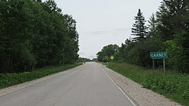 Signage looking east along Hiawatha Trail | |
 Garnet Location within the state of Michigan | |
| Coordinates: 46°09′30″N 85°18′24″W / 46.15833°N 85.30667°WCoordinates: 46°09′30″N 85°18′24″W / 46.15833°N 85.30667°W | |
| Country | United States |
| State | Michigan |
| County | Mackinac |
| Township | Hudson |
| Settled | 1891 |
| Elevation | 840 ft (260 m) |
| Time zone | UTC-5 (Eastern (EST)) |
| • Summer (DST) | UTC-4 (EDT) |
| ZIP code(s) | 49762 (Naubinway) |
| Area code(s) | 906 |
| GNIS feature ID | 626672[1] |


Garnet (/ɡɑːrnˈɪt/ garn-IT) is an unincorporated community in Mackinac County in the U.S. state of Michigan.[1] The community is located within Hudson Township. As an unincorporated community, Garnet has no legally defined boundaries or population statistics of its own.
Geography[]
Garnet is centrally located within Hudson Township in Mackinac County in the state's Upper Peninsula. The community is located along Hiawatha Trail (County Highway 40) just east of Borgstrom Street in a very rural area surrounded by forests belonging to Lake Superior State Forest. The Hiawatha National Forest is just to the east of the community.[2] Garnet sits at an elevation of 840 feet (260 m) above sea level.[1]
U.S. Route 2 runs along the northern shores of Lake Michigan about 5.5 miles (8.9 km) to the south. M-28 is about 12 miles (19.3 km) to the north. The nearest sizable community is the village of Newberry about 20 miles (32.2 km) to the northwest, and the city of St. Ignace is about 45 miles (72.4 km) to the southeast. Other smaller communities nearby include Naubinway to the southwest, Epoufette to the southeast, and Millecoquins and Engadine to the west. The community of Rexton is just east along Hiawatha Trail and is the only other community within the sparely-populated Hudson Township.[3]
Garnet and the surrounding area is served by Engadine Consolidated Schools.[4] Garnet does not contain its own post office and utilizes the Naubinway 49762 ZIP Code.[5][6]
Garnet Lake is located within the community.[7] The lake encompasses 32.1 acres (13.0 ha) and also includes the Garnet Lake State Forest Campground.[8][9] The rustic lakefront campground was formerly operated by the Michigan Department of Natural Resources but is now operating under the administration of the township.[3][10]
History[]

A railway line was constructed through the area as early as 1888, and the area soon received a railway depot.[11][12] The Minneapolis, St. Paul and Sault Ste. Marie Railroad opened a railway stop under the name "Welch" in 1891. The community began to grow and included a sawmill and general store.[13] A post office was opened on November 4, 1898. George Donaldson, who owned the general store, served as the community's first postmaster. By 1900, the population of Welch was around 500. The name of the post office was changed to Garnet on December 31, 1904.[14] The community grew around the sawmill and also became a dairy producing area, as well as including its own school, hotel, saloon, and other businesses. The Hudson Lumber Company also began operating in Garnet.[15]
The population began steadily declining, and the community had about 150 residents by 1915. Aside from the railway line and creation of M-48 and M-84, travel to Garnet was difficult and hindered the community's growth.[16] When U.S. Route 2 was constructed and rerouted through the area in the 1930s, it was built further south to provide a more scenic route and bypassed Garnet. In the early 1940s, M-48 was also decommissioned through the area. With a lack of highways and amenities, Garnet never benefited from the tourism boom that followed World War II. In the 1970s, the sawmill closed down.[17] The post office operated until February 4, 1972 when it became a community post office branch; it was finally discontinued on January 13, 1978.[14]
The community of Garnet no longer contains any businesses and is scattered with some remaining abandoned structures. The railway line remains active and is operated by Canadian National Railway but no longer contains a stop or railway station within Garnet.[18][19] There is still a small population of residents living in Garnet, but by some accounts, it can be considered a ghost town.[15][17]
Images[]
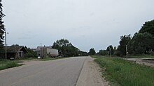
Looking west along Hiawatha Trail 
Garnet listed on a 1911 county map 
Former rail depot in Garnet


References[]
- ^ a b c U.S. Geological Survey Geographic Names Information System: Garnet, Michigan
- ^ U.S. Forest Service (2021). "Hiawatha National Forest: Maps & Publications". Retrieved July 4, 2021.
- ^ a b Hudson Township Board of Trustees. "Hudson Township 2017–2021 Recreation Plan" (PDF). Retrieved July 4, 2021.
- ^ Michigan Geographic Framework (15 November 2013). "Mackinac County School Districts" (PDF). Retrieved July 4, 2021.
- ^ Google (July 4, 2021). "49762 ZIP Code map" (Map). Google Maps. Google. Retrieved July 4, 2021.
- ^ UnitedStatesZipCodes.org (2021). "ZIP Code 49762: Naubinway". Retrieved July 4, 2021.
- ^ U.S. Geological Survey Geographic Names Information System: Garnet Lake
- ^ U.S. Geological Survey Geographic Names Information System: Garnet Lake Campground
- ^ Michigan Department of Natural Resources (January 1979). "Garnet Lake" (PDF). Retrieved July 4, 2021.
- ^ Michigan Department of Natural Resources (2021). "Garnet Lake State Forest Campground". Retrieved July 4, 2021.
- ^ Tinder, David (2013). "Directory of Early Michigan Photographers" (PDF). Retrieved July 4, 2021.
- ^ U.S. Geological Survey Geographic Names Information System: Garnet Station
- ^ Romig, Walter (October 1, 1986) [1973]. Michigan Place Names: The History of the Founding and the Naming of More Than Five Thousand Past and Present Michigan Communities. Great Lakes Books Series (Paperback). Detroit, Michigan: Wayne State University Press. p. 218. ISBN 978-0-8143-1838-6.
- ^ a b U.S. Geological Survey Geographic Names Information System: Garnet Post Office (historical)
- ^ a b Robinson, John (20 November 2019). "Michigan Ghost Town: Garnet, in Mackinac County". Retrieved July 4, 2021.
- ^ Michigan State Highway Department (July 1, 1919). State of Michigan (Map). Scale not given. Lansing: Michigan State Highway Department. Upper Peninsula sheet. OCLC 15607244. Retrieved December 18, 2016 – via Michigan State University Libraries.
- ^ a b Ray, Dodge (1990) [1973]. Michigan Ghost Towns: Of the Upper Peninsula (Michigan Ghost Towns III). Alpena, Michigan: Thunder Bay Press Michigan. ISBN 0934884021.
- ^ Michigan Department of Transportation (March 2017). "Michigan's Railroad System: Railroads Operating in Michigan" (PDF). Retrieved July 4, 2021.
- ^ MichiganRailroads.com (2021). "Mackinac County Stations - Other". Retrieved July 4, 2021.
Municipalities and communities of Mackinac County, Michigan, United States | ||
|---|---|---|
| Cities |  | |
| Civil townships | ||
| CDP | ||
| Other unincorporated communities |
| |
| Indian reservations | ||
| Footnotes | ‡This populated place also has portions in an adjacent county or counties | |
| ||
- Unincorporated communities in Mackinac County, Michigan
- Unincorporated communities in Michigan
- Populated places established in 1891
- 1891 establishments in Michigan