Nearmap
 | |
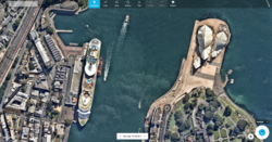 Screenshot of Nearmap's web portal showing Sydney, Australia. | |
| Type of business | Public |
|---|---|
| Traded as | ASX: NEA |
| Founded | Perth, Australia in 2008 |
| Headquarters | Sydney, Australia |
| Key people | Rob Newman (CEO and Managing Director) |
| Industry | Aerial Imagery |
| Products |
|
| Revenue | AU$96.71M [1] |
| URL | nearmap |
Nearmap Limited (often referred to as Nearmap or abbreviated as NEA) is an Australian aerial imagery technology and location data company that provides frequently-updated, high-resolution aerial imagery of 88% of Australia's population, 68% of the United States population, and 72% of the New Zealand population.[2][3]
History[]
Nearmap was founded in Perth, Western Australia, by Stuart Nixon in 2008. Nearmap's first capture of aerial imagery dates back to 2007.[4]
In 2012, the business was acquired by an ASX-listed company Ipernica and becoming the primary entity. Nearmap then moved its headquarters from Perth to Sydney.[5] In 2014, the company expanded into the United States market.[2] In 2017, Nearmap expanded its capture program and surveyed New Zealand's top 13 most populated cities, including Queenstown.[6][7] The same year, Nearmap expanded its aerial imaging content to provide 3D models of Australia's major capital cities. The business now offers Digital Service Model (DSM) and textured mesh data sets for bespoke download.[5]
Business[]
Concept[]
Historically, aerial imagery was available mainly to government and large enterprises, as it was quite an expensive and long process. First, a surveying company had to be engaged to take photos of a certain area of interest. Then, the data would be manually processed and stitched together digitally to create aerial maps. Imagery was then delivered on a hard disk. The entire process could take months and was repeated once every few years at best.[8]
Nearmap disrupted this model by creating a patented camera system and software pipeline that enables the company to capture aerial photos, stitch them together into seamless digital maps, and publish the content online within days of capture.[9]
With the cost of capture significantly lower than anything else on the market, Nearmap can update surveys more frequently and at a much lower cost. Its subscription model has effectively made high-quality aerial imagery available to a far wider swath of businesses and government organisations.[2] Nearmap captures aerial images frequently, up to six times a year in urban centres, at a resolution of 5.8 cm - 7.5 cm per pixel or better.[8]
By capturing aerial images with airplanes (as opposed to with satellites), Nearmap is able to solve for potential weather or atmospheric obstructions. The images are quickly processed and streamed to the cloud in a matter of days, where they are available for viewing and analysis on desktop, tablet, and mobile devices.[10]
Nearmap provides its high-resolution aerial imagery content as a subscription service to a broad base of customers from diverse industries including construction, engineering, urban planning, insurance, solar, telecom, utilities, and government entities across local, state, and federal agencies. Subscribers use Nearmap to remotely inspect locations for better informed planning and monitoring; evaluate properties and infrastructural assets; and understand historical context at their locations of interest.[11]
Nearmap serves over 8,200 businesses and organisations globally.[5]
Product[]
Nearmap provides several types of aerial imagery: Vertical, Panorama, Measurable Obliques and 3D.
Vertical imagery is also known as orthorectified, providing a top-down view of the ground captured at a 90° angle. Orthorectification is a process used to correct the terrain distortion in aerial or satellite images that results from variations in the surface of the Earth and tilt of the satellite or aerial sensor being used to collect the data. This process allows accurate information to be gathered from the images such as distances, angles, and positions.[10]
The Nearmap Panorama product provides a seamless mosaic view of locations and features from all four cardinal directions in a single viewing experience. Circumventing the need to switch from one image to another to view content from multiple perspectives, Nearmap Panorama allows users to pan and zoom across a large footprint uninterrupted, allowing information to be reviewed much more quickly.[10]
Nearmap's Measurable Obliques allow users to make accurate height measurements of buildings and other ground features. Users can then export these images with the measurements and annotations included, allowing multiple stakeholders to communicate with accurate detail to an entire project team.[10]
Nearmap aerial imagery is delivered through an easy-to-use cloud-based interface called MapBrowser™ or through API integrations.[12] The MapBrowser web application allows users to easily switch base layers from Vertical to Panorama or Measurable Obliques content. It also allows users to navigate and search Nearmap's library of current and historical content, and includes tools for measuring and analysing locations.[10] Nearmap's APIs offer integration with Esri® ArcGIS, Autodesk, CAMA systems, and other leading GIS and CAD applications via standard industry protocols including WMS, WMTS, and TMS.[12] Along with current imagery, Nearmap's online archive offers an extensive gallery of historical imagery; as of 2018, up to 10 years of photographic maps were available for some parts of Australia.[2]
Website[]
References[]
- ^ "NEARMAP LTD 1H21 ANALYST PACK FOR HALF YEAR ENDED 31 DECEMBER 2020" (PDF). Nearmap Limited Investor Centre. Retrieved 25 September 2021.
- ^ a b c d Wallace, Anthony (14 March 2017). "An aerial imagery success story: Nearmap". Spatial Source.
- ^ "NEARMAP LAUNCHES NEW ZEALAND PILOT CAPTURE PROGRAM AND CONFIRMS FIRST COMMERCIAL SALE OF IMAGERY" (PDF). Hubspot. Nearmap Limited.
- ^ Redrup, Yolanda (21 August 2019). "Investors punish Nearmap for widening losses". Australian Financial Review. Retrieved 22 August 2019.
- ^ a b c Redrup, Yolanda (8 April 2018). "Strengthening US market buoys Nearmap growth prospects". Australian Financial Review.
- ^ Sandberg, Phil. "Aussie Aerial Imagery Company Launches in New Zealand News Operations". Content+Technology.
- ^ "Nearmap launches NZ pilot capture program - 9Finance". Nine Finance.
- ^ a b Gabel, Julia. "Exclusive interview: Nearmap on competing with Google Maps". IT Brief.
- ^ King, Mike (22 May 2013). "Mapping out a promising stock". The Sydney Morning Herald.
- ^ a b c d e Heimgartner, Jeffrey. "Service Provides Clear, Orthorectified and Current Images of Construction Site". Engineering.com.
- ^ Hall, Author: Ben. "Nearmap posts record half yearly growth in aerial mapping subscriptions". Business News Australia.
{{cite web}}:|first1=has generic name (help) - ^ a b "Nearmap Delivers New 3-D Content and Oblique Imagery, Transforming Location Content for the Mapping, Construction, Engineering and Government Industries". Businesswire. 10 July 2017.
- GIS companies
- Companies based in Sydney
- Companies listed on the Australian Securities Exchange