New Hope, Wayne County, North Carolina
New Hope, North Carolina | |
|---|---|
 New Hope | |
| Coordinates: 35°22′52″N 77°53′16″W / 35.38111°N 77.88778°WCoordinates: 35°22′52″N 77°53′16″W / 35.38111°N 77.88778°W | |
| Country | United States |
| State | North Carolina |
| County | Wayne |
| Area | |
| • Total | 2.58 sq mi (6.69 km2) |
| • Land | 2.54 sq mi (6.57 km2) |
| • Water | 0.05 sq mi (0.12 km2) |
| Elevation | 118 ft (36 m) |
| Time zone | UTC-5 (Eastern (EST)) |
| • Summer (DST) | UTC-4 (EDT) |
| ZIP Codes | |
| Area code(s) | 919 / 984 |
| FIPS code | 37-46650 |
| GNIS feature ID | 2806992[2] |

New Hope is an unincorporated area and census-designated place (CDP) in Wayne County, North Carolina, United States. It was first listed as a CDP prior to the 2020 census.[2]
The CDP is in eastern Wayne County, bordered to the west by the city of Goldsboro, the county seat. It is bordered to the north by Old Mill Branch and West Bear Creek, which flows east to Bear Creek and then south to the Neuse River. It is bordered to the south by the EC Line of the North Carolina Railroad. The main road through the community is East New Hope Road, which leads west 2 miles (3 km) to U.S. Route 13 in Goldsboro and southeast 3 miles (5 km) to . The Goldsboro Bypass (U.S. Route 70 Bypass) passes 1 mile (1.6 km) east of New Hope, with access from Exit 364 (Mark Edwards Road).
References[]
- ^ "2020 U.S. Gazetteer Files – North Carolina". United States Census Bureau. Retrieved August 6, 2021.
- ^ a b "New Hope Census Designated Place". Geographic Names Information System. United States Geological Survey.
Municipalities and communities of Wayne County, North Carolina, United States | ||
|---|---|---|
| City | 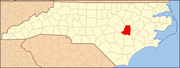 | |
| Towns | ||
| Village | ||
| CDPs | ||
| Other communities | ||
| Footnotes | ‡This populated place also has portions in an adjacent county or counties | |
| ||
This North Carolina state location article is a stub. You can help Wikipedia by . |
- Census-designated places in Wayne County, North Carolina
- Census-designated places in North Carolina
- North Carolina geography stubs