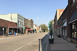
Fremont, North Carolina
Fremont, North Carolina | |
|---|---|
 | |
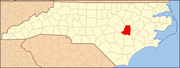
 Fremont, North Carolina Location within the state of North Carolina | |
| Coordinates: 35°32′35″N 77°58′29″W / 35.54306°N 77.97472°WCoordinates: 35°32′35″N 77°58′29″W / 35.54306°N 77.97472°W | |
| Country | United States |
| State | North Carolina |
| County | Wayne |
| Area | |
| • Total | 1.36 sq mi (3.51 km2) |
| • Land | 1.36 sq mi (3.51 km2) |
| • Water | 0.00 sq mi (0.00 km2) |
| Elevation | 148 ft (45 m) |
| Population (2010) | |
| • Total | 1,255 |
| • Estimate (2019)[4] | 1,262 |
| • Density | 930.68/sq mi (359.28/km2) |
| Time zone | UTC-5 (Eastern (EST)) |
| • Summer (DST) | UTC-4 (EDT) |
| ZIP code | 27830 |
| Area code(s) | 919 |
| FIPS code | 37-24900[2] |
| GNIS feature ID | 0985403[3] |
| Website | Town of Fremont |

Fremont is a town in Wayne County, North Carolina, United States. The population was 1,255 at the 2010 census. It is included in the Goldsboro, North Carolina Metropolitan Statistical Area.
History[]
Originally named Nahunta, it was renamed Fremont in 1869 after Col. Sewall Lawrence Fremont, a former U.S. Army artilleryman and chief engineer of the from 1854 to 1871.[5]
The Aycock Birthplace, Barnes-Hooks Farm, and Dred and Ellen Yelverton House are listed on the National Register of Historic Places.[6]
Geography[]
Fremont is located at 35°32′35″N 77°58′29″W / 35.54306°N 77.97472°W (35.543071, -77.974792).[7]
According to the United States Census Bureau, the town has a total area of 1.4 square miles (3.6 km2), all of it land.
Demographics[]
| Historical population | |||
|---|---|---|---|
| Census | Pop. | %± | |
| 1880 | 246 | — | |
| 1890 | 377 | 53.3% | |
| 1900 | 435 | 15.4% | |
| 1910 | 951 | 118.6% | |
| 1920 | 1,294 | 36.1% | |
| 1930 | 1,316 | 1.7% | |
| 1940 | 1,264 | −4.0% | |
| 1950 | 1,395 | 10.4% | |
| 1960 | 1,609 | 15.3% | |
| 1970 | 1,596 | −0.8% | |
| 1980 | 1,736 | 8.8% | |
| 1990 | 1,710 | −1.5% | |
| 2000 | 1,463 | −14.4% | |
| 2010 | 1,255 | −14.2% | |
| 2019 (est.) | 1,262 | [4] | 0.6% |
| U.S. Decennial Census[8] | |||
As of the census[2] of 2000, there were 1,463 people, 591 households, and 369 families residing in the town. The population density was 1,074.6 people per square mile (415.3/km2). There were 671 housing units at an average density of 492.9 per square mile (190.5/km2). The racial makeup of the town was 45.86% White, 50.72% African American, 0.21% Native American, 0.34% Asian, 2.32% from other races, and 0.55% from two or more races. Hispanic or Latino of any race were 2.67% of the population.
There were 591 households, out of which 27.4% had children under the age of 18 living with them, 39.1% were married couples living together, 19.8% had a female householder with no husband present, and 37.4% were non-families. 35.0% of all households were made up of individuals, and 18.6% had someone living alone who was 65 years of age or older. The average household size was 2.39 and the average family size was 3.11.
In the town, the population was spread out, with 25.8% under the age of 18, 6.1% from 18 to 24, 24.0% from 25 to 44, 24.1% from 45 to 64, and 20.0% who were 65 years of age or older. The median age was 41 years. For every 100 females, there were 81.3 males. For every 100 females age 18 and over, there were 77.0 males.
The median income for a household in the town was $25,167, and the median income for a family was $34,375. Males had a median income of $31,250 versus $18,869 for females. The per capita income for the town was $16,892. About 15.6% of families and 21.4% of the population were below the poverty line, including 34.6% of those under age 18 and 17.7% of those age 65 or over.
Education[]
Education in Fremont is administered by the Wayne County Public Schools system. Schools located in Fremont include Fremont STARS Elementary School, Norwayne Middle School and Charles B. Aycock High School. Higher education is offered through Wayne Community College in Goldsboro.
Transportation[]
Passenger[]
- Air: Fremont is served through nearby Kinston Regional Jetport (IATA: ISO, ICAO: KISO) with service to Orlando, Florida. Raleigh-Durham International Airport is the closest major airport with service to more than 45 domestic and international destinations. Goldsboro-Wayne Municipal Airport is an airport located nearby, but is only used for general aviation.
- I-795 is the closest Interstate Highway on the outskirts of Fremont intersecting with NC 222, while Interstate 95 is located 15 miles west in Kenly.
- Fremont is not served directly by passenger trains. The closest Amtrak station is located in Wilson.
- Bus: The area is served by Greyhound with a location in nearby Goldsboro.
Roads[]
References[]
- ^ "2019 U.S. Gazetteer Files". United States Census Bureau. Retrieved July 27, 2020.
- ^ Jump up to: a b "U.S. Census website". United States Census Bureau. Retrieved 2008-01-31.
- ^ "US Board on Geographic Names". United States Geological Survey. 2007-10-25. Retrieved 2008-01-31.
- ^ Jump up to: a b "Population and Housing Unit Estimates". United States Census Bureau. May 24, 2020. Retrieved May 27, 2020.
- ^ The Wilmington Post Wilmington, North Carolina 01 Apr 1869, Thu • Page 1
- ^ "National Register Information System". National Register of Historic Places. National Park Service. July 9, 2010.
- ^ "US Gazetteer files: 2010, 2000, and 1990". United States Census Bureau. 2011-02-12. Retrieved 2011-04-23.
- ^ "Census of Population and Housing". Census.gov. Retrieved June 4, 2015.
External links[]
| show Municipalities and communities of Wayne County, North Carolina, United States |
|---|
| show Authority control |
|---|
- Towns in North Carolina
- Towns in Wayne County, North Carolina