North East Derbyshire
This article needs additional citations for verification. (October 2016) |
North East Derbyshire District | |
|---|---|
District | |
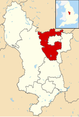 Shown within Derbyshire | |
| Sovereign state | United Kingdom |
| Constituent country | England |
| Region | East Midlands |
| Ceremonial county | Derbyshire |
| Admin. HQ | Wingerworth |
| Government | |
| • Type | North East Derbyshire District Council |
| • Leadership: | Leader & Cabinet |
| • Executive: | Labour |
| • MPs: | Lee Rowley, Mark Fletcher |
| Area | |
| • Total | 106.4 sq mi (275.6 km2) |
| Area rank | 142nd |
| Population (mid-2019 est.) | |
| • Total | 101,462 |
| • Rank | Ranked 237th |
| • Density | 950/sq mi (370/km2) |
| Time zone | UTC+0 (Greenwich Mean Time) |
| • Summer (DST) | UTC+1 (British Summer Time) |
| Postcode | |
| ONS code | 17UJ (ONS) E07000038 (GSS) |
| Ethnicity | 98.9% White |
| Website | ne-derbyshire.gov.uk |
North East Derbyshire is a local government district in Derbyshire, England. It borders the districts of Chesterfield, Bolsover, Amber Valley and Derbyshire Dales in Derbyshire, and Sheffield and Rotherham in South Yorkshire. The population of the district as taken at the 2011 Census was 99,023.[1] The district council is a non-constituent partner member of the Sheffield City Region Combined Authority.
In 2011, it formed a joint working arrangement with Bolsover District Council. Under this arrangement the two councils operate shared senior management roles. Other management roles and teams are also shared.
The council's head office was originally based outside the district, in the town of Chesterfield, which the district surrounds on three sides, and thus acts as the shopping and work centre for much of the district. However the council relocated to District Council Offices, Mill Lane, Wingerworth, within its own administrative area, in April 2015.
Settlements in the district include:
- Arkwright Town and Ashover
- Barlow
- Calow and Clay Cross
- Dronfield
- Eckington
- Grassmoor
- Holmesfield, Holymoorside and Holmewood
- Killamarsh
- Morton
- North Wingfield
- Pilsley
- Renishaw and Ridgeway
- Shirland, Spinkhill and Stonebroom
- Tupton
- Wingerworth
The district was formed on 1 April 1974 under the Local Government Act 1972. It was a merger of the Clay Cross and Dronfield urban districts along with all but one parish of Chesterfield Rural District.
Coal mining[]
This section does not cite any sources. (March 2018) |
The district, along with the district of Bolsover and much of the surrounding area of South Yorkshire, was a major producer of coal when a large seam was discovered during the building of the Clay Cross railway tunnel. Coal mining became the main industry of the region. During the 1980s the Conservative government closed down many of the mines after a dispute between the government and the National Union of Mineworkers, which is known as the miners' strike.
The strike began when the government reneged on previous declarations and announced the closure of the majority of pits due to unprofitability and inefficiency. The strike lasted for a year between 1984 and 1985. The strike was observed by approximately 70% of miners in North East Derbyshire. It caused massive social upheaval as traditionally close-knit communities became divided between those who worked and those who did not. Striking miners went unpaid and were not entitled to state welfare benefits, meaning that thousands of families relied on handouts and poverty became rife.
The strike was resolved by the spring of 1985, when the government effectively defeated the NUM and continued its policy of mine closures. The closure of the pits resulted in the closure of many associated industries, which decimated the local communities. Many former pit villages have struggled to recover. There are now no deep pit mines left in North East Derbyshire.
Regeneration[]
Following the closure of the pits there were large areas of the district left derelict, with old mine workings and spoil tips from the last 150 years of industrialisation. Over the last few years these sites have been re mediated and regenerated by open cast mining the remaining surface deposits and reclamation of coal from the old spoil heaps. The sites have then being restored as a mix of parkland, business parks and housing sites. A lot of the work being part funded by EEC Coalfield community regeneration grants, to provide money to help clean up the environmental legacy and fund the creation of job opportunities by providing the infrastructure for developments. This has resulted in several large and some smaller business parks, now providing jobs for thousands of people, albeit not of the same skill level of the engineering jobs lost. A lot being warehousing and distribution, as opposed to the old engineering trades.
Arms[]
|
References[]
- ^ "District Council population 2011". Neighbourhood Statistics. Office for National Statistics. Retrieved 23 March 2016.
- ^ "East Midlands Region". Civic Heraldry of England. Retrieved 6 March 2021.
| Wikimedia Commons has media related to North East Derbyshire. |

| show Authority control |
|---|

- North East Derbyshire District
- Non-metropolitan districts of Derbyshire