Bolsover District
This article needs additional citations for verification. (January 2012) |
Bolsover District | |
|---|---|
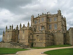 Bolsover Castle | |
 Shown within Derbyshire | |
| Sovereign state | United Kingdom |
| Constituent country | England |
| Region | East Midlands |
| Ceremonial county | Derbyshire |
| Admin. HQ | Clowne |
| Government | |
| • Type | Bolsover District Council |
| • Leadership: | Leader & Cabinet |
| • Executive: | Labour |
| • MPs: | Mark Fletcher (C) |
| Area | |
| • Total | 61.9 sq mi (160.3 km2) |
| Area rank | 178th |
| Population (mid-2019 est.) | |
| • Total | 80,562 |
| • Rank | Ranked 289th |
| • Density | 1,300/sq mi (500/km2) |
| Time zone | UTC+0 (Greenwich Mean Time) |
| • Summer (DST) | UTC+1 (British Summer Time) |
| Postcode | |
| ONS code | 17UC (ONS) E07000033 (GSS) |
| Ethnicity | 99.1% White[citation needed] |
| Website | bolsover.gov.uk |
Bolsover is a local government district in Derbyshire, England. It is named after the town of Bolsover, which is near the geographic centre of the district, but the council is based in Clowne. At the 2011 Census, the district had a population of 75,866.[1]
Town and parish councils[]
There are fourteen town and parish councils within the district.
In addition to the town councils of Old Bolsover and Shirebrook, there are the parish councils of:
- Ault Hucknall
- Barlborough
- Blackwell
- Clowne
- Elmton-with-Creswell
- Glapwell
- Hodthorpe and Belph
- Pinxton
- Pleasley
- Scarcliffe
- South Normanton
- Tibshelf
- Whitwell
Other settlements include Broadmeadows, Hilcote, Langwith, , Newton, Palterton, Shirebrook and Westhouses.
The current district boundaries date from 1 April 1974, when the urban district of Bolsover was merged with Blackwell Rural District and Clowne Rural District.
Governance[]
Bolsover District Council is elected every four years, with currently 37 councillors being elected at each election. The Labour Party had a majority on the council from the first election to the council in 1973 until 2019 and after the 2019 election the council was composed of the following councillors:
| Party | Councillors | |
| Labour Party | 18 | |
| Independent | 16 | |
| Conservatives | 2 | |
| Liberal Democrats | 1 | |
As of November 2020, the Conservatives have 3 councillors after a defection from the singular Lib Dem councillor, Natalie Hoy.[2]
The Bolsover District and the nearby North East Derbyshire, Borough of Chesterfield and Bassetlaw District alongside the High Peak Borough and Derbyshire Dales district are non-constituent members of the wider Sheffield City Region.
Local Development Framework[]
The council is currently in the process of consulting on its draft Infrastructure and Delivery Plan.[3]
References[]
| Wikimedia Commons has media related to Bolsover. |
- ^ "Local Authority Population 2011". Neighbourhood Statistics. Office for National Statistics. Retrieved 23 March 2016.
- ^ "Bolsover Councillors by Political party". Bolsover District Council. Retrieved 16 November 2020.
- ^ "Local Development Framework". Bolsover District Council. 20 December 2011. Archived from the original on 4 March 2012. Retrieved 2 January 2012.

| show Authority control |
|---|

- Bolsover District
- Non-metropolitan districts of Derbyshire