North Okaw Township, Coles County, Illinois
North Okaw Township | |
|---|---|
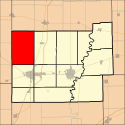 Location in Coles County | |
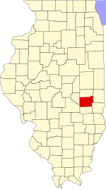 Coles County's location in Illinois | |
| Coordinates: 39°35′N 88°25′W / 39.583°N 88.417°WCoordinates: 39°35′N 88°25′W / 39.583°N 88.417°W | |
| Country | United States |
| State | Illinois |
| County | Coles |
| Established | November 8, 1859 |
| Area | |
| • Total | 54.41 sq mi (140.9 km2) |
| • Land | 54.37 sq mi (140.8 km2) |
| • Water | 0.04 sq mi (0.1 km2) 0.07% |
| Elevation | 653 ft (199 m) |
| Population (2010) | |
| • Estimate (2016)[1] | 955 |
| • Density | 18.1/sq mi (7.0/km2) |
| Time zone | UTC-6 (CST) |
| • Summer (DST) | UTC-5 (CDT) |
| ZIP codes | 61910, 61911, 61931, 61938, 61951 |
| FIPS code | 17-029-54014 |

North Okaw Township is one of twelve townships in Coles County, Illinois, USA. As of the 2010 census, its population was 983 and it contained 377 housing units.[2] The Kaskaskia River flows through the township. The Cook Mills Consolidated oil field is within this township. The township changed its name from Okaw Township on May 7, 1860.
Geography[]
According to the 2010 census, the township has a total area of 54.41 square miles (140.9 km2), of which 54.37 square miles (140.8 km2) (or 99.93%) is land and 0.04 square miles (0.10 km2) (or 0.07%) is water.[2]
Unincorporated towns[]
(This list is based on USGS data and may include former settlements.)
Cemeteries[]
The township contains five cemeteries: Brann, Mount Zion, Pleasant Grove, Smith and Zoar.
Major highways[]
 US Route 45
 Illinois Route 121
Demographics[]
| Historical population | |||
|---|---|---|---|
| Census | Pop. | %± | |
| 2016 (est.) | 955 | [1] | |
| U.S. Decennial Census[3] | |||
School districts[]
Political districts[]
- Illinois' 15th congressional district
- State House District 110
- State Senate District 55
References[]
- "North Okaw Township, Coles County, Illinois". Geographic Names Information System. United States Geological Survey. Retrieved 2010-01-10.
- United States Census Bureau 2007 TIGER/Line Shapefiles
- United States National Atlas
- ^ Jump up to: a b "Population and Housing Unit Estimates". Retrieved June 9, 2017.
- ^ Jump up to: a b "Population, Housing Units, Area, and Density: 2010 - County -- County Subdivision and Place -- 2010 Census Summary File 1". United States Census. Archived from the original on 2020-02-12. Retrieved 2013-05-28.
- ^ "Census of Population and Housing". Census.gov. Retrieved June 4, 2016.
External links[]
Adjacent townships[]
| show Places adjacent to North Okaw Township, Coles County, Illinois |
|---|
| show Municipalities and communities of Coles County, Illinois, United States |
|---|
| show Authority control |
|---|
Categories:
- Townships in Coles County, Illinois
- Townships in Illinois