North River Shores, Florida
North River Shores, Florida | |
|---|---|
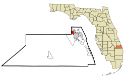 Location in Martin County and the state of Florida | |
| Coordinates: 27°13′23″N 80°16′15″W / 27.22306°N 80.27083°WCoordinates: 27°13′23″N 80°16′15″W / 27.22306°N 80.27083°W | |
| Country | |
| State | |
| County | Martin |
| Area | |
| • Total | 1.94 sq mi (5.03 km2) |
| • Land | 1.27 sq mi (3.28 km2) |
| • Water | 0.68 sq mi (1.75 km2) |
| Elevation | 3 ft (1 m) |
| Population (2020) | |
| • Total | 3,459 |
| • Density | 2,732.23/sq mi (1,054.93/km2) |
| Time zone | UTC-5 (Eastern (EST)) |
| • Summer (DST) | UTC-4 (EDT) |
| FIPS code | 12-49750[2] |
| GNIS feature ID | 0308058[3] |
| Website | http://www.northrivershoresfl.org/ |

North River Shores is a census-designated place (CDP) in Martin County, Florida, United States. The population was 3,101 at the 2000 census. It is part of the Port St. Lucie Metropolitan Statistical Area.
Geography[]
North River Shores is located at 27°13′23″N 80°16′15″W / 27.22306°N 80.27083°W (27.222999, -80.270851).[4]
According to the United States Census Bureau, the CDP has a total area of 1.9 square miles (4.9 km2), of which 1.3 square miles (3.4 km2) is land and 0.6 square miles (1.6 km2) (32.64%) is water.
Demographics[]
| Historical population | |||
|---|---|---|---|
| Census | Pop. | %± | |
| 2020 | 3,459 | — | |
As of the census[2] of 2000, there were 3,101 people, 1,417 households, and 916 families residing in the CDP. The population density was 2,385.8 people per square mile (921.0/km2). There were 1,701 housing units at an average density of 1,308.7/sq mi (505.2/km2). The racial makeup of the CDP was 97.84% White, 0.52% African American, 0.13% Native American, 0.61% Asian, 0.26% from other races, and 0.64% from two or more races. Hispanic or Latino of any race were 1.81% of the population.
There were 1,417 households, out of which 21.4% had children under the age of 18 living with them, 54.7% were married couples living together, 7.6% had a female householder with no husband present, and 35.3% were non-families. 29.5% of all households were made up of individuals, and 17.8% had someone living alone who was 65 years of age or older. The average household size was 2.18 and the average family size was 2.68.
In the CDP, the population was spread out, with 17.8% under the age of 18, 4.6% from 18 to 24, 21.8% from 25 to 44, 25.3% from 45 to 64, and 30.5% who were 65 years of age or older. The median age was 49 years. For every 100 females, there were 89.3 males. For every 100 females age 18 and over, there were 85.4 males.
The median income for a household in the CDP was $43,813, and the median income for a family was $55,052. Males had a median income of $47,330 versus $26,118 for females. The per capita income for the CDP was $28,449. About 5.6% of families and 5.3% of the population were below the poverty line, including 11.2% of those under age 18 and 2.0% of those age 65 or over.
References[]
- ^ "2020 U.S. Gazetteer Files". United States Census Bureau. Retrieved October 31, 2021.
- ^ a b "U.S. Census website". United States Census Bureau. Retrieved 2008-01-31.
- ^ "US Board on Geographic Names". United States Geological Survey. 2007-10-25. Retrieved 2008-01-31.
- ^ "US Gazetteer files: 2010, 2000, and 1990". United States Census Bureau. 2011-02-12. Retrieved 2011-04-23.
- ^ "Census of Population and Housing". Census.gov. Retrieved June 4, 2016.
Municipalities and communities of Martin County, Florida, United States | ||
|---|---|---|
| City |  | |
| Towns | ||
| Village | ||
| CDPs | ||
| Unincorporated community | ||
| ||
- Census-designated places in Martin County, Florida
- Port St. Lucie metropolitan area
- Census-designated places in Florida