Notre-Dame-des-Pins, Quebec
Notre-Dame-des-Pins | |
|---|---|
Parish municipality | |
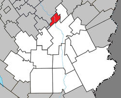 Location within Beauce-Sartigan RCM. | |
 Notre-Dame-des-Pins Location in southern Quebec. | |
| Coordinates: 46°11′N 70°43′W / 46.183°N 70.717°WCoordinates: 46°11′N 70°43′W / 46.183°N 70.717°W[1] | |
| Country | |
| Province | |
| Region | Chaudière-Appalaches |
| RCM | Beauce-Sartigan |
| Constituted | June 29, 1926 |
| Government | |
| • Mayor | Pierre Bégin |
| • Federal riding | Beauce |
| • Prov. riding | Beauce-Sud |
| Area | |
| • Total | 25.00 km2 (9.65 sq mi) |
| • Land | 23.95 km2 (9.25 sq mi) |
| Population (2011)[3] | |
| • Total | 1,227 |
| • Density | 51.2/km2 (133/sq mi) |
| • Pop 2006-2011 | |
| • Dwellings | 453 |
| Time zone | UTC−5 (EST) |
| • Summer (DST) | UTC−4 (EDT) |
| Postal code(s) | G0M 1K0 |
| Area code(s) | 418 and 581 |
| Highways | |
| Website | www.notredame despins.qc.ca |

Notre-Dame-des-Pins is a parish municipality in the Beauce-Sartigan Regional County Municipality in the Chaudière-Appalaches region of Quebec, Canada. Its population is 1,227 as of the Canada 2011 Census.
Notre-Dame-des-Pins is known for its covered bridge crossing the Chaudière River. Built in 1928 and opened in 1929, it is 146 m long. It is the longest of its kind in Quebec and the second longest in Canada.
References[]
- ^ Reference number 92439 of the Commission de toponymie du Québec (in French)
- ^ Jump up to: a b Geographic code 29120 in the official Répertoire des municipalités (in French)
- ^ Jump up to: a b "(Code 2429120) Census Profile". 2011 census. Statistics Canada. 2012.
- Commission de toponymie du Québec
- Ministère des Affaires municipales, des Régions et de l'Occupation du territoire
| show Places adjacent to Notre-Dame-des-Pins, Quebec |
|---|
| show |
|---|
| Authority control |
|
|---|
Categories:
- Incorporated places in Chaudière-Appalaches
- Parish municipalities in Quebec