Nouvelle, Quebec
Nouvelle | |
|---|---|
Municipality | |
 Saint-John-the-Evangelist Church in Nouvelle | |
 Location within Avignon RCM. | |
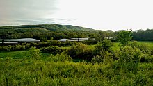
 Nouvelle Location in eastern Quebec. | |
| Coordinates: 48°08′N 66°19′W / 48.133°N 66.317°WCoordinates: 48°08′N 66°19′W / 48.133°N 66.317°W[1] | |
| Country | |
| Province | |
| Region | Gaspésie– Îles-de-la-Madeleine |
| RCM | Avignon |
| Settled | late 18th century |
| Constituted | October 10, 1907 |
| Government | |
| • Mayor | Richard St-Laurent |
| • Federal riding | Gaspésie— Îles-de-la-Madeleine |
| • Prov. riding | Bonaventure |
| Area | |
| • Total | 234.60 km2 (90.58 sq mi) |
| • Land | 232.16 km2 (89.64 sq mi) |
| Elevation | 7.00 m (22.97 ft) |
| Population (2011)[3] | |
| • Total | 1,689 |
| • Density | 7.3/km2 (19/sq mi) |
| • Pop 2006-2011 | |
| • Dwellings | 935 |
| Time zone | UTC−5 (EST) |
| • Summer (DST) | UTC−4 (EDT) |
| Postal code(s) | G0C 2E0 |
| Area code(s) | 418 and 581 |
| Highways | |
| Website | nouvellegaspesie |

Nouvelle is a municipality in eastern Quebec, Canada, on the south shore of the Gaspé Peninsula at the mouth of the , where the Restigouche River widens into Chaleur Bay. It is the seat of the Avignon Regional County Municipality.
In addition to Nouvelle itself, the municipality also includes the communities of Allard, Brébeuf (Dugal), Drapeau, Miguasha, Miguasha-Ouest, Nouvelle-Ouest, and Provancher.
Nouvelle's graphic seal is a world globe overlaid by Eusthenopteron foordi, whose fossil discovery brought worldwide fame to the Miguasha National Park, now a UNESCO World Heritage Site within the municipality. The seal's red and gray colours represent the colors of the rocks present on the fossil site.
History[]
Nouvelle was first settled by Acadians fleeing the deportation of 1755, fish merchants from Jersey, Channel Islands and some Irish. The name Nouvelle (French meaning "new") was used as early as the end of the 18th century and stood for the "new land" being made available West of town now called Carleton-sur-Mer. It first appeared on documents in 1787, by a Jersey business man Charles Robin, and Abbé Joseph Mathurin Bourg, the first Acadian priest.
In 1842, the geographic township of Nouvelle was proclaimed. In 1845, the township, which included the area now known as Escuminac, was first incorporated as Municipality of Shoolbred. It was named after John Shoolbred, who was the first owner of the seignory granted there. In 1847, the municipality was abolished but re-established in 1855. From 1861 on, it was known as the Township Municipality of Nouvelle-et-Shoolbred.[1]
On July 1, 1869, the local mission was proclaimed as a parish, known as Saint-Jean-l'Évangéliste (Saint John the Evangelist). In 1881, the post office opened, also designated as Saint-Jean-l'Évangéliste.[1]
In 1907, the place separated from the township municipality and formed the Municipality of Nouvelle-et-Shoolbred-Partie-Nord-Est. It was renamed in 1912 to Municipality of Saint-Jean-l'Évangéliste, and then on December 5, 1953, renamed again to Municipality of Nouvelle. That same year, the post office name followed suit.[1]
Demographics[]
Population[]
| hideCanada census – Nouvelle, Quebec community profile | |||
|---|---|---|---|
| 2011 | 2006 | ||
| Population: | 1,689 (-6.9% from 2006) | 1,815 (-7.4% from 2001) | |
| Land area: | 232.16 km2 (89.64 sq mi) | 232.16 km2 (89.64 sq mi) | |
| Population density: | 7.3/km2 (19/sq mi) | 7.8/km2 (20/sq mi) | |
| Median age: | 49.7 (M: 49.8, F: 49.6) | 45.8 (M: 45.9, F: 45.6) | |
| Total private dwellings: | 935 | 963 | |
| Median household income: | $41,737 | $42,364 | |
| References: 2011[3] 2006[5] earlier[6] | |||
|
|
|
Economy and tourism[]

- Fishing. The Rivière-Nouvelle ZEC (including "Petite rivière Nouvelle" and "ruisseau Mann"[1]) is world-renowned for its sea trout fly fishing and Atlantic salmon.[8]
- Fossils. World class museum of natural history at the Miguasha National Park.
- Miguasha beach. The word Miguasha comes from the Mi'kma "Mégueck Shawk" meaning longtime red, referring to the majestic red cliffs of the [9]
- Miguasha port facility offers yachting services and ferry service from July to September.[10]
- 50+ Games. The 5th edition of the Jeux des 50 ans et plus de la Gaspésie et des Îles-de-la-Madeleine will take place here June 12–15, 2008.[11]
Education[]
- Commission scolaire René-Lévesque (used to be Commisstion scolaire Tracadièche, from the Mi'kma «Place of many herons»
- Elementary schools: École centrale
- Highschool students attend École Antoine-Bernard de Carleton
Climate[]
| hideClimate data for Nouvelle (1981–2010) | |||||||||||||
|---|---|---|---|---|---|---|---|---|---|---|---|---|---|
| Month | Jan | Feb | Mar | Apr | May | Jun | Jul | Aug | Sep | Oct | Nov | Dec | Year |
| Record high °C (°F) | 8.5 (47.3) |
11.1 (52.0) |
17.0 (62.6) |
27.5 (81.5) |
33.0 (91.4) |
33.5 (92.3) |
34.5 (94.1) |
35.0 (95.0) |
32.0 (89.6) |
23.9 (75.0) |
17.8 (64.0) |
12.8 (55.0) |
35.0 (95.0) |
| Average high °C (°F) | −7.5 (18.5) |
−5.0 (23.0) |
0.8 (33.4) |
7.1 (44.8) |
15.1 (59.2) |
20.6 (69.1) |
23.6 (74.5) |
22.9 (73.2) |
17.3 (63.1) |
10.6 (51.1) |
3.0 (37.4) |
−3.4 (25.9) |
8.8 (47.8) |
| Daily mean °C (°F) | −12.3 (9.9) |
−10.4 (13.3) |
−4.3 (24.3) |
2.5 (36.5) |
9.3 (48.7) |
14.7 (58.5) |
17.9 (64.2) |
17.2 (63.0) |
12.0 (53.6) |
6.1 (43.0) |
−0.4 (31.3) |
−7.4 (18.7) |
3.7 (38.7) |
| Average low °C (°F) | −17.0 (1.4) |
−15.8 (3.6) |
−9.4 (15.1) |
−2.1 (28.2) |
3.4 (38.1) |
8.7 (47.7) |
12.1 (53.8) |
11.4 (52.5) |
6.6 (43.9) |
1.6 (34.9) |
−3.8 (25.2) |
−11.3 (11.7) |
−1.3 (29.7) |
| Record low °C (°F) | −35.0 (−31.0) |
−33.0 (−27.4) |
−29.5 (−21.1) |
−18.0 (−0.4) |
−6.7 (19.9) |
−2.5 (27.5) |
2.2 (36.0) |
−0.5 (31.1) |
−5.6 (21.9) |
−9.4 (15.1) |
−20.0 (−4.0) |
−28.5 (−19.3) |
−35.0 (−31.0) |
| Average precipitation mm (inches) | 73.3 (2.89) |
49.8 (1.96) |
58.4 (2.30) |
59.1 (2.33) |
82.4 (3.24) |
85.8 (3.38) |
100.0 (3.94) |
88.4 (3.48) |
73.0 (2.87) |
88.0 (3.46) |
84.9 (3.34) |
70.2 (2.76) |
913.3 (35.96) |
| Average rainfall mm (inches) | 11.3 (0.44) |
7.5 (0.30) |
26.3 (1.04) |
44.4 (1.75) |
81.9 (3.22) |
85.8 (3.38) |
100.0 (3.94) |
88.4 (3.48) |
73.0 (2.87) |
87.5 (3.44) |
62.5 (2.46) |
24.7 (0.97) |
693.3 (27.30) |
| Average snowfall cm (inches) | 62.0 (24.4) |
42.3 (16.7) |
32.1 (12.6) |
15.2 (6.0) |
0.5 (0.2) |
0.0 (0.0) |
0.0 (0.0) |
0.0 (0.0) |
0.0 (0.0) |
0.5 (0.2) |
22.3 (8.8) |
45.5 (17.9) |
220.5 (86.8) |
| Average precipitation days (≥ 0.2 mm) | 11.3 | 9.5 | 9.7 | 11.4 | 12.9 | 12.2 | 13.4 | 12.3 | 12.8 | 13.1 | 13.0 | 11.0 | 142.6 |
| Average rainy days (≥ 0.2 mm) | 1.7 | 1.8 | 3.9 | 8.9 | 12.7 | 12.2 | 13.4 | 12.3 | 12.8 | 13.0 | 9.2 | 3.5 | 105.2 |
| Average snowy days (≥ 0.2 cm) | 10.8 | 8.3 | 6.4 | 3.1 | 0.14 | 0.0 | 0.0 | 0.0 | 0.05 | 0.11 | 4.3 | 8.9 | 42.1 |
| Source: Environment Canada[4][12] | |||||||||||||
Recreation[]
- Centre sportif Louis-Sleigher (skating arena), named in honour of the first native of Nouvelle to play for the NHL
- Sport fishing
- Hunting (ruffed grouse or partridge, moose, deer and black bear)
- Tennis courts
- Soccer field
- Nature trails
- Snowmobile and ATV trails
- Harness racing
See also[]
- List of municipalities in Quebec
- Zec de la Rivière-Nouvelle, a zone d'exploitation contrôlée (controlled harvesting zone)
References[]
- ^ Jump up to: a b c d "Nouvelle (Municipalité)" (in French). Commission de toponymie du Québec. Retrieved 2012-01-04.
- ^ Jump up to: a b "Nouvelle". Répertoire des municipalités (in French). Ministère des Affaires municipales, des Régions et de l'Occupation du territoire. Archived from the original on 2012-06-10. Retrieved 2012-01-04.
- ^ Jump up to: a b c "2011 Community Profiles". 2011 Canadian Census. Statistics Canada. July 5, 2013. Retrieved 2014-01-28.
- ^ Jump up to: a b "Nouvelle, Quebec". Canadian Climate Normals 1981–2010. Environment Canada. Retrieved 10 June 2015.
- ^ "2006 Community Profiles". 2006 Canadian Census. Statistics Canada. March 30, 2011. Retrieved 2012-01-04.
- ^ "2001 Community Profiles". 2001 Canadian Census. Statistics Canada. February 17, 2012.
- ^ Statistics Canada: 1996, 2001, 2006, 2011 census
- ^ http://www.rivierenouvelle.com/fhtm/index.html Archived 2007-09-18 at the Wayback Machine ZEC Rivière-Nouvelle
- ^ Newly identified Carboniferous units (the Pointe Sawyer and Chemin-des-Pêcheurs formations) in the Gaspé Peninsula, Quebec; implications regarding the evolution of the northwestern sector of the Maritimes Basin
- ^ http://www.tc.gc.ca/Quebec/EN/port/miguasha.htm Transport Canada
- ^ http://www.urlsgim.com/index.aspx?sec=6 Jeux des 50 ans et plus
- ^ "Nouvelle, Quebec". Canadian Climate Normals 1981–2010. Environment Canada. Retrieved 10 June 2015.
External links[]
| show Adjacent Municipal Subdivisions |
|---|
| hide | |
|---|---|
| Cities & Towns | |
| Municipalities | |
| Townships | |
| Unorganized Territories | |
| |
| show Authority control |
|---|
- Municipalities in Quebec
- Incorporated places in Gaspésie–Îles-de-la-Madeleine